The History of Morley Square
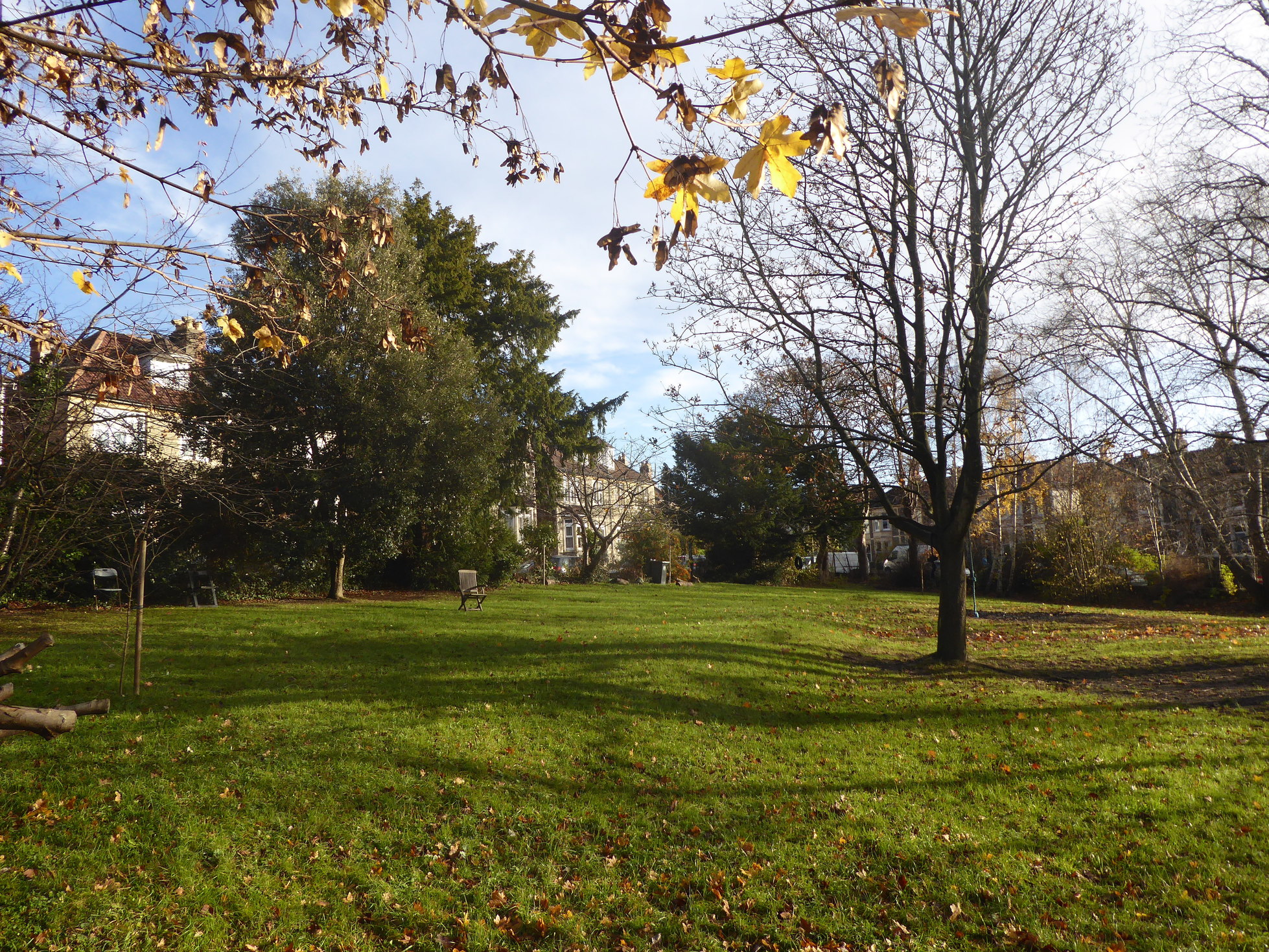
fig 1: View of Morley Square in Autumn looking North-East
Introduction
Morley Square has been our home for the past 20 years. One of about half a dozen private squares in Bristol, it is the only one in Bishopston. Relieving the density of the surrounding streets, it is a tranquil and intimate oasis of green in the midst of the buzz of the city, just off Gloucester Road. From the first sight of trees and spaciousness on approaching the square, to its calm interior - not quite a garden, not quite a park - it is a lovely place to live.
The idea for researching the history of the square evolved from the years spent gazing out across it every morning - an uplifting start to the day, whatever the season and whatever the weather. Our interest was sparked more specifically during a kitchen renovation project, when a servant's bell mechanism was revealed, prompting a more active curiosity about the people who have lived here over the years.
It has been a fascinating project with a very steep learning curve. The project expanded as the more we discovered, the more we realised we didn't know. We kept discovering new resources and were thrilled to unearth so much - though also frustrated by the gaps in information. The research also revealed numerous intriguing side alleys tempting us off our main track.
Through this project we have come to meet most of the square's residents which has been a lovely experience, and we have very much appreciated all the help and encouragement we have received.
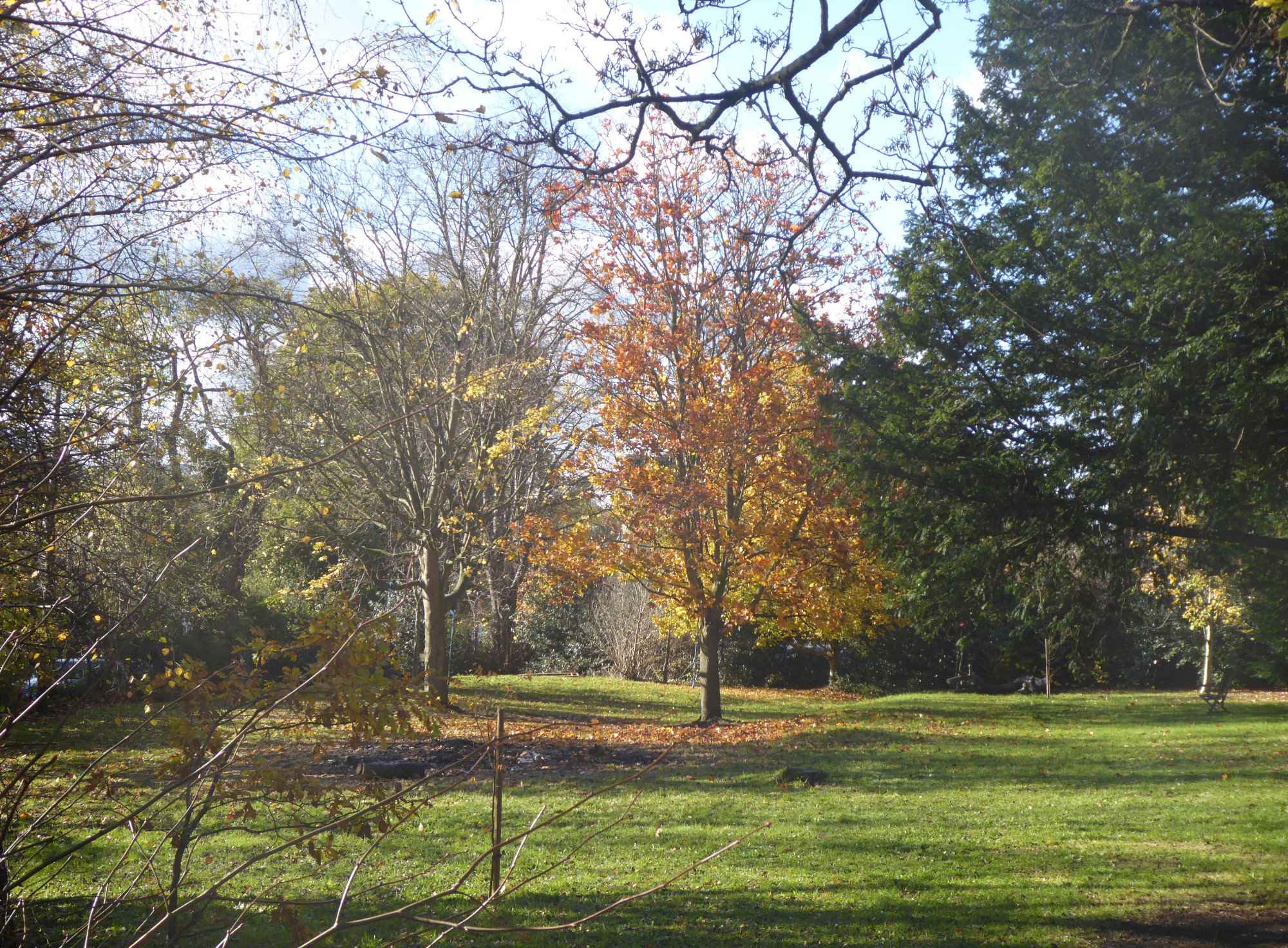
fig 2: Morley Square in Autumn looking South-West
The 'pre-history' of Morley Square
Morley Square is situated on the eastern side of the old Parish of Horfield towards its southern end, bordered by the Parish of St Paul in the City of Bristol. Prior to the mid-1800s, it was a rural area well outside the city.
Horfield is an ancient parish mentioned in the Doomsday Book of 1086. Horfield Manor estate was included in lands given to St Augustine's Abbey by Lord Berkeley on its foundation in 1140. When monastic holdings were confiscated by Henry VIII, the Manor was given to a newly formed Bishopric of Bristol - under the personal control of the bishop rather than the church. For several centuries the bishop traditionally leased the estate to a 'Lord Farmer' for a period of three lives - which meant that the lease could be passed on by will twice, but after the third person's death the lease would revert back to the Bishop, unless it was renewed to the then leaseholder. The land was sub-leased in a convoluted medieval manorial system of copy-holdings.
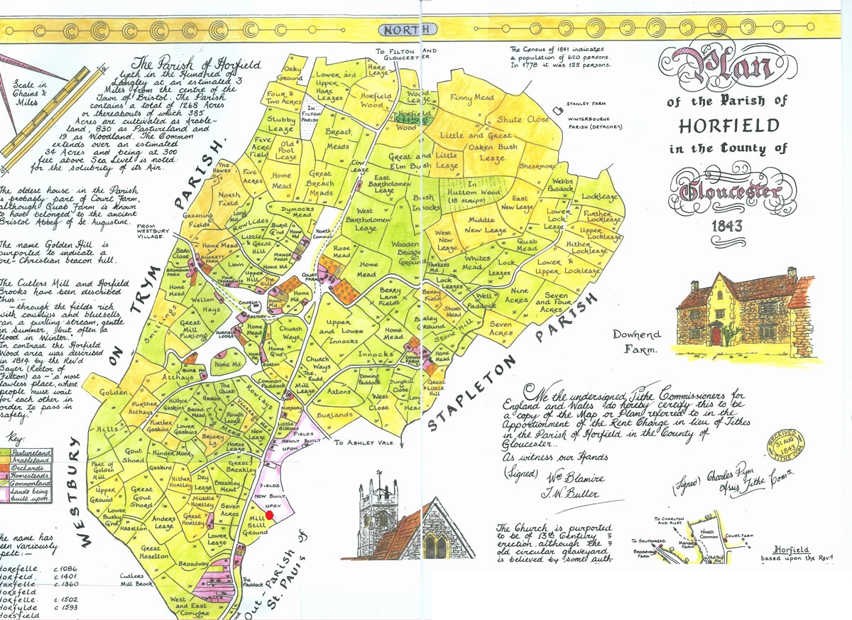
fig 3: Plan of Horfield Parish,1843
In the 1830s, the then bishop and Church Commissioners agreed that when the lease
expired on the death of the next third life (John Shadwell), the land should revert
back to the church rather than being renewed and its income used to support
cathedrals and churches. However, a new bishop was appointed in 1836, who had other
ideas. Bishop Monk considered it was for him, not the church, to decide what to do
with the land. The issue became subject of a hugely controversial dispute within the
church, even raising questions in Parliament. However, on the death of John Shadwell
in 1849, the Horfield Manor estate was broken up after 700 years. Part of it was
retained as Bishop Monk's Horfield Trust, intended to fund homes and stipends for
clergy in the poorer parishes of the city. The bishop's idea was that the remaining
land should be sold: being contiguous to the city of Bristol it presented a
favourable site for the erection of villas .... I conceived the idea of
effecting a great public benefit to the city and neighbourhood .....
And so
this land was sold - much of it to the existing copy-holders. Among these
copy-holders were the Rev Henry Richards and Anthony Mervyn Reeve Story-Maskelyne
who each held parcels of land including that now occupied by Morley Square.
The 1800s saw an unprecedented increase in population throughout the UK due to growing birth and survival rates. The population of Bristol rose from 61,153 in 1801 to 140,000 in 1851, and then more than doubled to 330,000 in 1891, reflecting the growing prosperity of the city, with its large factories and myriad of diverse small businesses and enterprises. As slum dwellings were cleared from the centre of the city, urban development began to spread outside the city boundaries. The newly available farmland of Horfield was ripe and ready for development.
Horfield was, in the mid-19th century, a country village two miles north of the Bristol boundary. However, Bristol was beginning to creep northwards. One of the first examples of expansion out of the city into the country was the move of the Muller Orphan Homes to Ashley Down. The first home was completed there in 1849 and by 1870 all five homes had been built - at that time still surrounded by country fields and pastures.
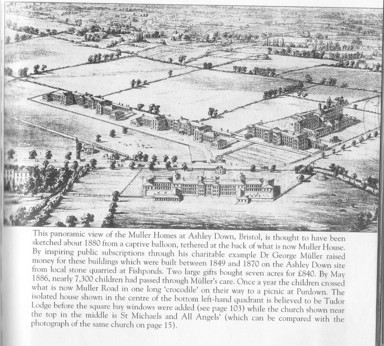
fig 4: Drawing form a balloon of Muller Homes and Bishopston looking South West
The church of St Michael and All Angels was opened in 1858, built by the Rev. Henry Richards - 'Perpetual Curate of Horfield' from 1828 until his death in 1864.
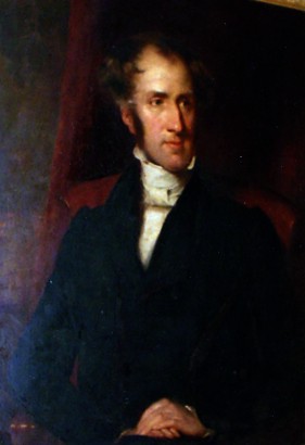
fig 5: Rev. Henry Richards
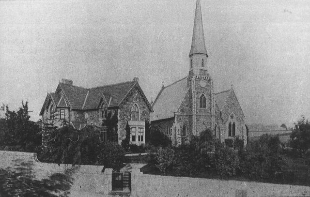
fig 6: St Michaels and All Angels
Gloucester Road had for centuries been the main route northwards out of Bristol, through Horfield towards Thornbury and Gloucester. In 1727 it was made a turnpike road with a toll to pay for its upkeep and became known colloquially as 'the Turnpike Road'. By the mid-1800s there were a smattering of country villas built along the road. Urban development out of Bristol was reaching Bishopston with the development of Berkeley and Egerton Roads which started in the late 1850s on land bought from Henry Richards. Houses on Denmark Place and Princes Place were built in the 1870s. The Horfield Inn (now Bristol Flyer) had long been in existence and a number of other pubs - the Royal Hotel (now Hobgoblin), The Prince of Wales, Golden Lion, Fox Inn (now the Guru Indian Restaurant) and Robin Hoods Retreat (now The Grace) had appeared on the road by the 1870s.
By 1881 development of shops had spread northwards to Sommerville /Berkeley Roads but, on the east side very little up to the church and vicarage beyond. The terraces of houses beyond the parish church and beyond the Wesleyan Church (built in 1890) were built in 1885 and 1886 - on Maskelyne land. On the west side beyond Egerton Road were half a dozen shops up to St Michael's School (now one of the church halls), with a mix of shops and private residences beyond that by 1890. The area was still evidently somewhat rural - neighbours of 204 Gloucester Road (now Odd Sox) complained in 1883 about the occupier keeping pigs. However, the road was evidently smartening up, with plans for a brick pavement to be laid from the church down to Sommerville Road with 'stone haulingways' and spaces for trees to be planted by house owners. In 1885 the post office opposite the church was renamed 'Bishopston Post Office'.
Further up Gloucester Road on the eastern side, with frontage on Gloucester Road between Wesley and Nevil Roads, was the small rural development of Russells Fields of Cottages. Edward Russell acquired sub-leases on 4 fields in 1827 and built 'hamlets and cottages' on two of them. These appear to have been scattered small-holdings each averaging about half an acre of land. However, this lease was not renewed in 1849, and Bishop Monk sold the land to Anthony Story-Maskelyne - who at that time simply wanted to consolidate his lands and considered that the Horfield farmland 'had no buildable land on it'.
A residential building boom was under way in St Andrews. In 1880 Belmont, Effingham and North Road are mapped as being under construction.
The development of a public transport infrastructure further stimulated urban expansion during this time. Opened in 1875, by 1881 Bristol's tramway had expanded to provide routes to Blackboy Hill, Eastville, Totterdown, Bedminster, Hotwells and Horfield and by 1886 were operating 60 horse-drawn trams each carrying 36 passengers. The route up Gloucester Road terminated at Egerton Road where there was a 'switch' allowing trams to make the return route.
The County Ground is an exact contemporary neighbour of Morley Square. Gloucestershire County Cricket Club founded by the Grace family in 1870 and captained by W. G. had no ground of its own in its early years. After consideration of several other potential sites the 25-acre site at Ashley Down was purchased in February 1888 for £6,500 for the newly created Gloucestershire County Ground Company Limited. A space 100 yards square was to be retained solely for the Cricket Club's use, with the remaining area available for cricket, football, cycling, athletics, bowls and tennis - evidently an early form of leisure centre. The cricket ground was laid out and pavilion built, and the first Gloucestershire match was played in April 1889.
The Maskelyne Estate
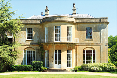
fig 7: Salthrop House
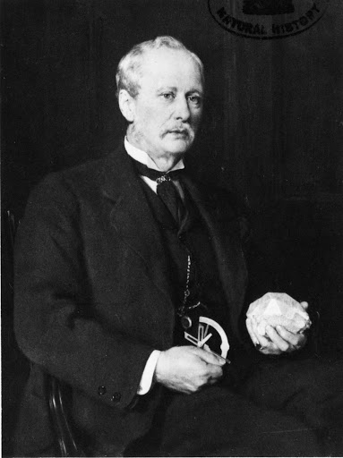
fig 8: Nevil Story-Maskelyne
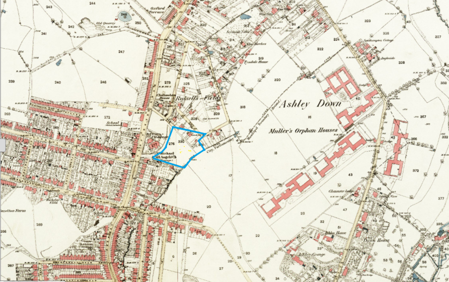
fig 9: Bishopston in the 1880's , Morley Square outlined in blue
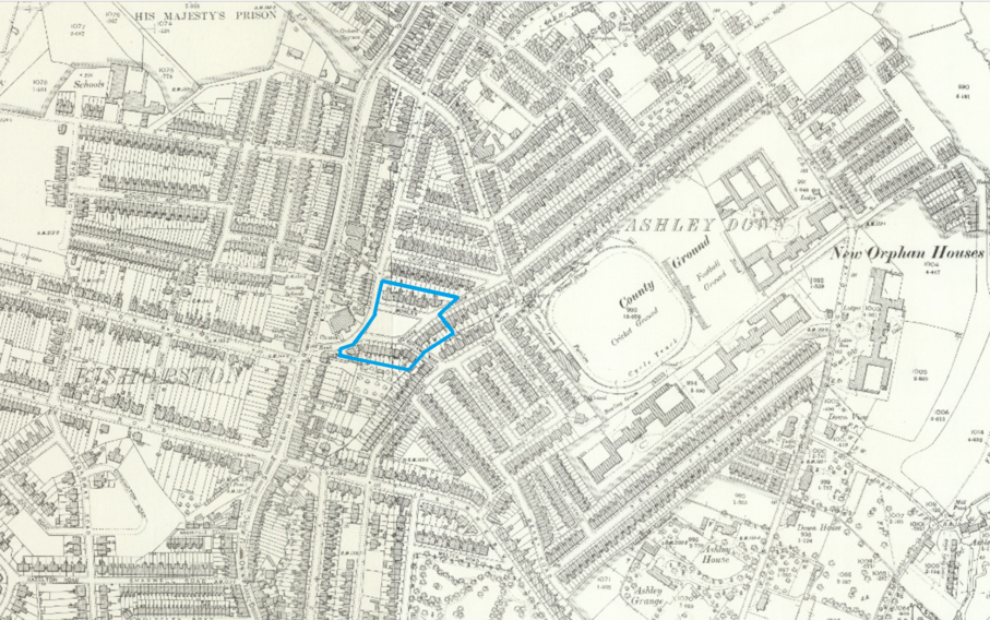
fig 10: Bishopston in the 1890's , Morley Square outlined in blue
Despite his father's earlier comment that the area had no 'buildable land', this whole area was clearly ripe for development as part of the explosion of development in this area of Bristol. The speed of development was quite extraordinary - as can be seen from the maps illustrating how rural pastureland and small-holdings were transformed to dense urban development within the space of no more than five years.
The creation of Morley Square
The first mention we could find of Morley Square was in October 1887 in the minutes of the Horfield Local Board:
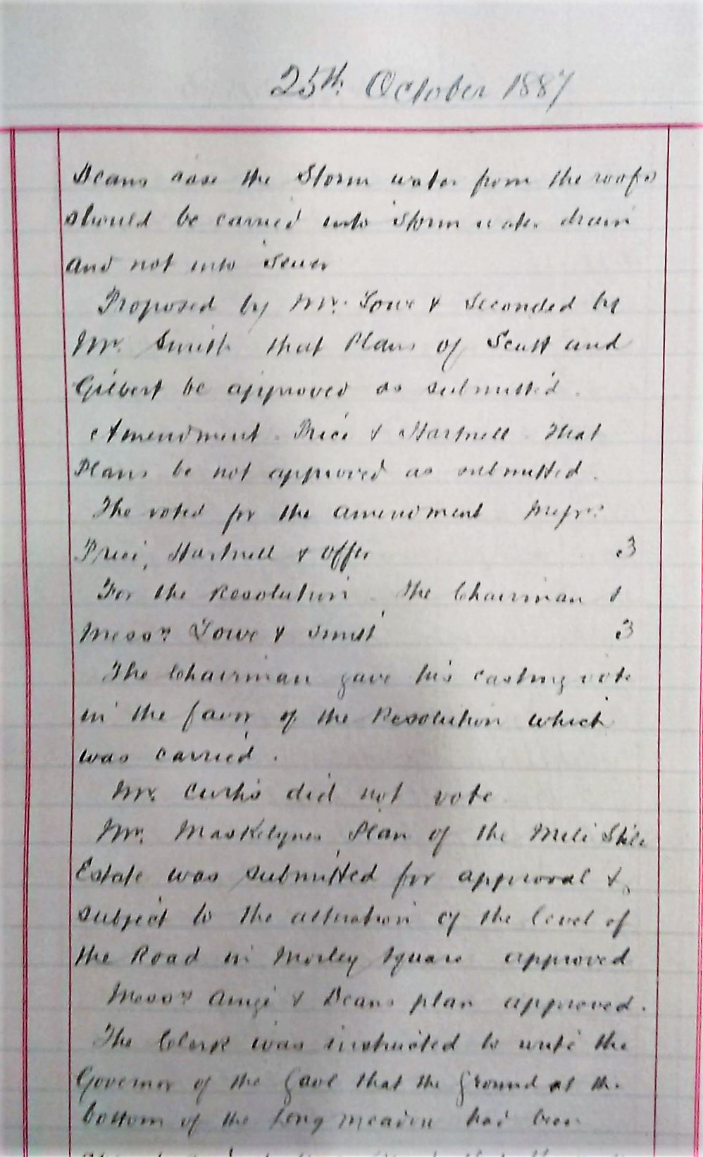
fig 11: Horfield Local Board Minutes, October 1887
Reading through these meticulously hand-written minutes for the 10 years or so starting in 1885, conjures up a graphic impression of the hectic activity of myriad teams of builders working away in conditions ranging from a muddy quagmire to dry dust blowing off the unmade roads, surrounded by heaps of building materials and rubbish and horses pulling laden carts.
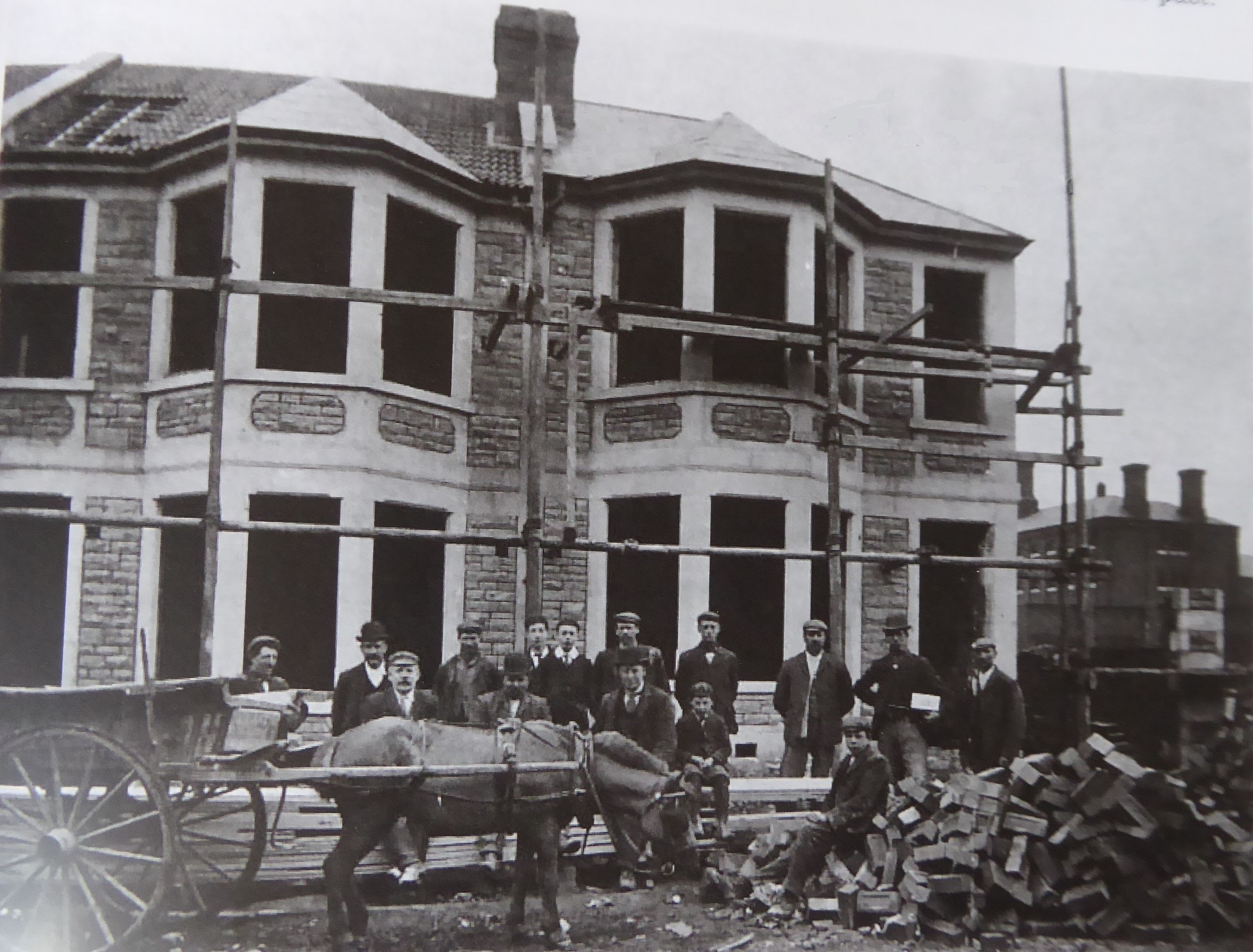
fig 12: Builders in Radnor Road
The Horfield Local Board
From 1883, the Horfield Local Board met in 'Horfield Villa' on Gloucester Road (now Boston Tea Party), rented on a 20-year lease from Mr Maskelyne for £25 per annum. This provided not only a suitable meeting room, but also valuable yard space, stables and cart storage. Their staff of surveyors was from 1886 headed by Mr Albert Cotterell, the first owner of 2 Brynland Avenue who lived there from 1888 to 1891.
There appears to have been little by way of an overall scheme for development of the area. The bigger picture seemed to evolve as building work proceeded, rather than having been part of a comprehensive initial plan. Development of the estate, and others around, seems surprisingly piecemeal with new applications and alterations from numerous independent builders flooding in to the Board while building works were underway. See Minute in June 1887.
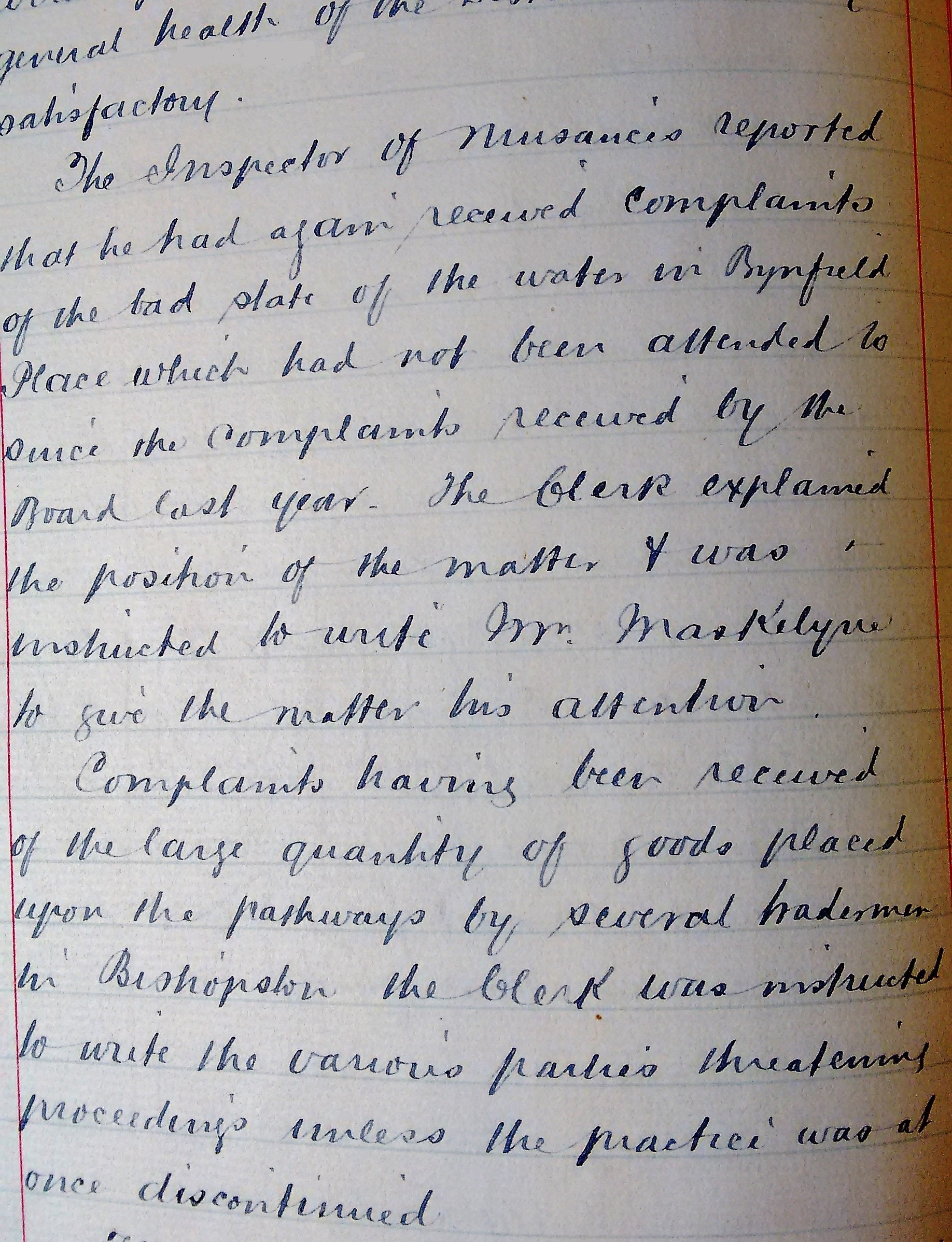
fig 13: Horfield Local Board Minutes, June 1887
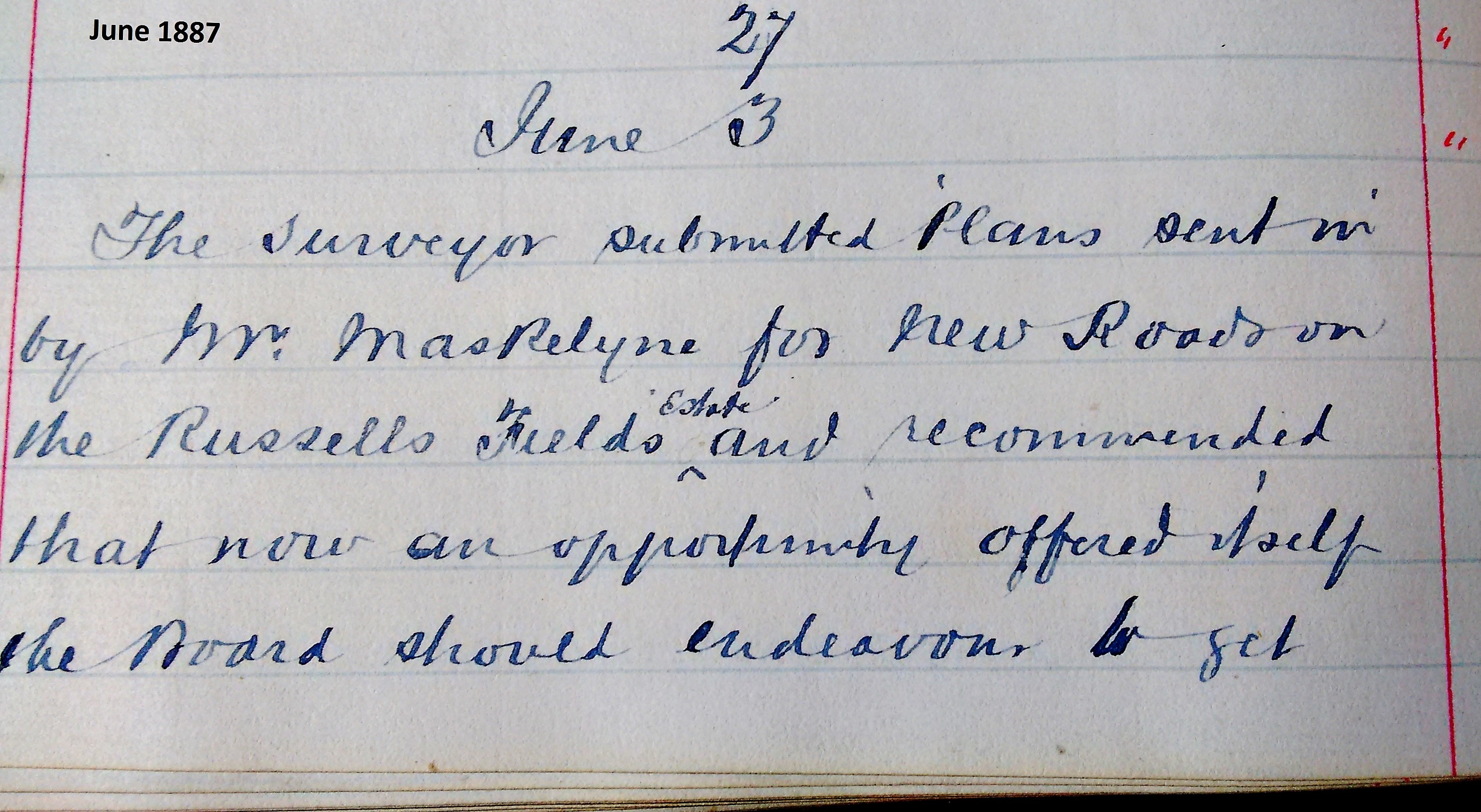
fig 14: Minutes of Horfield Local Board
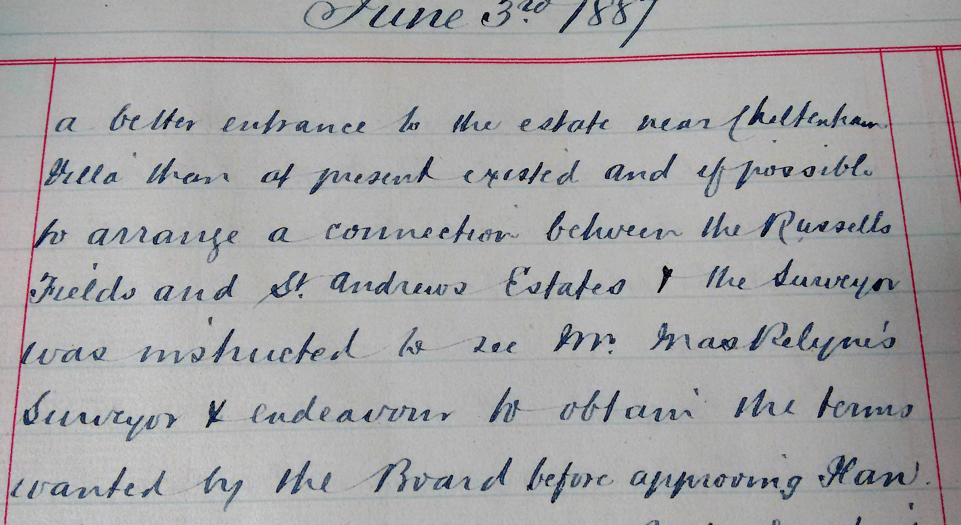
fig 15: Horfield Local Board Minutes, June 1887
Initially the main focus was on roads and drains. The issue of drains was clearly a vital one and difficulties could arise when land-owners had land spanning different districts - for example Mr Maskelyne's land spanned Horfield and Stapleton - see Minute in January 1889.
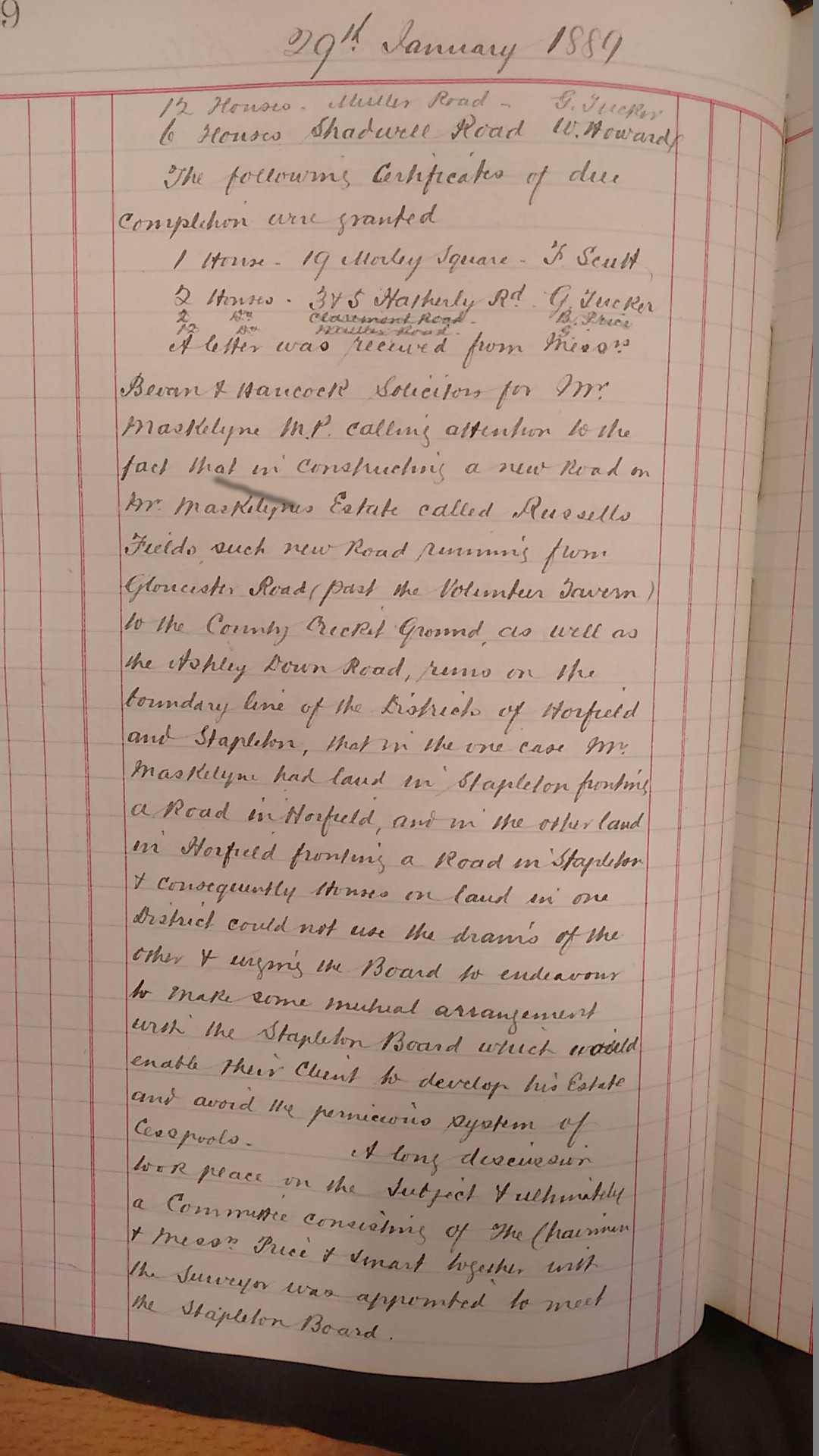
fig 16: Horfield Local Board Minutes, January 1888
Plans submitted by builders and landowners frequently went back and forth for
amendment. For example, Mr Maskelyne's plan for a new road on Russells Fields was
required - looking to the future of the district
- to be re-submitted with
better specifications. When re-submitted 3 months later, the plans were found still
unsatisfactory with regard to the fall of the sewer and a compromise was negotiated.
Maskelyne, for all his academic eminence and public service worthiness, appears to have been somewhat of a rogue with regard to drains. The minutes indicate a fractious relationship between him and the Board. As landlord of the rural properties on Russells Fields he was frequently found, over a decade, not to have complied with agreed actions and being ordered to resolve various nuisances.
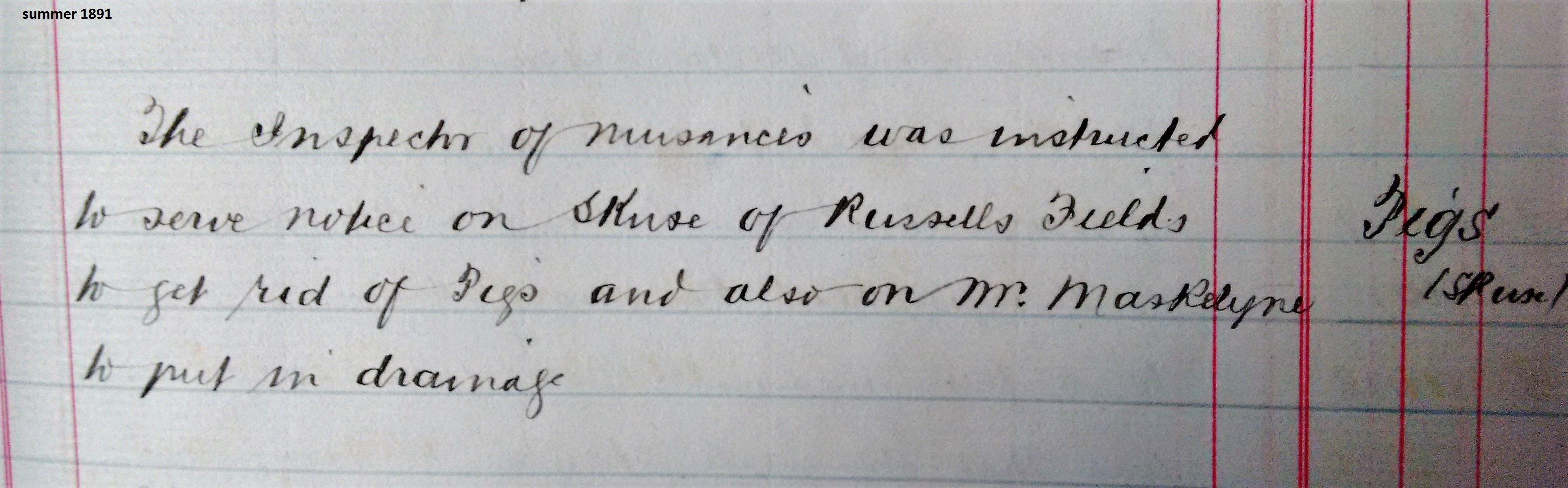
fig 17: Horfield Local Board Minutes, Pigs again
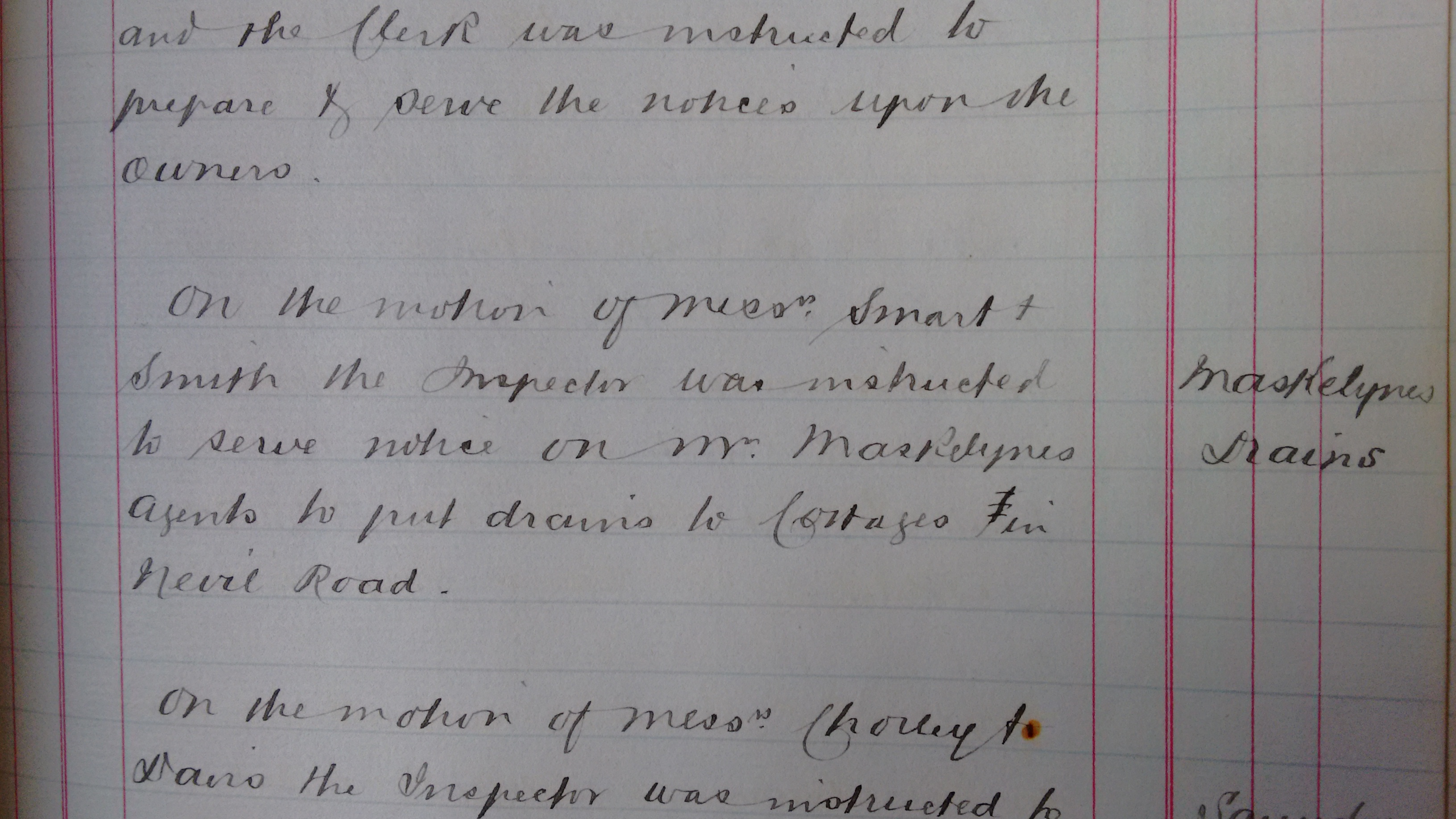
fig 18: Horfield Local Board Minutes, Drains again
Mr Maskelyne was also a hard negotiator regarding road plans for the new housing estates. His dealings with the Board were sometimes in person and sometimes through his agent or solicitors. For example, in March 1888 he was asked by the Board to continue Cricklade Road through to Gloucester Road, but was not happy to do this unless the Board would bear the entire cost of making the road as well as to compensate him for injury to adjoining property and for any additional land required. This did not happen.
By 1887 plans for roads and houses were being submitted to the Board thick and fast. In January 1889 it is reported in the Minutes that 136 house plans were passed, and 87 houses completed during 1888, compared to 105 and 41 the previous year.
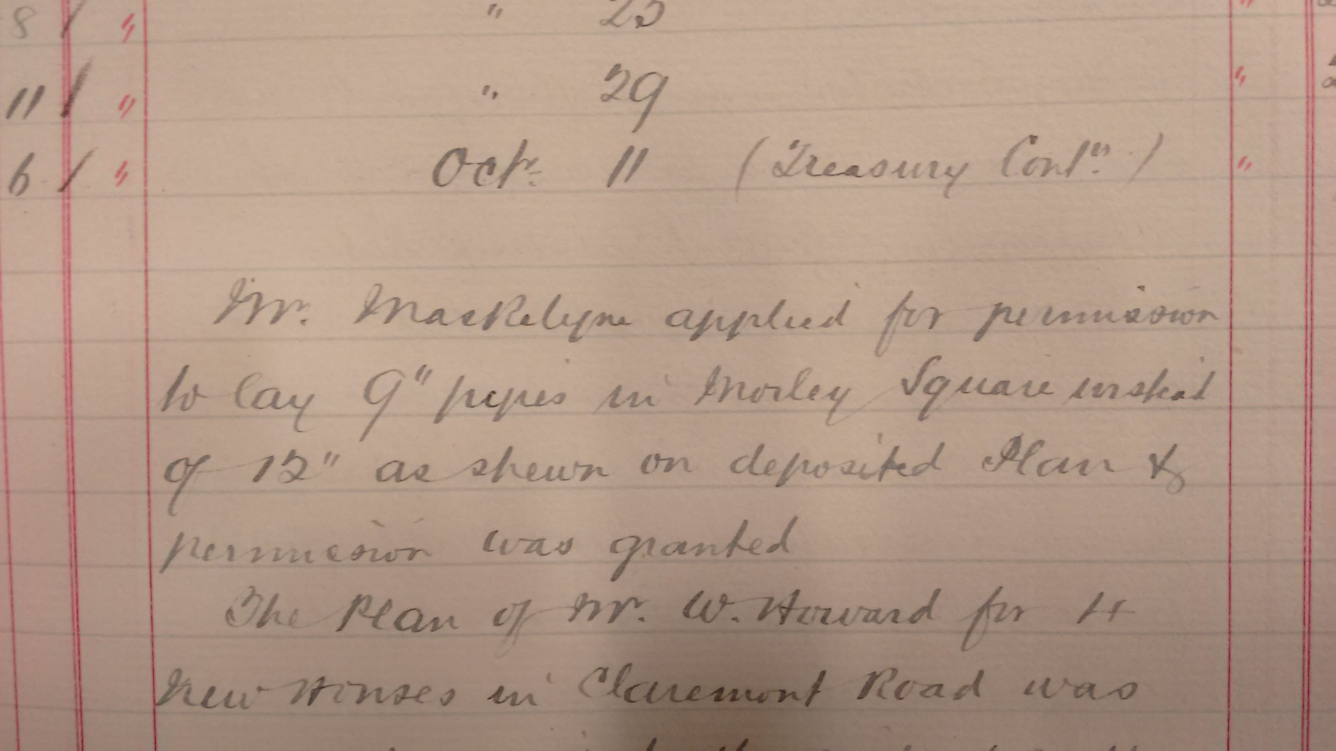
fig 19: Horfield Local Board Minutes, November 1887
The square was built partly on Mile Stile Ground and partly over the southern part of
Russells Fields, requiring the demolition of several properties. In the course of
time all the Russells Fields properties were lost in the building of the whole
Maskelyne estate which extended north to Ashley Down Road. However, the replacement
of these rural habitations seems, at least by some, to have been regarded
positively. A report to the Local Board in 1885 referring to one of many of the
nuisances at Russells Fields, commented with approval that these ancient
specimens
of architecture were being replaced by modern handsomely built
villas
. Clearly the rural nature of Russells Fields, subject to numerous
'nuisance notices,' was now considered an anomaly, with its manure heaps, mushroom
grounds, cess pits and unsatisfactory drainage leaking into wells, alongside the
newly developing modern housing estate.
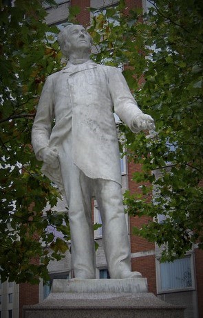
fig 20: Statue of Samuel Morley in the Horsefair, Bristol
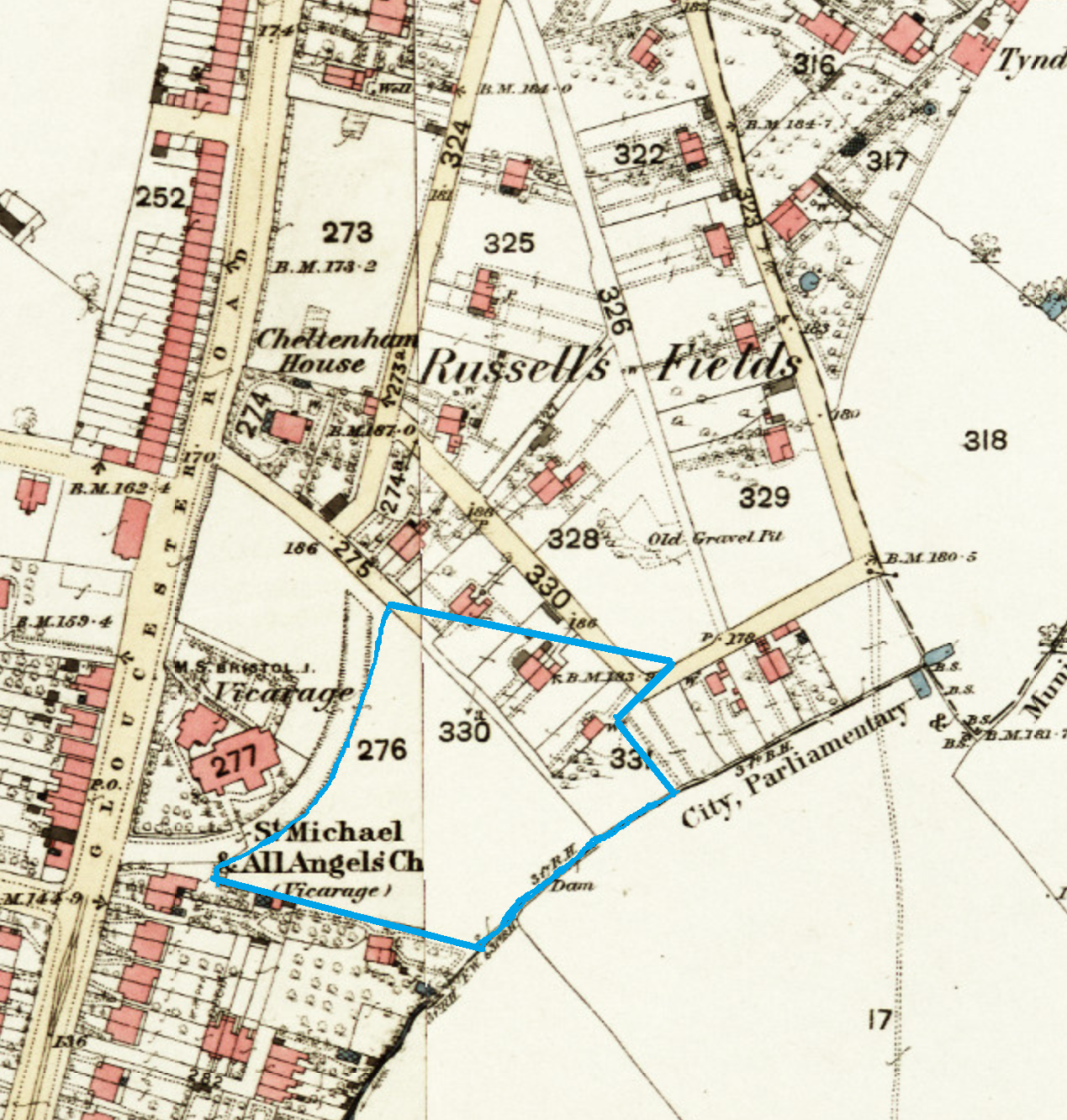
fig 21: Morley Square prior to development
Sadly, the plans referred to in Mr Maskelyne's planning submissions have been removed from the Plans Book - without any explanation or any clue as to where they might have gone. Neither could we find any explanation as to why he chose to create a square here. The name, we assume, commemorates the eminent philanthropist Samuel Morley. Morley, who died in 1886, was a wealthy woollen merchant, and a prominent abolitionist and dissenter. As a Liberal MP for Bristol he was an exact contemporary of Nevil Maskelyne in Parliament. Maskelyne clearly had a liking for using names linked to himself for roads on his estate - Salthrop, Nevil, Cricklade, Mervyn.
Planning
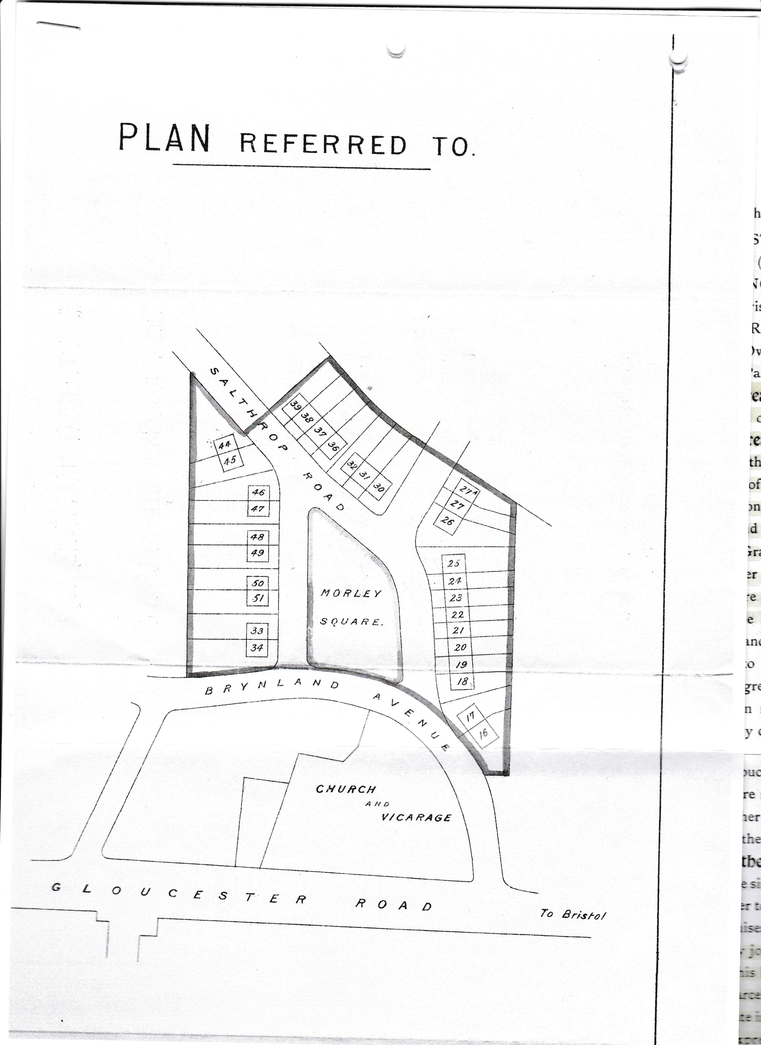
fig 22: Plan of Morley Square - looking East
Morley Square comprises 28 properties built around three sides of the private garden, which measures about half an acre. It is bounded by Brynland Avenue on the western side, an orchard (now built over) on the southern side, a culverted stream - a tributary of Horfield Brook - running along the end of the gardens of houses on the eastern side and alongside number 11 to the orchard (the then boundary between the parish of Horfield and City of Bristol). The northern side of the square adjoins the rest of the 'Maskelyne Estate'
Planning documents show applications for houses in Morley square made in May and August 1888 for the houses on the northern and southern sides of the square. These were made by different builders, both using the same architect - J. Craik. By today's standards the speed of the planning process is staggering with plans being approved within a week of submission. Evidently amendments to plans could be made simply by giving notice.
The builders
The rapid increase in population presented both an enormous challenge to the building industry and huge opportunities. Four builders were involved in the construction of the square, which started in 1888.
Frank Scutt
Frank Scutt - aged 30 at the start of the scheme - built numbers 1 - 11. He went on to live in number 8 with his wife and son who was born there, together with his older sister and a domestic servant, until 1899. He built a large number of properties on and around Gloucester Road, retaining a portfolio of rental properties. Engaged in public life he put himself forward for election to the Horfield Local Board. He gave evidence to an enquiry in 1891 into the proposed extension of the Bristol Boundary - in favour because this would allow for better drainage arrangements. He died after a long illness in in 1926 aged 68 at his then home in Clifton. His obituary describes him as being formerly a well-known figure in the building trade especially in the district around the County Ground, but having been retired for 20 years. He left his wife and daughter - his son having died in France in 1917.
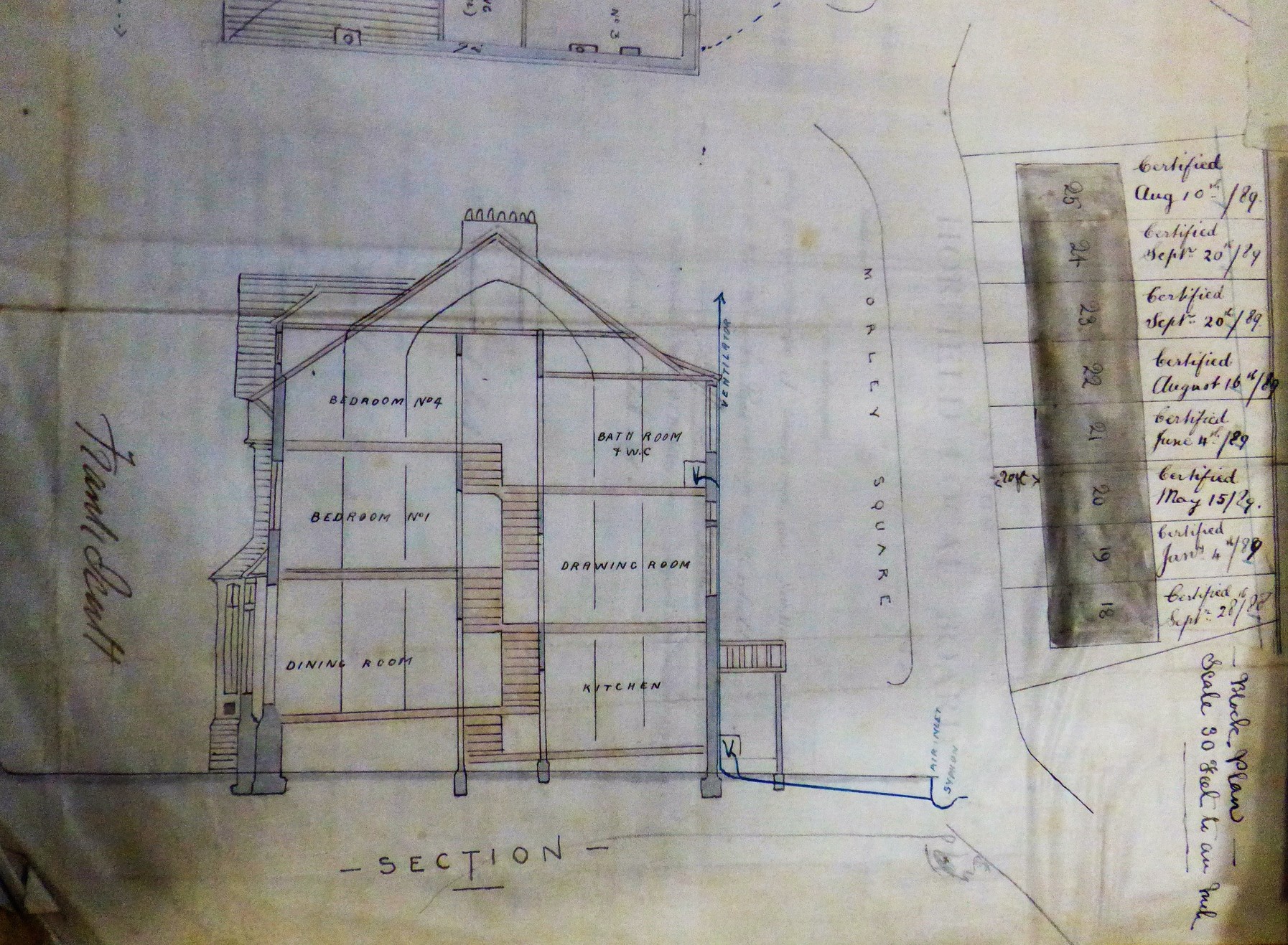
fig 23: Section of house
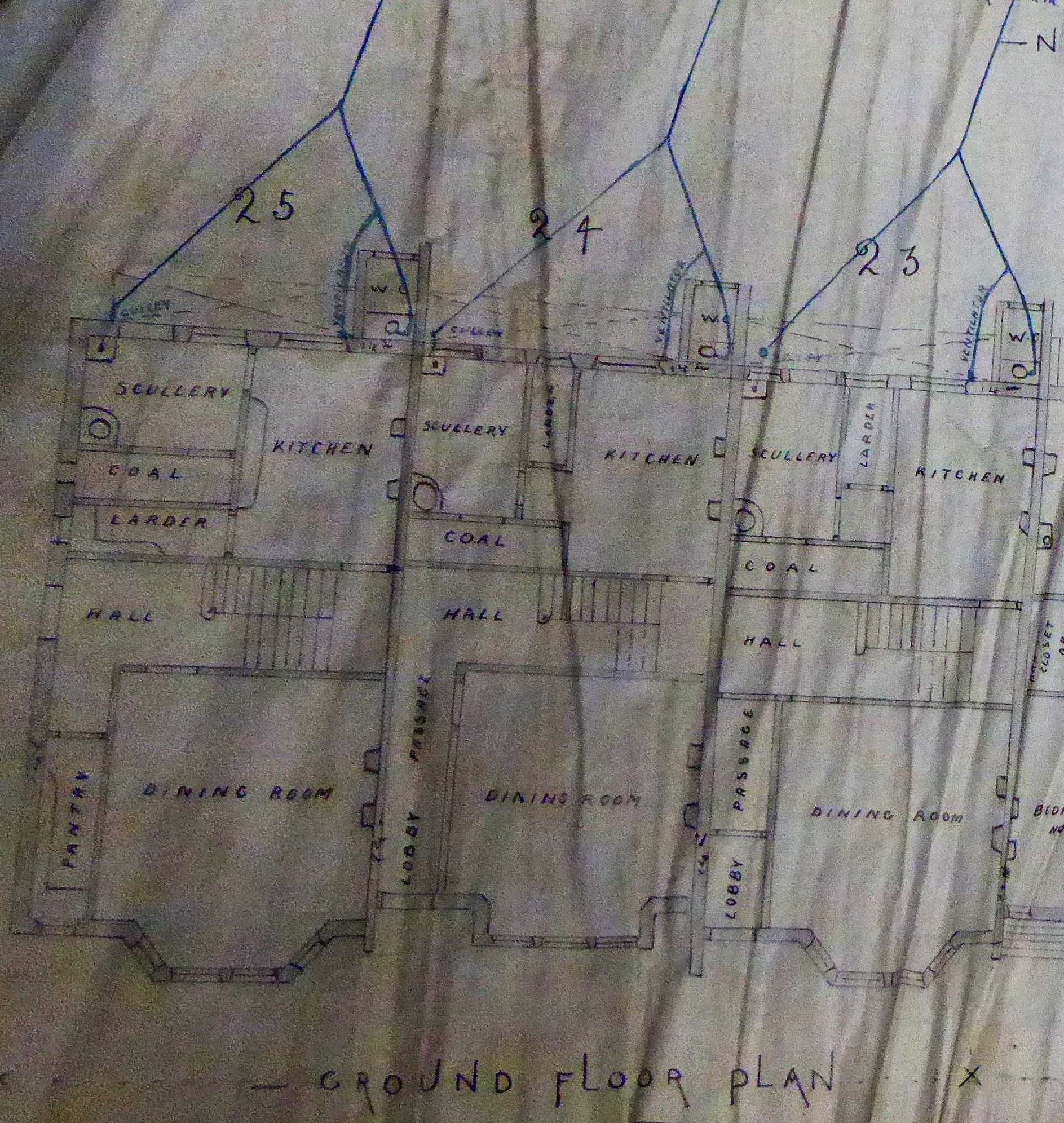
fig 24: Ground Floor plan Nos 6-8
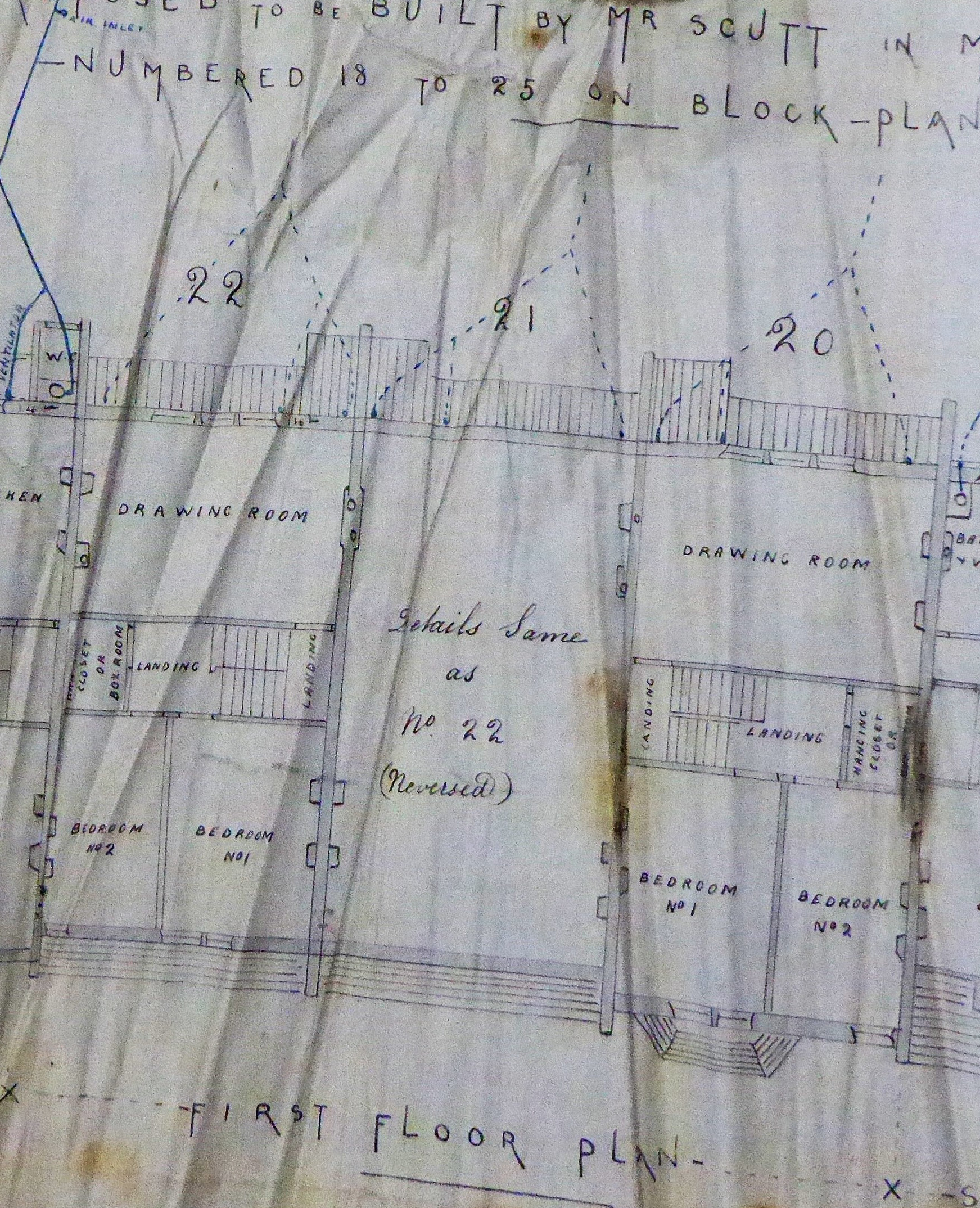
fig 25: First Floor plan Nos 3-5
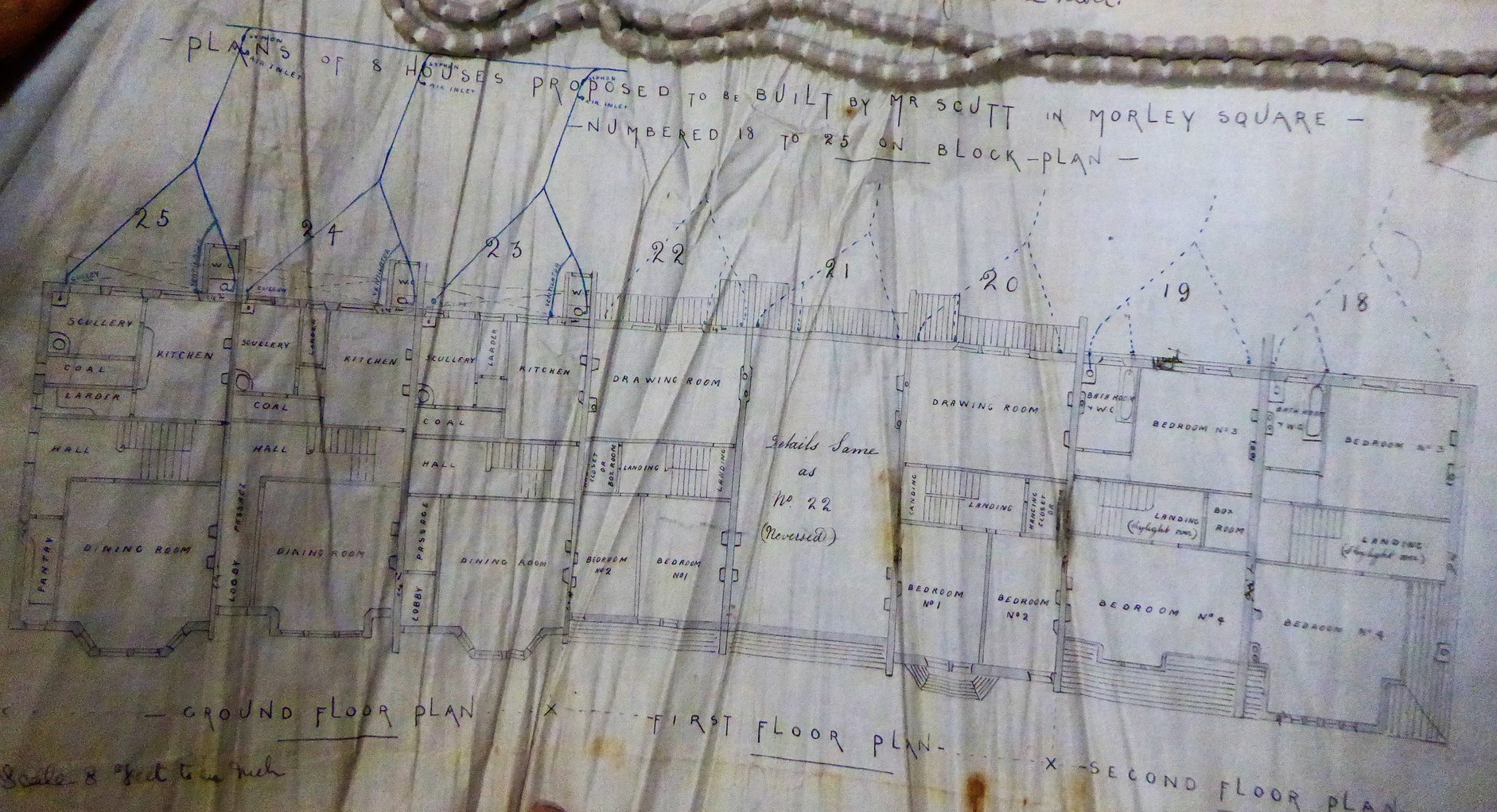
fig 26: Mr Scutt's overall plan for 1- 8 Morley Square
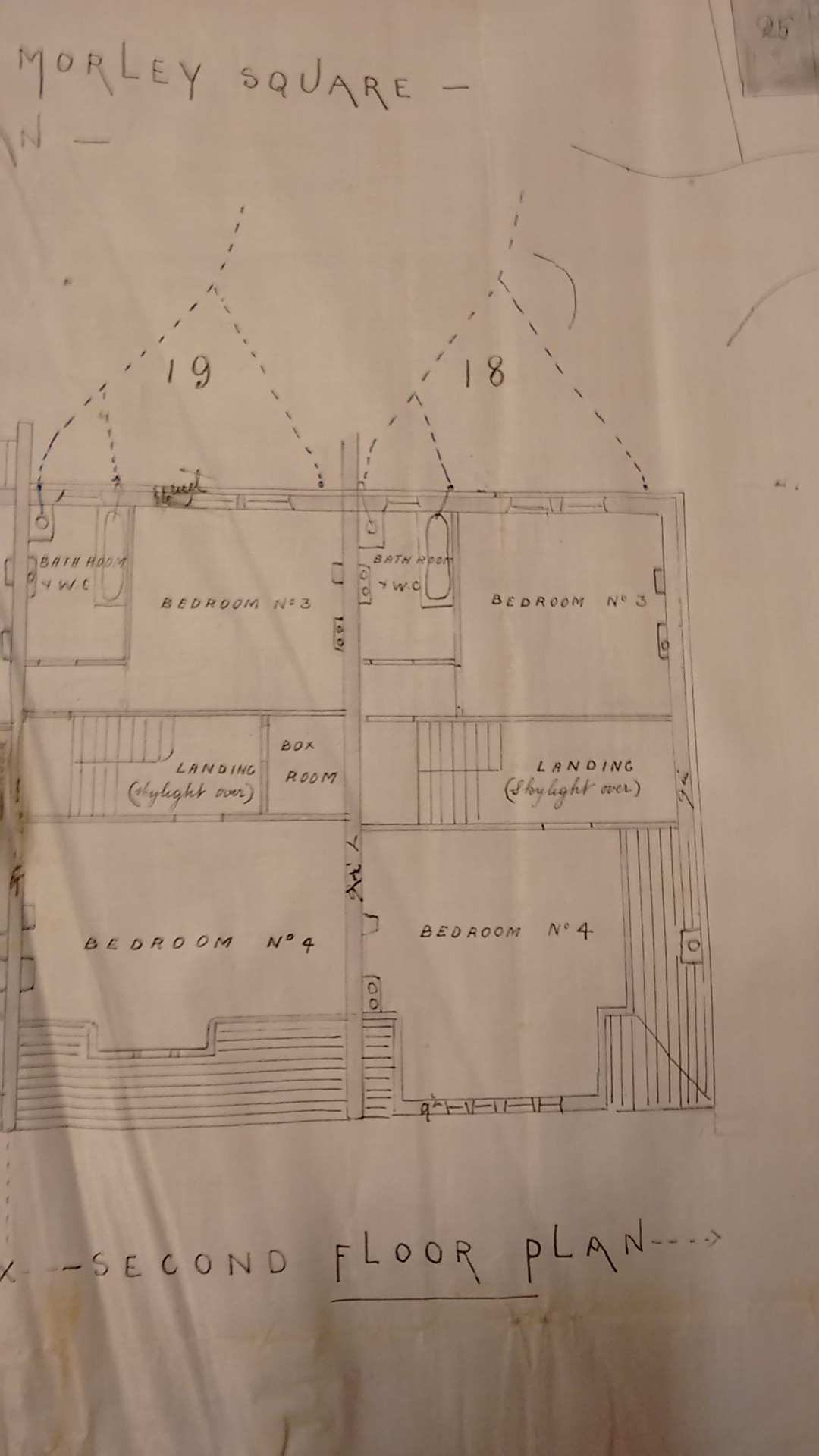
fig 27: Second Floor plan Nos 1-2
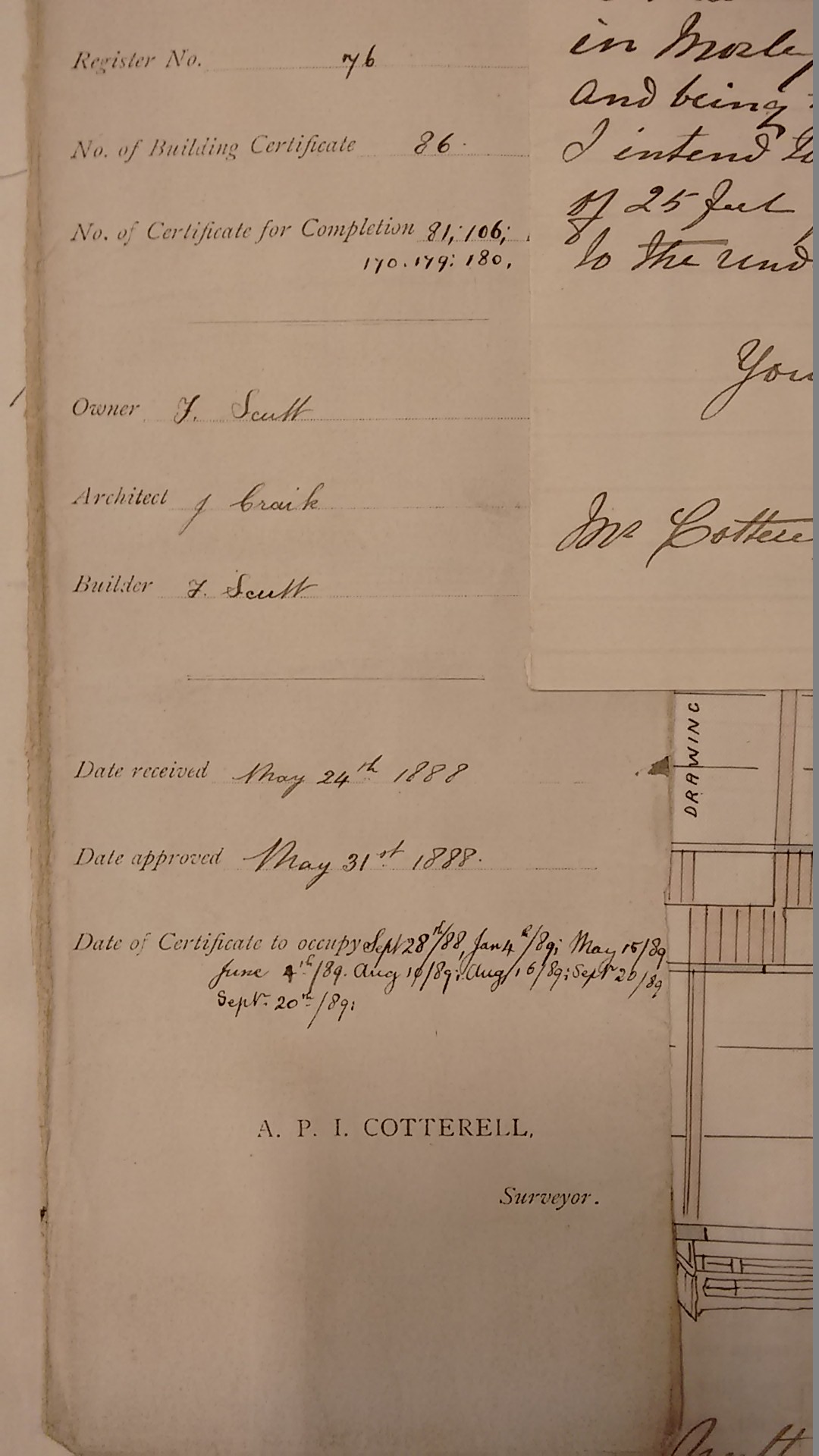
fig 28: Completion Certificate
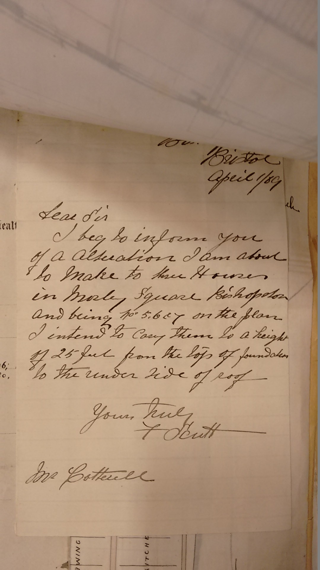
fig 29: Notification of amendment
James Gilbert
James Gilbert built numbers 12-14 and was a prolific builder in the area, mentioned
numerous times in the Horfield Local Board Minutes. He lived locally on Egerton Road
and was a member of the Board in 1884. The question of any possible conflict of
interest seems not to have arisen - though it was not uncommon for members of the
Board not to vote on matters in which they had an interest. Having retained all
three Morley Square houses as rental properties, he transferred his interest in
numbers 12 and 14 to his son in 1893 desirous of making some provision for his
son and agreed to assure to him several properties, subject to mortgages
.
His son continued to rent out these two properties until selling them in 1912.
William Howard
William Howard built numbers 15-18 and was clearly very active in the area during this period, with numerous references to his plans and house completions in the Minutes, both in this immediate area and also in Clifton. Son of a labourer he was born in Devon in 1854 and was married without children. Starting as a carpenter he evidently went on to become an entrepreneurial builder. He appears to have moved houses on a frequent basis - records show him living in Raglan Road, Horfield from 1881 to 1891 before moving to Hazleton Road by 1891, though it is possible he may have lived in number 15 for a brief period. He moved upmarket to Redland in 1897.
George Tyler
Finally, George Tyler was the builder of the north side of the square (numbers 19 - number 7 Brynland Road). He also built many other houses in the area and further afield, including number 2 Brynland Avenue, facing the square, completed in June 1888 and, earlier the same year, the houses up to Wesley Road. A developer in his own right, he purchased farmland from Mr Maskelyne for development in 1895. In 1891 he was living with his wife and five children at number 16 Brynland Avenue (on the corner of Wesley Road) - where he remained until his death at the age of 72"> in 1915. One of his sons - Wilfrid who married in 1917 - continued to live at the property until at least 1973.
The houses
The Square was constructed during 1888 and 1889. The garden itself had evidently
already been created by the autumn of 1888, described in conveyances as a newly
laid out enclosure intended to be called Morley Square
. The first house to
be completed was number 7 Brynland Avenue, conveyed on 29 September 1888, shortly
followed by its neighbour, number 27 Morley Square a week later. By the end of 1888
the sales of six properties had been completed - mainly those built by George Tyler
on the north side. Ten more conveyances followed during 1889 and with a couple of
exceptions, these were conveyed directly to their first owner/occupants with the
builder joining as a party. In 1890 the remaining properties were conveyed to their
builders - in February numbers 12-14 to James Gilbert and in July numbers 3-11 to
Frank Scutt. Many of these houses continued as rental properties for several years.
The conveyances are in identical format, other than the descriptions of plot, size and position - referring to Mile Stile Ground, Horsehill and Brynland Estate or both. They contain an easement creating the rights to enjoy the square:
....said Plot of land and also the right in common with the Occupiers of adjoining plots of Land the property of the Grantor at all convenient times to enter upon and use as a Recreation or Pleasure Ground All that Close or Garden known by the name or designation of Morley Square together with the free use and enjoyment of all Roads ways and sewers now existing or .........said Plot of land and also the right in common with the Occupiers of adjoining plots of Land the property of the Grantor at all convenient times to enter upon and use as a Recreation or Pleasure Ground All that Close or Garden known by the name or designation of Morley Square together with the free use and enjoyment of all Roads ways and sewers now existing or .....
and set out the obligations in relation to the square:
.... and will in common with the Occupiers of adjoining plots of Land the property of the Grantor keep and maintain in good condition and order as a Recreation or Pleasure Ground and to the satisfaction of the Grantor or his Surveyor the said Close or Garden called Morley Square and that in case the said Close or Garden shall not be kept in such condition and order as aforesaid it shall be lawful for the Grantor to put the same into such condition and order and thereupon the Grantee shall pay to the Grantor his proportionate part or share of the expenses incurred in so doing .....
These rights and responsibilities were given to houses with Morley Square addresses, plus number 7 Brynland Avenue, adjoining 27 Morley Square. It seems odd that the houses directly opposite the square on Brynland Avenue do not have rights and responsibilities regarding the square - given that they were on land belonging to the same landowner and completed by the same builder immediately prior to houses in the square.
Houses built in this era benefited from Public Health legislation from the mid-1800s requiring local authorities to make byelaws regarding the structural stability of buildings, drainage and the provision of air space. The 1858 Local Government Act required the deposit of plans for new buildings. Significant improvements had been made to the provision of services in urban housing, in particular the mains water supply and a sewerage system to replace wells and cesspools. House designs now incorporated bathrooms with a water supply and fixed appliances. Hot, as well as cold, water was on tap via a range. Cast iron baths had become popular in the 1880s. In 1884 the new all-ceramic WC was introduced. Gas and coal were the main sources of power. Gas incandescent lighting was introduced during this decade - electricity was not in common use. Cookers generally used solid fuel - though gas cookers were gradually coming into service.
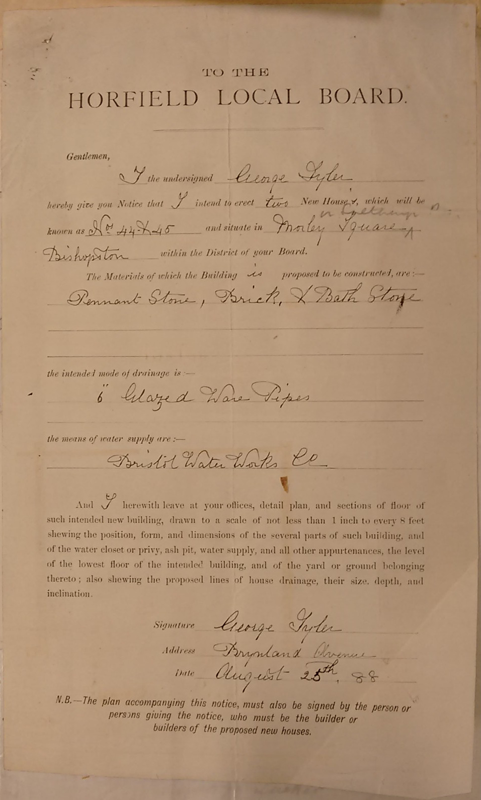
fig 30: George Tyler's permision to erect two houses in Morley Square
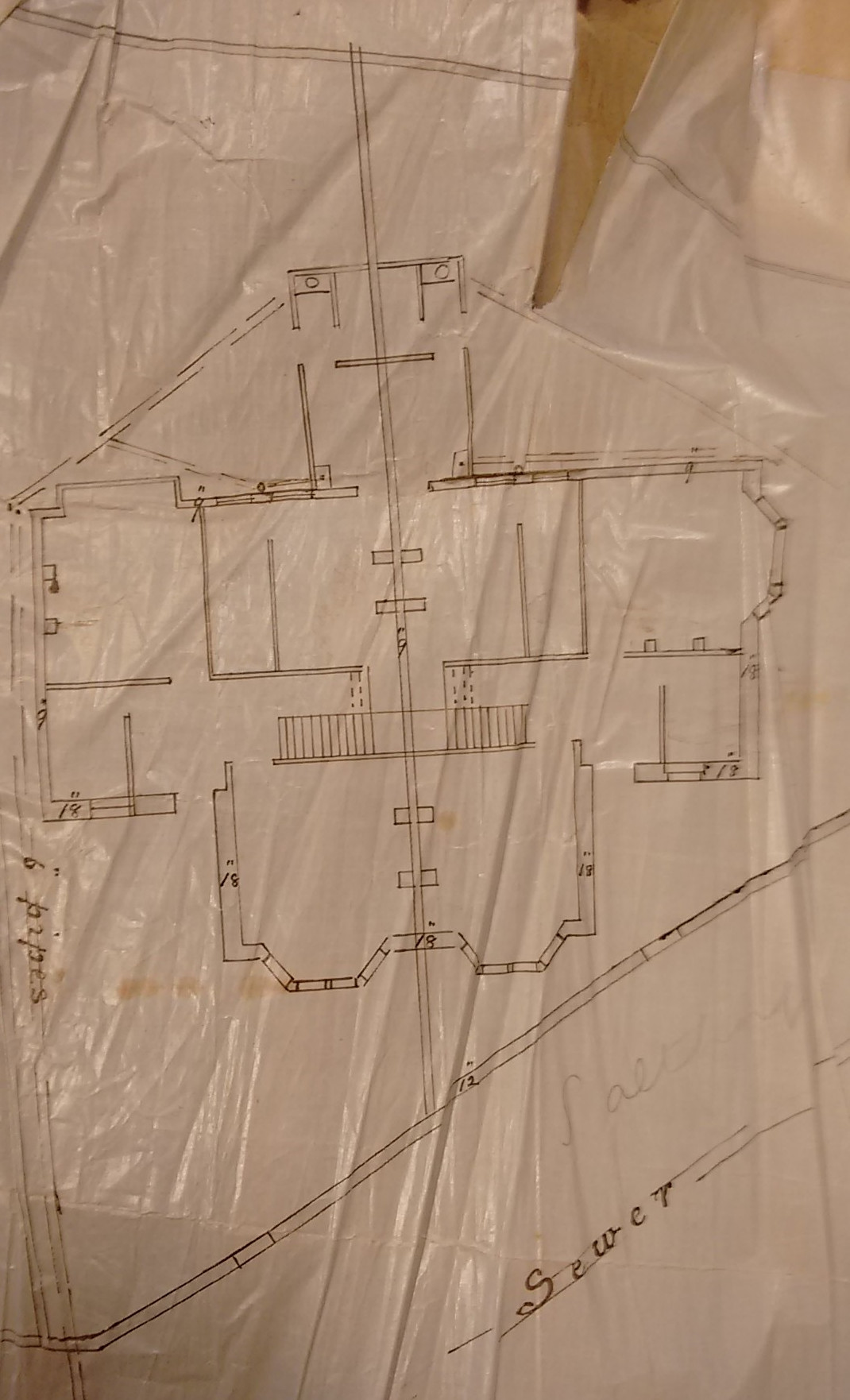
fig 31: George Tyler's ground floor plan for nos. 19 and 20 Morley Square
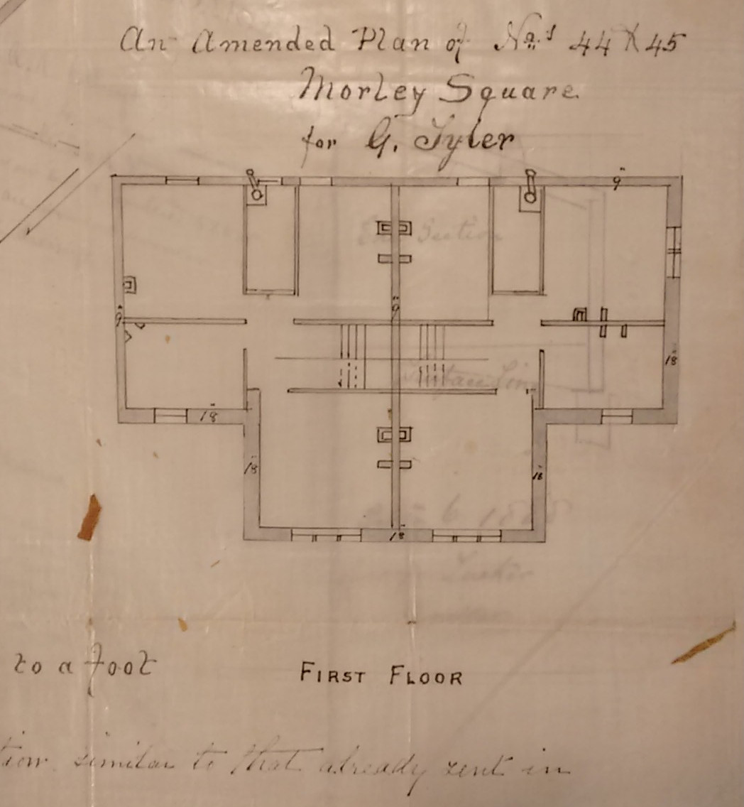
fig 32: George Tyler's first floor plan for nos. 19 and 20 Morley Square
The Morley Square houses, built for an upwardly mobile lower middle class, benefitted from these innovations. Frank Scutt's plans for the terrace of numbers 1-8 Morley Square show that in addition to sitting rooms, bedrooms, kitchens and sculleries, they have upstairs bathrooms and a WC in addition to the more conventional downstairs WC.
The purchase price of the houses to owner occupiers ranged from £320 to £400. We know less about how much was paid by the builders who retained the properties they had built to rent - presumably less. Numbers 12-14 appear to have been sold for a total of £600.
Both houses for sale and for rent were advertised, by their builders, in local
newspaper classified ads. We found advertisements placed by George Tyler for the
sale of 10 rooms semi-detached villa, 2 WCs, splendid views. Near trams. Internal
arrangements to suit purchaser.
And Frank Scutt advertising number 1: Gas
and water laid on. Close to trams. No city taxes.
Prices are not mentioned
in these ads. Advertisements for rooms in a house were not unusual: 'Three or four
unfurnished rooms, good position, can furnish part if required' - number 5.
Owner-occupiers might also let rooms to boarders: Two or three rooms, without
attendance, situated near trams and County Ground
- number 26. Proximity to
the trams was evidently a big selling point.
It is difficult to assess the relative cost of these houses by today's prices. However, judging by the ages and the relatively modestly paid occupations of the first residents, the houses were clearly more in the realm of affordable housing that they are today. We were surprised at the number of female purchasers. Several purchases involved mortgages - all private at this time. Several mortgagors were female - spinsters and widows. Evidently a mortgage was regarded as a solid investment.
The roads and square
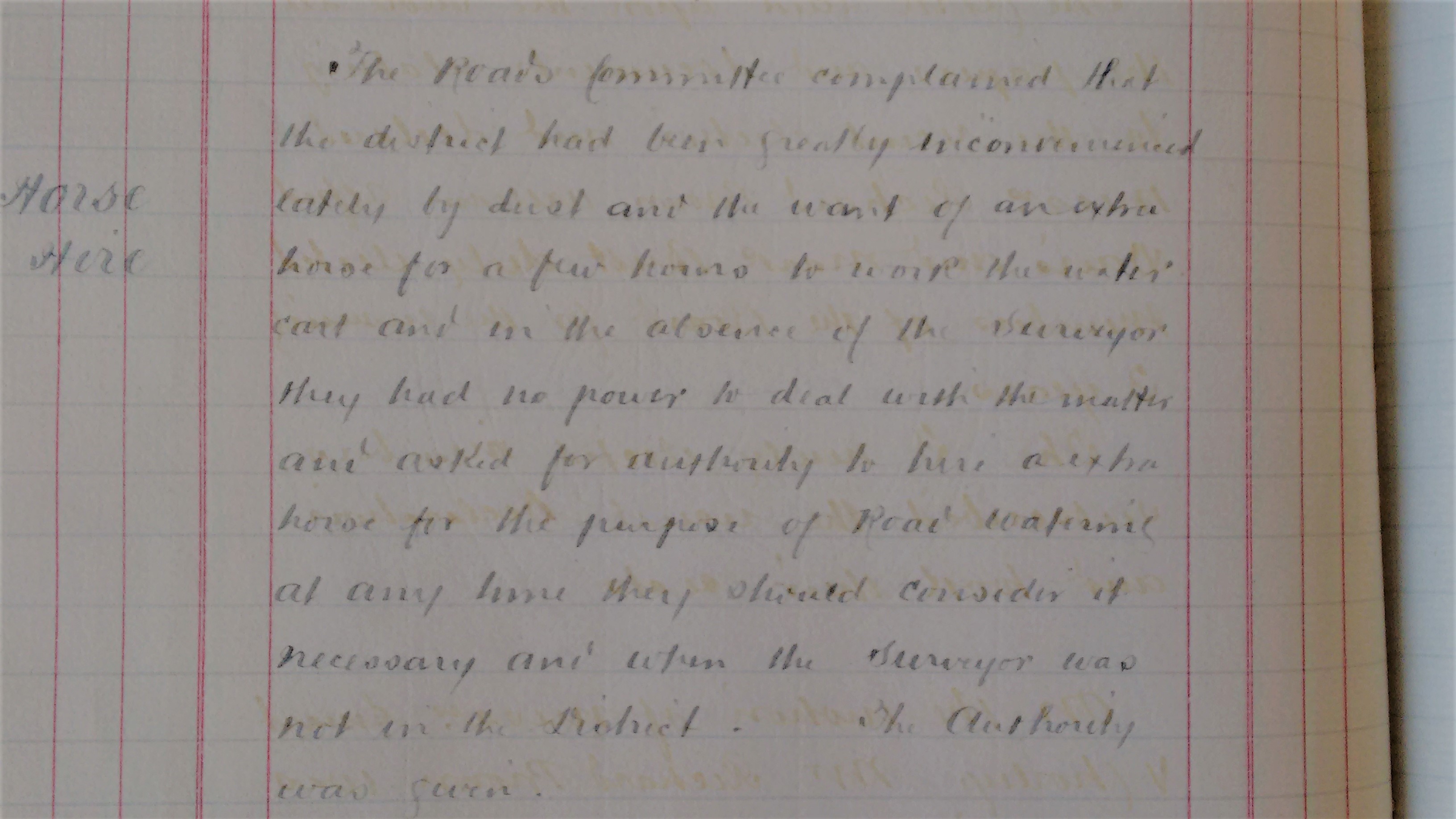
fig 33: Minutes of Horfield Local Board
Adoption of the roadway lagged some way behind the houses becoming occupied - and then only after much complaint about the conditions - in wet or dry weather. A flavour of this comes from an item in the Local Board minutes authorising the hire of a horse to work the water cart.
In December 1891 the Local Board Minutes report that a 'memorial' has been received from the inhabitants of Morley Square asking for the reconstruction of the road there. The surveyor was instructed to prepare specifications. Strangely a similar request from a resident of Salthrop Road in March 1892 was left 'to lie on the table'!
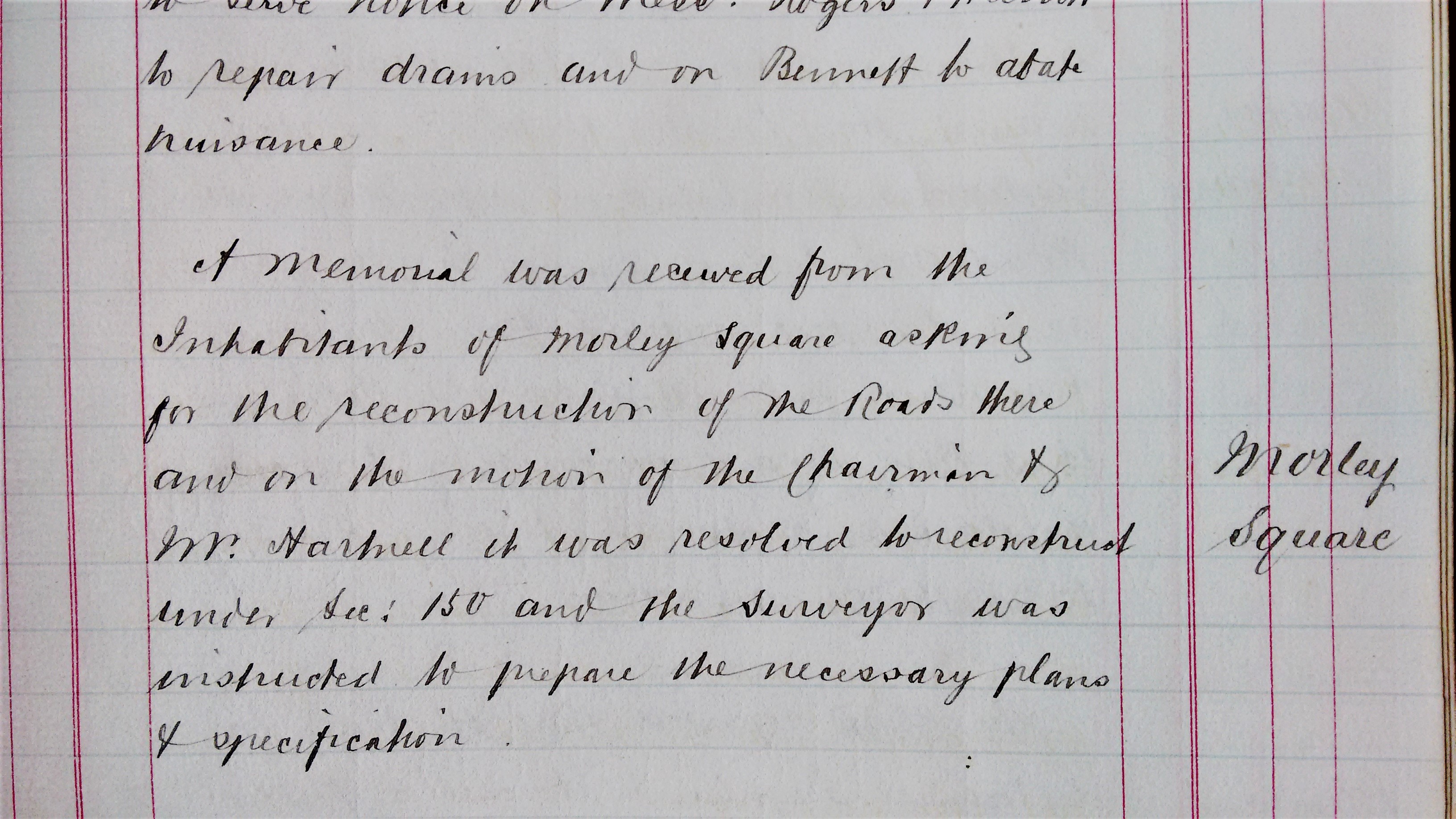
fig 34: Minutes of Horfield Local Board
A furious letter to the local press in October 1892 complained about roads near the County Ground:
Take Morley Square and its connection roads. Mountains and valleys fairly represent their condition at present - mountains of mud and valleys filled with water, which overflows the footpaths, rendering them impassable except by wading through it. And why? Simply for a few hours to clean out the water courses and a few loads of ashes to make a decent path - a very poor return for the hundreds of pounds paid by the residents in rates.Another the following month complained about being charged 'sanitary rates' of £6 but still being 'surrounded by a sea of mud and in total darkness at night', ending plaintively 'Please cart our mud away'. A correspondent to the Western Daily Press commented in February 1893:
I walked around the roads in question yesterday and I was literally astounded at the abominable state of things. The roads are nothing but a literal quagmire, the average depth of the mud over the whole of the surface being quite a foot; all sorts of refuse thrown into the roadways is allowed to remain there, and, in fact every one of those thoroughfares resembling rather the run of a gigantic pig-stye is utterly neglected by the model Local Board of Horfield. .... Apart from the hygienic aspect, the whole of the newer part of the district is in an utterly impassable condition.....He goes on to say that the Board have resolved to borrow funds to improve conditions in
such places as Morley Square. Horfield therefore may still hope to be saved from its 'Slough of Despond'.
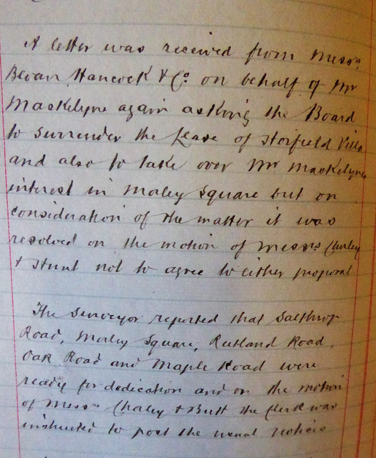
fig 35: Minutes of Horfield Local Board
Eventually in May 1893, the Board reported that tenders were to be obtained for the reconstruction of Morley Square and Salthrop Road. These were duly received a month later and one for £188 accepted. By January 1894 the roads were ready for dedication and the instruction was given to 'post the usual notices'. In July 1894 builders Scutt and Gilbert wrote asking the Board to take over Rutland Road. This was agreed, and notices were to be given of the intention to dedicate the road as a public highway.
Mr Maskelyne seems to have been more or less permanently in some sort of dispute or fraught negotiation with the Board. In September 1892, as landlord of their premises at Horfield Villa, he requested that the Board give up a portion of the grounds to enable him to extend Brynland Avenue to Gloucester Road. The Board were reluctant to do this, not wishing to lose their precious yard accommodation. A year later he requested the Board to surrender their lease. This request was subsequently repeated in January 1894, at the same time as the additional request that the Board take over his interest in Morley Square. The Board however resolved not to agree to either request.
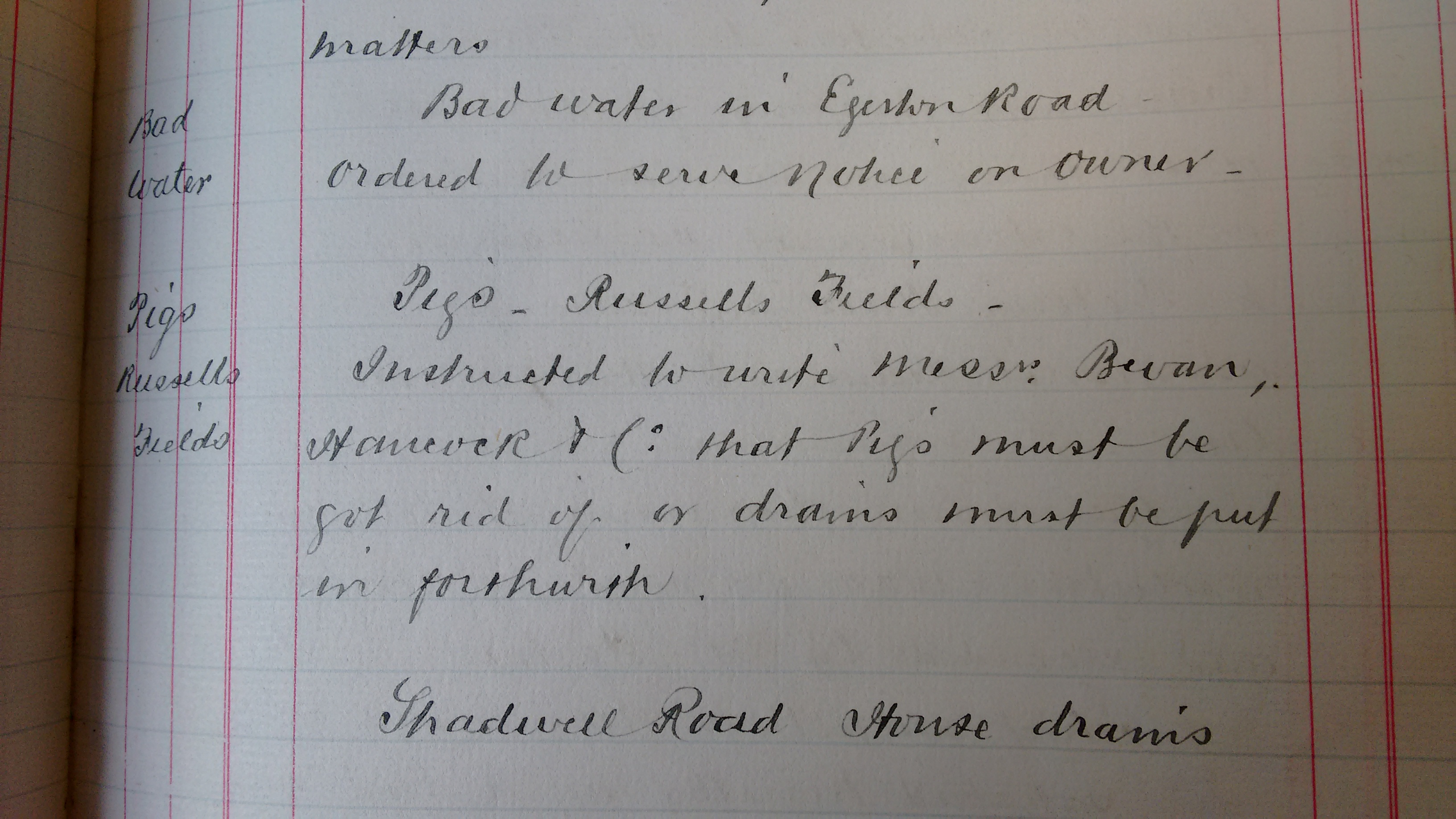
fig 36: Minutes of Horfield Local Board
The square - which thereby narrowly avoided being taken over by the local authority - was conveyed at the end of 1896 to three owners of properties around the square - presumably as representatives of all those sharing the same rights and obligations. There is no record of the state of the square at that time.
Early Years - to 1900
The first residents of the square are conveniently described by the census of 1891. The total number of this first population of the square was 153 - probably the largest it was ever to be. This first population was a young one, with 70 children (17 and under), 58 adults under the age of 40 and only 25 over 40 years old. Nearly all the houses were inhabited by families with between one and six children. Several of these households also included wider family members, for example nephews, brother-in-law, adult children. There were live-in servants in 15 homes - including all but two of the houses on the north side of the square. Several households included boarders and lodgers. The largest household totalled 11 occupants including parents, children, boarders and a servant. One family had three additional school aged children living with them. Residents of the remaining four houses were couples, a mother and son and a group of four adult sisters. 44% of these original adult residents were born in Bristol with a majority of the others coming from the south of England, though some from as far afield as Ireland and the Cape of Good Hope. One of the original residents came to live in the square aged 6 and stayed for 75 years - until 1965.
The male residents all worked unless retired. The occupations were varied, indicating a diverse community. The preponderance were clerical support workers - clerks and shop assistants and several commercial travellers. There were a few professionals - accountants, an auctioneer, a clerk in holy orders and a 'financier'. Some were in craft related trades. The builder of many of the houses in the square was one of the first inhabitants. Wives and mothers did not have specified occupations. None of the single females worked, but were described as 'living on their own means'. Of the children in the age range 14-17, four were working in occupations such as clerk and telegraph messenger, while another four were still in education. Six of the servants were also in that age range.
The houses quickly acquired names. These seem not to follow any pattern or theme - for example 'Rockleaze', 'Dundee Villa', 'Camden House', 'Pengreep', 'South View'. It is not clear whether the names were chosen by the builders or their first occupants. Early adverts - whether for letting, or for servants, used names rather than numbers.
The population of Bishopston had risen from 4,756 (483 houses) in 1881, to 7,557 (912 houses) in 1891. The rapidly expanding growth in population in the area created the need for greater capacity in schools, churches and transport. The church school opposite the vicarage on Gloucester Road had been struggling to accommodate the increasing number of children for some time. In 1888 an extension to accommodate 150 infants had been built with funds raised from the public. However, the whole school was replaced in 1894 by the new school on Bishop Road under the Horfield School Board. Several extensions were added to the new school over the next 10 years.
In 1890 the vicar of St Michael and All Angels told parishioners that the accommodation of 520 in the church was now inadequate. The situation of the original vicarage prevented further extension of the church and it was therefore demolished and rebuilt. Evidently number 2 Brynland Avenue became a temporary vicarage until the new vicarage was completed. The Wesleyan chapel and school built in 1890 almost immediately became far too small for the size of its congregation and in 1894 the large new church with accommodation for 600 people was opened next to the original. Similarly, the Methodist chapel built in 1900 was superseded by a far larger building next door within a decade.
The tram service was a vital asset to the newly created urban area. In January 1889
the Horfield Local Board had requested that it be extended further up Gloucester
Road in view of the increased and increasing population
. A new depot was
opened in Horfield in February 1893 a little way beyond Ashley Down Road with
accommodation for 135 horses, 20 cars and six 'infirmary' boxes. The trams were
timetabled to run every 10 minutes from Horfield. It was noted that while only six
years earlier, five cars had been enough for the traffic, now 10 were required.
Scope was made for the expansion of the service for this rapidly growing
district
.
Development continued along Gloucester Road. Between 1890 and 1900 there was a dramatic increase in the number of shops extending northwards up to and beyond Ashley Down Road. The shops were typical of any high street - grocers, bakers, fruit and vegetable shops, butchers of various types and fishmongers, and clothing and shoe shops. All types of building trades were well represented along with all types of supplies for new houses - paints, tiles, furniture, carpets, linen, etc.
The Minutes of the Horfield Local Board refers to the planting of trees in July 1889. Unfortunately, in June the following year, the Board notes damage being caused to the trees by horses and buses and also the nuisance caused by boys assembling by the horses.
New clubs and societies formed to occupy the new inhabitants of the area. The newly formed Bishopston and District Choral Society gave their first concert in May 1891. The Horfield and Bishopston Unionist Club was founded in 1899 on the former premises of the Horfield Local Board. On a more discordant note, the Local Board had their attention drawn to 'the disorderly conduct of soldiers and girls on the Gloucester Road also to the bad language used and other annoyances ....' The clerk was instructed to write to the police.
Cricket at the County Ground was proving a great success with the expectation of
crowds of 8-10,000. The local paper reported enthusiastically on a game at the
County Ground between the visiting All America and Chicago Baseball Teams - Most
of them are tall, finely developed athletes - one a giant of 6' 4”
.
Thousands came. However - perhaps foreshadowing frictions with local residents to
come - even before it opened, the Ground's application for a drinks license had been
refused, though it was stressed that the ground would 'of course' never be open on
Sundays and closed every day at 7pm. However, the 'At Home' given by the Directors
of the Ground in January 1890 for 600 guests was a brilliant success, both as
regards the enjoyment of the 600 guests who were there and also as regards the
practical object in view - to teach Clifton people that Ashley Down is not an
immeasurable distance away, and to induce them to come and see what a splendid
ground the directors have there.
Alongside all this new-found gentility however, the problem of the drains and pigs of
Russells Field persisted for some years. The Local Board resolved in October 1890
that Pigs in Russells Fields must be got rid of and drains must be put in
forthwith
. In April 1891 the Inspector of Nuisances was instructed to serve
notice on Skuse of Russells Fields to get rid of pigs and on Mr Maskelyne to put in
drains. Mr Maskelyne's difficult relationship with the Horfield Local Board
persisted, not infrequently resulting in his having to be ordered to deal with
matters on his land. In March 1896 they were in dispute over an alleged breach of
byelaws in Blacksmith's Lane (off Brynland Avenue north of Nevil Road), with the
Board resolving to take proceedings.
Edwardian years - 1900-1914
Queen Victoria died in 1901 and was succeeded by Edward VII. The Edwardian era stands out as a time of peace and plenty. There were no severe depressions, and prosperity was widespread.
The population of Bishopston in 1901 had increased to 9,140, and was still increasing
- to 11,996 in 1911 (boundary changes make exact comparisons difficult). Bishopston
remained part of the parish of Horfield for civil matters. The issue of whether
Horfield should be absorbed into the City of Bristol had become a matter of
controversy. The Local Board strongly favoured independence: The district is
efficiently sewered, lighted, watered and scavenged and provided in all other
suchlike respects equally as well as the City of Bristol ... without borrowing
....
However, a Bristol resident in 1889 expressed the opposing view:
Land at Bishopston, Horfield ... is being rapidly built over and all the
houses in those districts are ultimately drained into the Bristol sewers ....Now
the draining from the localities I have mentioned increases the risk of low
lying parts of Central Bristol being flooded after heavy storms. If the
boundaries of the city were extended so as to include Bishopston, Horfield and
Ashley Hill, the inhabitants would have to pay their contributions towards the
costs of the sewerage of the city and would also help to bear the expense of
constructing works to remedy floods, towards causing which their draining
contributes not a little.
Although in 1895 the Board resolved to oppose
Boundaries Extension Bill, ultimately Horfield was absorbed into Bristol in 1904.
The main form of transport at this time was still the horse. Cars were still very much a novelty - seen as a fad by most people. However, Bristol was one of the venues for the 'Automobile 1000 Miles Trial' - a nationwide event to demonstrate the practical advantages of the car and to allay fears such as the danger to pedestrians, smells, noise, vibration, etc. and this created the beginnings of a groundswell of enthusiasm for motor vehicles.
The first electric trams arrived in Bristol in 1895 and by 1900 the whole system was electrified amid huge civic pride and public enthusiasm with opening ceremonies marked by firework displays and even free meals for the public, and routes lined by huge numbers of spectators. In 1905 Bristol Tramways undertook trials of motor buses - open-top double-deckers which soon spread to all routes.
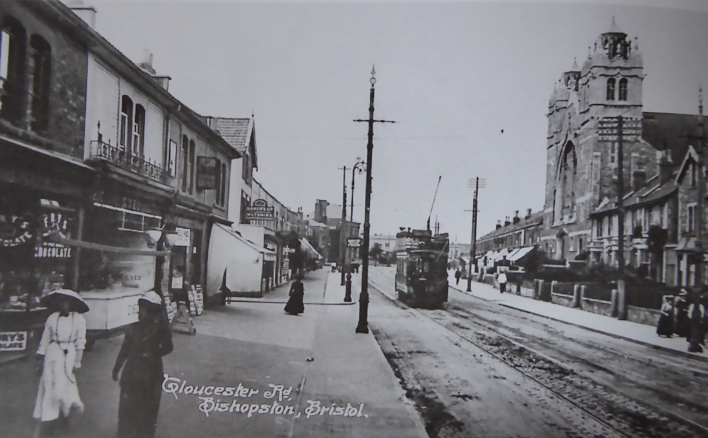
fig 37: Gloucester Road with trams 1914
Moving pictures arrived in the locality when the Premier cinema opened in 1914, built by a local engineer Samuel Justin, who also owned a bicycle business on Stokes Croft and amusement arcade in Weston-super-Mare. With 600 seats downstairs and 100 seats in the balcony it was much loved until falling out of favour in the 1940s.
The census of 1901 shows that 15 properties were still occupied by the original families - twelve of the 16 owner occupied houses, and three of the 11 rental houses. Some quite large families had moved after surprisingly short periods of tenancy - whether to buy their own homes, or for work reasons is impossible to know. The overall population of the square had reduced from 153 in 1891 to 129. Given that half the population were the same families 10 years on with children having moved out, it is perhaps not surprising that the number of children had shrunk to only half the number in 1891. Only 53% of families had children aged 17 or under, compared to 82% 10 years earlier. The number of children nine years or younger was only just over a quarter of the number in 1891. Households were generally smaller - a consequence of fewer children, only half the number of houses with servants and many fewer relatives. Occupations were broadly similar to those in 1891, with the addition of several teachers.
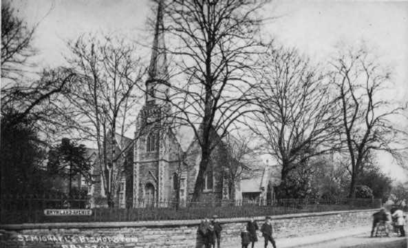
fig 38: St Michaels and All Angels church from Brynland Avenue
The census of 1911 shows a further reduction in the overall population of the square - down to 103. The number of children had again reduced - only 21% of the total population compared to 46% in 1891, though the number of families with children remained roughly the same at 52% as it was 10 years earlier. The population of servants had halved again - now only 4 - a quarter of the number in 1891. The average size of household was again reduced in comparison to earlier years - now 4 - though there were still 3 homes with 8 residents. The average age of adults was edging up from 36 in 1891, to 38 in 1901 and 43 in 1911, as the number of those over 60 was steadily increasing - more than double that of the original population by 1911 - from 7% to 17%. Occupations again covered a wide spectrum but with notably more self-employed men than previously. The number of rented properties, as revealed by the 1910 Valuation Survey appears to have risen to over 50%.
Twenty years after the houses were built, there were still five of the original families living in the square - all owner-occupiers. Living at number 11 were Priscilla Westover (then aged 61) and her 19-year-old son Herbert. They had come to the square from a small farm in Dorset where they had lived with Priscilla's husband George and their 7 living children. Some catastrophe seems to have occurred resulting in the breakup of the family and departure from the farm - George and another son going to lodgings in Gloucestershire. Herbert was listed as a clerk in 1891, then a law student in 1901 and then an insurance agent in 1911. Beatrice, one of Priscilla's daughters married in 1891 and came to live nearby, first in Kennington Avenue and then in Nottingham Road, with her two children. Priscilla died in 1919 at the age of 89, at which point Herbert left the property.
At number 17 were a couple already in their 50s when they first came to the square - Samuel Rawlings, a grocer, and his wife Caroline - both from Somerset. Their married daughter Rose lived elsewhere. The family had previously been living over their grocery shop on Gloucester Road. By 1901 Samuel had retired. Caroline does not appear in the 1911 census, but there was a servant. Samuel died in 1911 aged 75.
fig 39: Looking down the east side of Morley Square from Salthrop Road
At number 21 was the Codrington-Hobkirk family. The Rev John Hammond Codrington-Hobkirk, born in Northampton was aged 45 when he came to the square, and was Domestic Chaplain to the Right Hon. Lord Haldon. His wife Frances, 10 years older than him, came from Oxfordshire. They had two daughters then aged 20 and 21 and a son, Hammond, aged 19 - a banker's clerk. Their servant Anne Pillinger was aged 25. Daughter Ethel was married in 1894, at St Michael's church, to a schoolmaster and went to live at a preparatory school in Wrexham. Her sister Emily was married in 1896, also at St Michael's, to a gas collector and moved to nearby Lancashire Road. By 1896 John seems to have become a barrister. John, Frances, Hammond and a series of servants remained at the property for many years. John died in 1915 aged 71, outlived by Frances who died in 1917 at the age of 84. Hammond lived there until 1919 - 30 years after first coming to the property.
Next door at number 22 was the Jefferies family - Robert aged 49 in 1891 - a commercial clerk, his wife Anne, children Robert and Maggie aged 13 and 12. Son Robert had left by 1901, but 22- year old Maggie was still there with her parents. By 1911 Robert and Anne still lived at the property, together with Frederick and Marion Bishop, a couple in their 30s.
The Salmon family lived at number 26 - Lewis, aged 35 when they came to the square, a clerk born in London, and his wife Sarah aged 30, born in Frome. They had children - Leslie aged 11 and baby Daisy, born in the square. The household also included a servant Maud Davis, a 22-year-old brother-in-law - a cabinet maker, and John and Janet Turner a couple in their 20s. Another son Cyril was born in 1894. By 1901 Lewis was clerk to the Orphan Homes. The family had been joined by 78-year old aunt - Mary Isaac, and a servant Ethyl Gibbs; the Turners had left. By 1911 son Leslie was married and gone to live in London. Daisy - now 21 - was a Fine Art Colourist and Cyril was studying at Bristol University. Daisy married Albert Heber in 1921. Lewis and Sarah remained at the property until 1929 - after 40 years in the square. Lewis died in 1940 aged 85 and Sarah in 1942 aged 81.
First World War - 1914-1918
All Edwardian jollity came abruptly to an end with the outbreak of the Great War on 28 July 1914. This was the first war to involve the entire nation rather than just the armed forces, with the government able to command the energies of the whole population in the mobilisation of modern industries towards the war effort.
The British and Colonial Aeroplane Company was founded in 1910 by Sir George White, chairman of the Bristol Tramway and Carriage Company. The company's first premises were two former tram sheds suitable for aircraft manufacture at Filton, leased from the Bristol Tramway Company. During the First World War over 3,000 Bristol Fighter planes were built in Filton and Brislington. Women worked in these aircraft factories for the first time replacing men who had joined up to fight. Several Morley Square residents were employed in the engineering and aircraft industries.
The Bristol North Baths had been started in 1915 and were immediately taken over by the Ministry of Munitions for use as an instrumental factory where relays of workers - nearly all young women - were taught to perform various tasks in the manufacture of aircraft wings so that when they moved to the actual workshops they would be familiar with the work and implements.
There seems to have been little change in the physical structure of the area. The shops on Gloucester Road show hardly any change over the duration of the war. Some familiar businesses arrived, including Boots and Lloyds bank, and the neighbourhood was well served by butchers, grocers, green-grocers. However, it retained some of its rural connections too, with five corn merchants, presumably feeding chickens, horses and pigs. Entertainment was sorely lacking however, apart from 17 pubs and beer sellers. It was boom-time for buying clothes, with 45 clothes shops.
A major impact on civilian life was of course the loss of the lives of so many young men, affecting so many families. The 'Your Country Needs You' campaign resulted in over a million voluntary recruits to the forces by January 1915. However, this was not considered adequate and, amid much controversy, conscription was introduced in March 1916 - initially for all single men between the ages of 18 and 41 and later to include married men - both subject to various exemptions. By 1918, one in four men were in the forces.
In 1914 an estimated 11 men of conscription age were living in Morley Square, with another two who came to live in the square during the war. We assume that many, of these young men must have served in the Great War. Of these, we know of three who died.
Ernest Congdon from number 20 had been a pre-war Territorial soldier and was sent to France on 2 November 1914. Just 15 days later he was killed in action in the Flanders trenches - at the age of 21. His name is recorded on the Menin Gate Memorial at Ypres.
Francis Kitchen from number 7 - a Lieutenant in the Royal Flying Corps, having transferred from the Army - was killed in action on 11th April 1917 at the age of 20. He was reported missing in action after sorties checking on the position of our troops, dropping supplies and artillery spotting for the Battle of Arras. The Arras Flying Services Memorial in Arras commemorates nearly 1,000 airmen killed on the Western Front with no known grave. Francis' brother Eric also saw service in France, with the army.
Herbert Bennett from number 24 - former pupil of Fairfield School - died at the age of 18 on 6th August 1918 - a private in the Cyclist Battalion of the Gloucesters. He is buried at Niederzweheren Cemetary in Kassel, Germany.
Another victim of hostilities was Tom Phillips, one of the original residents of the square, having come to number 19 as a baby or having been born there. The family were resident in the square for only a few years, but remained in the area moving first to 5 Brynland Avenue and then to Kent Road. Tom was killed in action on the Somme on 19 September 1916 at the age of 26. His brother Stanley also saw action in France and was awarded the Distinguished Conduct Medal.
We know of one young man taken prisoner, from his father's letter to the Western Daily Press in 1915. James Olds wrote about his son who had been a prisoner in Doberitz - a large POW camp near Berlin - for over a year. His son had told him that his fellow Bristolian prisoners were in great need of boots and clothes, prompting his father's request for contributions to forward on to his son to distribute among these young men.
One of the curates at St Michael's and All Angels enlisted in the forces and was reported missing believed killed in October 1916. The vicar, the Rev. Archibald Sewell, feeling he should do his bit, went with his wife - a qualified nurse - to serve with the British Mission in Serbia. They returned to Bristol after six months - just before Serbia was overrun by Bulgaria. He was then asked to take up the Army Chaplaincy in Woolwich where his wife also served as a nurse.
Inter-war years - 1918-1939
This seems to have been a relatively peaceful uneventful period in the square and locality. Shop development along Gloucester Road was much as now. The main categories of business were food shops of all types, together with clothes and shoe shops. This seems to have been the heyday for confectionery shops with nearly 30 along the road during this period - together with around 10 tobacconists. There were, however, only two or three places to eat!
Following its appropriation for the war effort, the Bristol North Baths were not finally fitted out and opened until 1922. The design incorporated temporary flooring so that during the winter months the premises could be converted to a cinema - common practice during this era. Further up the road, the Premier cinema underwent a number of upgrades as the talkies arrived in the late 1920s.
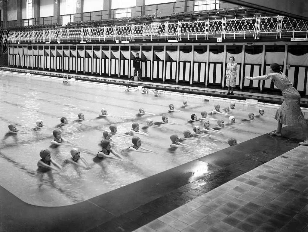
fig 40: Swimming lessons at Bristol North Baths
fig 41: Bristol North Baths as a cinema.
In July 1920, during a debate as to the re-siting of the statue of Samuel Morley (now in Lewins Mead), a correspondent to the local press suggested Morley Square as a possible location - but no more was heard of this.
In 1921 the Prince of Wales made a visit to Bristol. His tour around the city included a 50-minute visit to the County Ground for the match between Gloucestershire and Australia, after which the tour continued through Morley Square en route to his next venue at Cotham Hospital. In November 1926 another newspaper correspondent suggested Morley Square as a suitable site for a bowling green for north Bristol - referring to the square simply as 'a plot of ground'. There is reference to a tennis court on Morley Square before the war which may have given rise to this idea.
There is no record of the condition or management of the square during this era, though it was later reported that Morley Square had been well maintained during this period. Cars were now beginning to make their presence felt - not always a positive presence. A newspaper reported on the driver of a motor van being charged with 'furious driving', witnessed by someone who thought he was driving too fast into Morley Square 'having regard to the amount of people and traffic about at the time'. He pleaded guilty.
With cars came the issue of car parking - as we know only too well today. A press announcement made in April 1923 set out the 'official regulations' listing places where 'motorists will be allowed to park their private cars or cycles for a reasonable period while they are shopping or making business calls.' The list of 18 locations, providing 150 spaces in Bristol, included 10 places in Morley Square - on the north side alongside the railings. Parking was only permitted during daylight hours and all at the owner's risk. The places were marked at each end by 'pitching stones'.
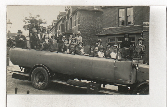
fig 42: Coach trip
Again, as a forerunner of frustrations to come, an item in May 1926 from the Western Daily Press about the visit of the Australian Cricketers to the County Ground, headlined 'A Motor-car Invasion', reported that the organisers had announced that no cars would be allowed inside the gates (despite complaints from those who would habitually watch matches from the comfort of their own car seats!). The report continued that had the police not taken over the direction of car traffic, chaos would have ensued, with over 1,000 cars to be dealt with. The police adopted the procedure of handing notices to drivers specifying where they should park - using all local roads around the Ground, including Morley Square. The match lasted for four days with daily admittance being nearly 10,000.
The square was by now 30 years old and well-established. There had been very few changes of occupation around the square during the war but the the 1920s saw a major turnover of residents, with 19 (68%) of properties changing occupants. Only one of the original families now remained, though four families who arrived in the early years up to 1908 were still in residence after the war, and continued to live there for some time.
Many of the 1920s newcomers went on to continue living in the square for a considerable number of years themselves - three into the 1950s, one into the 1960s, another into the 1970s, two into the 1980s and one right until 1999. Many had come to the square as families, but as the years went by gradually dwindled until a sole survivor of the family continued living at the property, sometimes with other occupants - presumably lodgers.
For example, the Bullocks moved into number 8 in 1927 - Fraser, a builder in the Carpenter and Joiners Union, and his wife Janet were both 38. Janet previously had a fruiterer's shop at 238 Gloucester Road (now part of Joe's Bakery). In 1930 the couple bought number 12, over the road as a rental property for £635. Fraser died in 1935 aged only 46 but Janet continued living at number 8, initially with four lodgers including Florence Cole - a shorthand typist from Bedminster. She sold number 12 in 1946, but remained at number 8, intermittently with others, though from 1956 only Florence Cole. Janet moved out in 1970 after Florence died.
Arthur Collins came to number 3 in 1925 with his wife Annie. Arthur, aged 48 was an engineer's cost clerk, while Annie - four years older - was engaged in 'unpaid domestic duties' - like most married women at the time. Their two sons were Joseph, aged 23 - an electrical engineer and Arthur Alfred aged 19, a market gardener. Arthur suffered injuries when knocked down by a motor cycle in 1941. The family grew older together in the house, diminishing in number - Annie died in 1967 at the age of 94, Arthur in 1973 aged 96. Arthur Alfred died in 1980 aged 73, and finally Joseph died at the property in 1986 - aged 84.
Between 1914 and 1930 curates from the parish church were living in number 23 - first the Rev. Sydney Robert Worters until 1917 and then The Rev. William Edwin Dance from 1921 to 1930.
A notable resident of the square during this era, very active in public life, was Arthur Bennett who came to number 24 in 1917 - with his wife Clara and five sons. Arthur, who died in 1928 aged only 54 received a glowing obituary in the Western Daily Press describing him as 'widely known in many circles in the city and district'. Born in Chichester he worked as a Commercial Traveller in the leather trade - and served one year as Chairman of the Bristol Branch of United Kingdom Commercial Travellers' Association. With his wife he was a leading player in the Commercial Travellers' Dramatic Society, being particularly commended for his performance as Crichton in 'The Admirable Crichton' at the Victoria Rooms the previous year. He was a well-known public speaker and had won the Clara Butt Challenge Cup at the Bristol Eisteddfod two years running. He was a popular entertainer - ably assisted by his wife, and broadcast on several occasions. He was a keen free church worker - a lay preacher for many years all over Gloucestershire, Somerset and Wiltshire. For four years he was honorary pastor of Westerleigh Tabernacle, before accepting the pastorate of Brunswick Congregational Church in Bristol. He was also a deacon at the David Thomas Memorial Church locally, and Secretary of the David Thomas Literary Society. He was also Secretary of the Bristol and District Council of the League of Nations Union. During the war he organised Soldiers Concerts on Salisbury Plain and at the YMCA at Shirehampton. He was interested in sport and reputed rarely to miss a home match at Bristol Rugby Club. He was survived by Clara and four sons. Clara moved away in 1931.
The 1930s saw a few more properties changing hands. Two families, the Smiths at number 14 and the Congdons at number 20, both resident in the square since the early days, left after 30 and 40 years respectively.
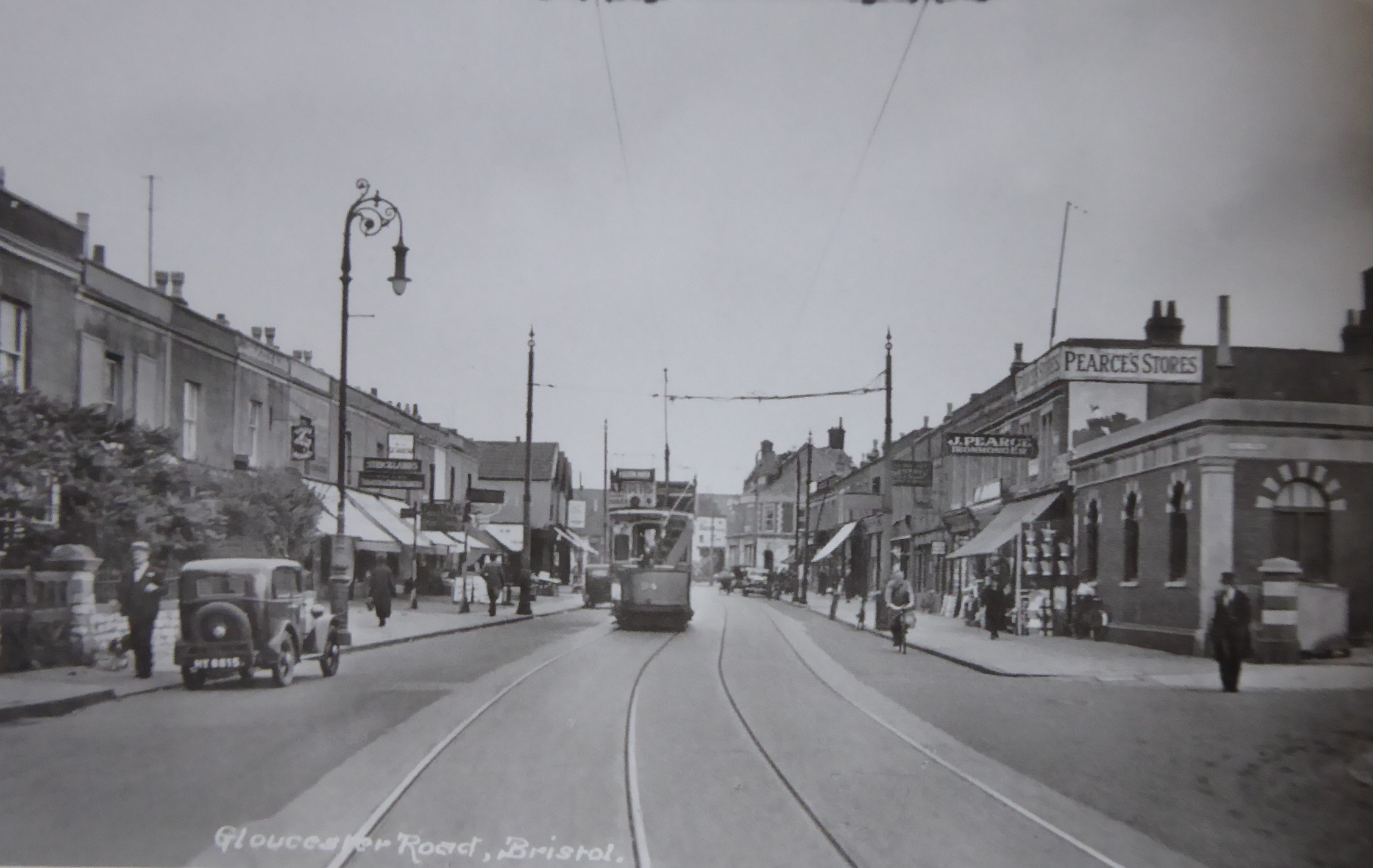
fig 43: Looking North up Gloucester Road
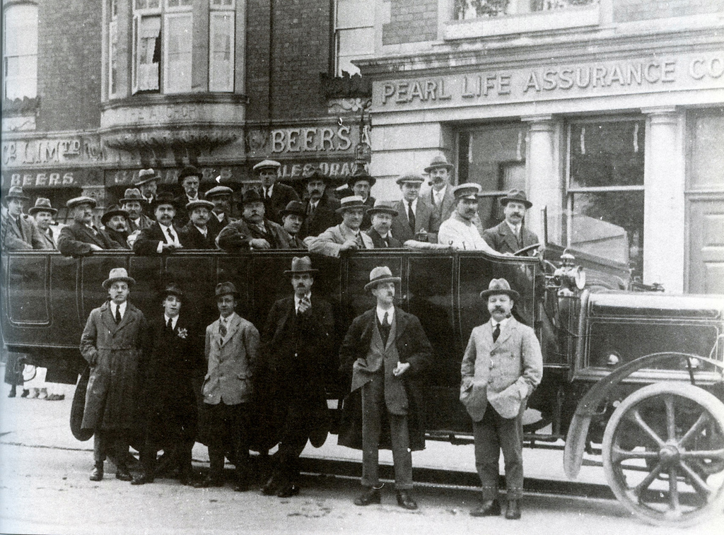
fig 44: Licensed Victuallers Association outing
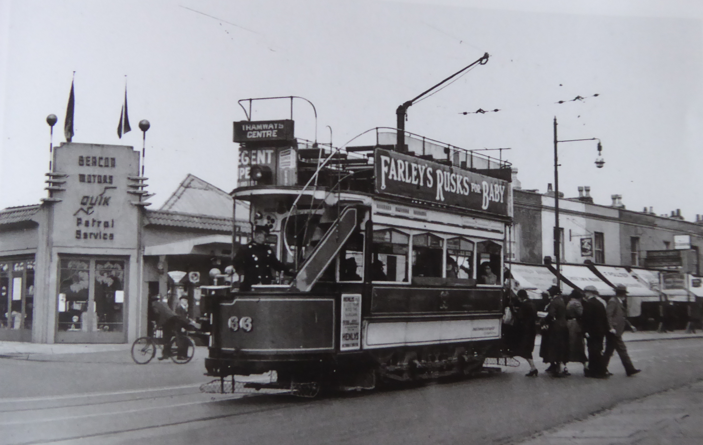
fig 45: Beacon Motors at the corner of Longmead Road with tram
Some of the families moving into the square during this decade were destined also to become long term residents. For example, the Durbin family moved to number 2 in 1936 - Arthuraged 46 and his much older wife Susan aged 69. Arthur, Susan's second husband, was a petrol checker and lubricator. Also in the household were Henry, 33 - an electrical engineer and Margaret, 27 - 'unpaid domestic duties' who were Arthur's nephew and niece. Susan died in 1952 aged 84. Arthur lived in the property until 1960 when it was sold and amalgamated with number one to become a residential home.
The new intake of residents in the 1920s and 30s clearly contrasted with the square's first residents in being older - typically middle-aged parents with young adult children in work. The families were smaller, but more households appear to have included lodgers and boarders. Most shared property arrangements appear to have ben informal at this point, but the first of several formal conversions to flats was approved in May 1933 for number 21.
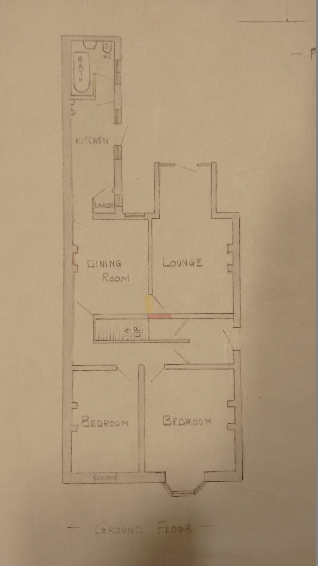
fig 46: Ground floor Plan for conversion of No 21 to flats

fig 47: First floor Plan for conversion of No 21 to flats
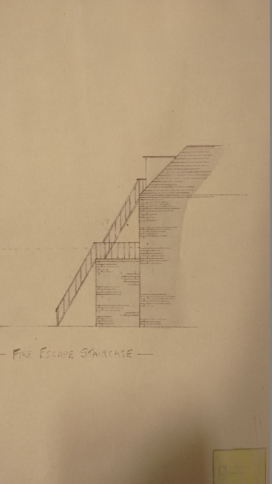
fig 48: Fire escape staircase for conversion of No 21 to flats
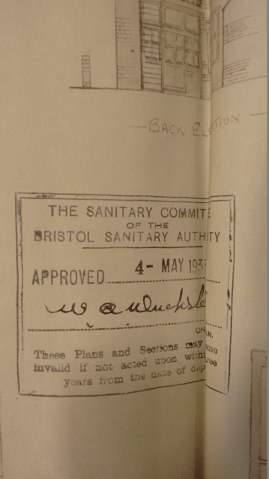
fig 49: Approval for conversion of No 21 to flats
House prices at this period, judging from what data we have, seem to have doubled since first purchased - but were still well under £1,000. However, relative to salaries, the cost of houses in the square would appear to be rising at this time, in comparison to the original prices and becoming out of the reach of young families.
The Sarah family - living in number 15 during this period included the resident holding the record for the longest duration of residence in the square - Mary Sarah. This family were among the original residents of the square, purchasing their house in November 1890 for £400. The father William Coad Sarah then aged 32 and his wife Emily aged 34 were both born in Cornwall. Their children were Mary aged 5, Emily aged 2 and baby William. They had a servant Helen Word aged 13. William worked his way up in the post Office from Assistant Supervisor to become Assistant Postmaster of Bristol. He was a founder member of the Retired Post Office Officers Association. Evidently active in public life, he was a member of the Bristol Guardians - an organisation arranging excursions to the country for children, picnics for mental patients and concerts in the winter - paid for by voluntary offerings. He was also a member of the Bristol and District Cornish Association, and an active member of the Bishopston Methodist church. He died at home in January 1935 - aged 77, his funeral at the Methodist Church being attended by neighbours from the square. His wife Emily died in 1937 aged 81, leaving their daughters Mary and Emily, by then aged 52 and 49 and both unmarried, living in the property. Emily seems to have been an elementary school teacher at one stage. Mary Sarah continued the tradition of public service and is mentioned in several newspaper items relating to her work in the St Johns Ambulance Service. She ran courses in First Aid for ladies in 1939 and in 1941 was promoted to Lady Corps Superintendent. In 1949 at a ceremony in London she was invested with the insignia as Officer (Sister). Emily died aged 62 in 1950, leaving Mary, who was joined in the house by Elsie Govey a shorthand typist born in Clifton. Mary died in 1965 at the age of 80 - having lived in the square for 75 years. Elsie Govey remained living in number 15 until 1970 and died in 1975.
The 1939 Register confirms the striking changes to the population of the square compared to the early years. With a total population of 108, the most remarkable feature is that there were only seven children - compared to 70 in 1891 - just 6% of the square's population, compared to 46%. The average size of household had dramatically reduced to 2.6, with 50% of households comprising only one or two people. However, the total number of households had increased to 41 - 13 houses in the square now contained double households as the number of lodgers increased. The average age of adults was 49 of whom 36 - 34 % - were over 60 and a further 17% over 50. This compares to only 6 (7%) over 60-year olds in the original intake. There was a preponderance of single women between the ages of 18-50 - 16, compared to the 9 married women in the same age group - which explains the dearth of children. Only 27% of women were working - only two of whom were married. The range of occupations now included more working in the craft and related trades, especially in the aircraft industry - with Filton just up the road - such as motor mechanics and aircraft fitters.
The Second World War
Britain declared war on Germany on 3 September following the invasion of Poland. This war had a more visible impact on everyday civilian lives than the First World War, as Britain anticipated and prepared for imminent enemy attack on its shores.
In the immediate locality, a barrage balloon was sited in St Andrews Park along with a large air raid shelter. St Michael's Church Hall was taken over by the Home Guard Battalion of the Gloucestershire Regiment, with Battalion HQ at 99 Sommerville Road. Small arms ammunition and explosives were stored in the Church Halls and the Sunday School moved to Bishop Road School. Another of the halls was used as a serviceman's canteen. The County Ground was taken over by the military and became a training establishment for British - and later American - naval personnel, as HMS Cabot.
The Bristol North baths had its floors taken out to be laid out on the Downs as a dry and flat area around the mess rooms. They did not survive the experience and never came back.
Railings were removed from parks and gardens, supposedly to provide scrap metal to assist the war effort in the form of material for munitions. Late in 1941 a survey of iron and steel railings, posts, chains, bollards, gates and stiles was carried out by the Local Authority in Bristol. Railings in place for safety reasons, or to prevent cattle from straying, or those of 'special artistic merit or of historic interest' were allowed to remain. Clearly the railings around Morley Square did not fall into any of these categories and although appeals were possible, the railings were duly removed in 1942. The removal of railings was generally not popular - newspaper items report vandalism and damage to trees and shrubs, and the removal of plants and also public seats. According to a resident at the time, Morley Square fell into disrepair - the wall deteriorated, and a path developed where people walked across between Rutland Road and Brynland Avenue. It became a rubbish dump and place for dogs and tramps - and children playing! Sadly, it now appears that there is some doubt as to how much of the ironwork collected actually went towards the war effort. A widely held view is that the government, not wanting to reveal that the sacrifice of so much highly valued ironwork had been in vain, stockpiled the excess away from public view in depots, quarries, railway sidings and quietly disposed of it.
Bristol was subject to severe bombing targeting the harbour, the railway and the Bristol Aeroplane company. In all 1,299 people were killed in bombings and nearly 90,000 buildings destroyed or damaged in Bristol. Spring 1941 saw the worst raids and while Morley Square suffered no direct hits itself, the bombs came very close. On 16 March bombs intended for the railway, instead hit properties first in Cromwell and Belvoir Roads and then destroyed houses on Windsor Road, Melita Road and Sommerville Road. On 11 April 1941 - 'The Good Friday Raid' - houses in Somerville, Belmont and Cromwell Roads were set on fire. On 30 April, a Wellington bomber on a training flight became entangled with a barrage balloon cable and ditched in St Andrews Park where its bombs started exploding. Three airmen were rescued, but three died. Amazingly, no houses were damaged.
Static water tanks were placed around Bristol - many on bombed sites, basements and swimming pools - to be used both for fire-fighting and also as emergency water supplies in case of fractures of the mains water supply. On 26 June 1942 'part of the recreation ground' of Morley Square was requisitioned under the Emergency Powers (Defence) Act 1939 and the Defence Regulations 1939 and a 1,000-gallon water tank was installed on what had been a tennis court in the square. Residents were given to understand that the square would be re-instated at the end of hostilities. Newspaper reports at the time reveal a shocking number of children drowning in similar tanks around the city, rubbish being thrown into them or their being damaged.
Conscription was introduced immediately war was declared - initially for all men between the ages of 18-41 and at the end of 1941 for unmarried women and childless widows. There were about 16 men of conscription age living in the square at the beginning of the war, but we have no record of what happened to them. Several were in occupations which would have been reserved - in particular those in the new technical trades.
In March 1940 shortly after the outbreak of war, the Rev Dennis B Hall - vicar of St Michael & All Angels church from 1930 to 1947 - started writing a series of circular letters to members of his congregation who were serving in the armed forces. The aim was to keep them in touch with what was going on back at home, and they provide a fascinating flavour of local life during the war years:
September 1940
.... Now for some home news. Our Church and all the houses in the parish still stand unharmed. Bristol has had some hard knocks, but it is still substantially the same. The spirit of the people is splendid. So are our A.R.P. Services. So don't worry about us. Our congregations are nearly as big as ever and include many in uniform. .... The Home Guard (which includes several Church and Bible Class members) have taken over our Parish Hall and Room 3. But our other buildings are free, so we hope to see our Clubs, etc. back in their old haunts this winter. We hope also to run a Club for Service Men on certain nights in the New Buildings, as well as a Canteen for the Home Guard. Our Sunday Schools have been transferred to Bishop Road School to be near their air-raid shelters.
September 1941
..... Bishopston has had a few nasty knocks, but generally speaking looks much the same, but for changed faces and the absence of young people. Many of our children have been evacuated, and, would you believe it, we have ladies in the choir! .... Socially, the Canteen is still our chief job. It is bigger than ever with about 1,000 sales a night”.
July 1945
..... We had a great time here on V.E. Day - great jollity but no disorder. The children were especially well catered for. I personally went to eleven street tea-parties, marched around with a jazz band, and danced round seven bonfires! So Bishopston made merry, and the Church was represented. We also had nearly 1,000 people in the Church on that day. Things continue to go well here. Our Hall is now back in our hands and we anticipate having the Sunday School back next September, but as our Canteen is now crowded out with A.T.S. (who now occupy Muller's Orphanage), we shall have to have both Schools in the Parish Hall.
Post-war - 1945-59
The legacy of the Second World War was evident in Bristol, with vacant bomb-sites, damaged houses, temporary prefabs and gardens turned into allotments. Unemployment rates were low, but many basic commodities like butter, meat, tea and coal were still rationed until the early 1950s. There were also shortages of most consumer products which prompted a continuing wartime 'make do and mend' culture. The standard rate of income tax was 9/- in the pound - more than twice today's rate. There was little surplus money and even less to spend it on.
The square emerged from the war structurally unscathed, but in a sad and sorry state. Very few properties had changed hands during the war and many properties were split between more than one household. The population which was already aging in 1939 was now even older and bereft of children.
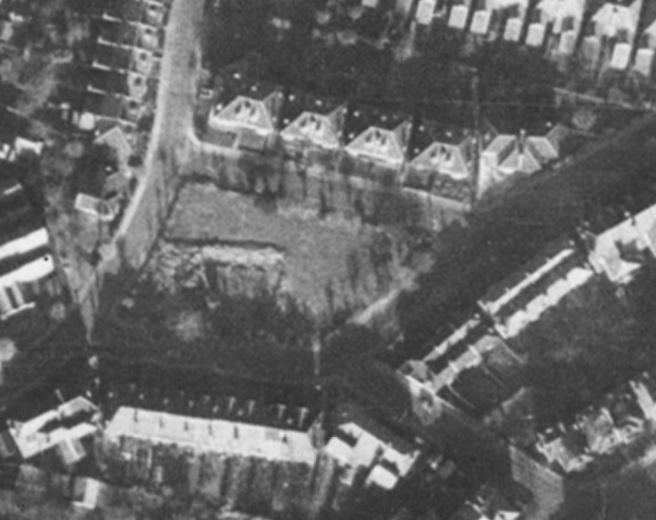
fig 50: Aerial photograph of the square showing damage in the south-west corner
Despite the residents' understanding that the garden would be re-instated following its war-time requisition for the installation of the water tank, not only was nothing done, but the square was in danger of being taken over by the Local Authority. Miss Winifred Watts from number 17 described the state of the square, once the brick tank had been smashed up and some of the debris removed for the Brabazon runway in Filton, leaving the residents to clear up the mess. Miss Watts reports that the residents believed the Corporation wanted to use the square as a car park or for building.
In September 1948 the Public Works Maintenance Committee noted an article and photographs which had recently appeared in the local press regarding the unsightly state of a number of private squares in the Bristol. The City Engineer was requested to submit a report. The following month the City Engineer reported that 11 private squares, including Morley Square, had generally been well maintained prior to the war when the protective railings had been removed. He suggested that the owners of these squares should be informed that the Corporation were prepared to take them over and to limit their public use to preserve 'the amenities of the neighbourhood'.
Later that year, the Committee were told that a letter had been submitted from Mr J C Watts, Secretary of Morley Square Residents' Committee, stating that 'subsequent to the settlement of war damage and requisition claims, certain work had already been carried out' to the square and that the owners, 'who desired to retain it as a private open space had already made arrangements for its restoration'. A number of other Bristol squares were taken over at this time.
Miss Watts noted that the restoration of the square involved obtaining the signatures of all those resident in the square in 1939 - not a trivial job since some had by then moved away and had to be traced. Public funding for the project fell short, so the deficit was made up by raising an additional £20 levy from each house (today's equivalent of over £500). The work was carried out in 1949 - starting with clearing debris and levelling the ground with 10 lorry loads of sub-soil, before sowing half a hundredweight of grass seed, rebuilding the wall, installing fencing, and building a hut which required Planning Permission. Three seats were acquired together with a 'Rotascythe' mower. Keys were made, labelled and distributed. A Union Jack was flown on the day the square was re-opened.
The Watts family were a presence in the square for 72 years. They bought number 17 in 1927 - John, at that time aged 50, was a Building Inspector for the Education Committee, his wife Winifred aged 46 and their daughter, also Winifred, then aged 12. John was a keen footballer, swimmer, oarsman and squash player. He had taken up cycling in 1898 and continued to enjoy it into his retirement in 1946 at the age of 68. He acted as Chairman/Secretary of the Morley Square Residents' Committee for 20 years, handing over only when he was 90. Mrs Watts died in 1948 and four flowering cherry trees were planted in the square in her memory by John and daughter Winifred. John died in 1969 at the age of 92. Winifred, who became a domestic science teacher, continued living at number 17 until 1999 when, at the age of 84, she became too infirm to live alone and moved to a nursing home. She died in 2000 and is remembered vividly by several current residents for her fiercely protective attitude to the square. It was obviously difficult for her, as the character of the square changed from being the tranquil space lovingly created by her father, to the rowdier atmosphere of a children's playground from the 1980s onward.
Changes and modernisations were afoot in the square. Planning consents were approved in 1946/7 for three more houses to be converted to two flats - numbers 11, 18 and 19, following number 21 in 1933. Other properties continued to be divided informally with more than one household living at the same address in various sharing arrangements.
In 1947 the Council discussed the provision of automated electric street lighting to replace the gas lamps. Gas lamps were lit manually by lamp-lighters, so automated electric lighting would represent a huge saving. After complaints about inadequate street lighting in Morley Square the City Engineer inspected and reported that the lamps were well-spaced at about 50-yard intervals, but that in this time of fuel economy, only one of the two mantles were being lit. However, though the lamps would be replaced by electric, the 25-watt bulbs to be used in the present conditions would not provide much of an improvement in lightness. Two years later Morley Square was included in a long list of car parks where the Public Works Maintenance Committee decided that lighting would be brought up to standard. Parking at this time was allowed only on one side of the road and for a limited time only.
After a long period of stable occupation following the wave of new residents in the 1920s, a new wave of residents came into the square between the years 1947 and 1953 when 50% - of houses changed hands. Two of these residents are still living in the square today.
1960 - 1979
Bishopston in the 1960s was not the vibrant, sought-after area it is now. An article in the Evening Post in 1967 paints a very down at heel image, though hinting at a resurgence:
It is easy, but mistaken, to get depressed over Bishopston. Some of its Victorian houses are seedy. Some of its streets have a forgotten air, with weeds having a summer holiday along pavements. Bishopston is changing in character. It has little appeal to young people who were raised here. They are leaving old fashioned family homes. The Vicar of Bishopston told us “I began to get pretty depressed about the way the parish was getting depleted. But recently there has been quite a change. People have been moving into the district from other places and proving that these old houses are capable of being adapted for modern living. I have been quite amazed at the way some young couples have completely redecorated these large houses in a most tasteful style.
House prices were beginning to creep up during the 1960s; properties sold in the square were in the range £2,000 - £3,500 at this time.
This period also saw the beginnings of change on Gloucester Road. Many of the traditional categories of business started to decline - confectioners, tobacconists, clothes shops and some of the food shops. In their place eating establishments were beginning to appear, along with more estate agents, electrical appliance shops, second-hand shops and the start of charity shops.
The resurgence of Bishopston was reflected in changes in the square. Following the mass change in ownership between 1947-53, eight more properties changed hands during the 1960s and 70s. Numbers 1 and 2 were amalgamated in 1960 to create a residential Home for Elderly Believers, run by the Christian Brethren. Number 10 was acquired in 1970 by Home Group Trust - a housing association with charitable status providing supported housing. It was at that time a hostel for 6 adults - people just out of prison, on license, on probation or classed as vulnerable or at risk of re-offending.
Following the restoration of the square it is apparent that the Residents' Association was actively maintaining the square, though there are no records going back that far. One of the longest-standing current residents recalls that there were not as many trees and shrubs in the square as there are now, and the trees were not as high. He remembers that on Sundays residents used to come out and work on the edges of the square creating quite a community feel. His son, then aged around 13, was paid £5 for mowing the square every couple of weeks and the square was kept tidy. A big party was held in the square for the Silver Jubilee in 1976 - for which he provided the sound system.
By the end of this period the last of the original residents of the square were gone.
1980 - 1999
There is a dearth of official data for this period regarding family composition, occupations, ages or ownership, and very little information from newspapers. However, we have the Residents' Association minutes, together with a number of personal recollections from past and current residents.
Topics for discussion by the Residents' Association in the 1980s include many issues still being discussed today. An application was made for a grant from the Tree Council, but proved ultimately unsuccessful. Despite this setback, a number of new trees were planted in 1980, to a professionally drawn up plan, including an Ash, Rowan, Oak, and two Maples. All but the Rowan are still in the square after nearly 40 years.
In 1982 the Residents' rights and responsibilities were set out, with a further request that gates not be left open to vandalism, theft and dogs:
Use of the Square for Residents only
    NO lending of gate keys to non-Residents
    NO dogs in the Square
    NO hard ball cricket
    NO living trees to be climbed or used as wickets
    NO litter or bottles to be left in the Square
    NO unauthorised fires to be lit in the Square
    NO football to be played in the Square
    All games to cease before dark or 9pm whichever is the earlier.
    Subs to be kept at £6
However, in the following year, subs went up to £8, to allow for payment for grass cutting - Miss Watts, then treasurer, had obtained the services of Mr E Chapman from 1 Brynland Avenue, who was assistant groundsman at the County Ground. Mr Chapman recommended scarifying the grass to prevent it being overtaken by moss and dead grass.
In 1985 James Gardiner from number 26, then Secretary, reported that £360 had been spent on repairs to the wall but that more would be needed. It was noted that more children were playing football in the square and parents were asked to ensure that games did not involve more than six players, used a light ball and not to be played on Sundays 'when residents would appreciate peace and quiet'.
In his report for the year to May 1986, James Gardiner reported that much work had been done on the walls, but that the grass was deteriorating. He requested parents to make sure children 'are sensible about the equipment they use and where and how they play their games.' Also, children were to be reminded to lock the gate. There was consideration of a Neighbourhood Watch scheme in view of several recent burglaries. Subs were raised to £10.
The report for 1989 was given by Dr Boseley from number 20, who had replaced James Gardiner. £125 had been spent on maintenance of trees - after long period with no work done. £86 was spent on maintenance - repair to wall and fence. It cost £60 to repair part of the wall knocked down by a stolen car. The £12 sub could only be maintained if people were willing to do some work on the square themselves - more help was requested. Miss Watts would be round to collect subs. Dr Boseley was very active in pursuing the collection of subs from the HMO properties - with mixed results.
In his report for the following year, Dr Boseley thanked residents for making donations over and above subs towards the cost of a new mower which cost £415. Unfortunately, on its third use it was damaged by hitting an old tree stump costing £162 to repair. Requests and thanks were made for offers of help in maintaining square. A swing and climbing frame had been put in square, donated by families with children. All welcome to use, but to exercise control and not allow them to be used by 'larger' children. Equipment to be used at own risk. Subs to be increased from £12 to £15.
The orchard and stream behind numbers 1 - 8 - a place where children used to play - disappeared in 1985 when the land was built over to provide 26 sheltered home units for elderly people - despite a campaign to save the orchard. Number 25 was acquired by the church in 1987 to provide accommodation for the vicar of St Michael and All Angels. A number of vicars lived there until the property was sold to the current residents in 2011. The roof of number 24 was destroyed in the 1980s by a fire caused by a blowtorch being left unattended. This was so severe that it started spreading to number 23. Mary well recalls the difficulties of evacuating her elderly wheelchair-bound mother from the property.
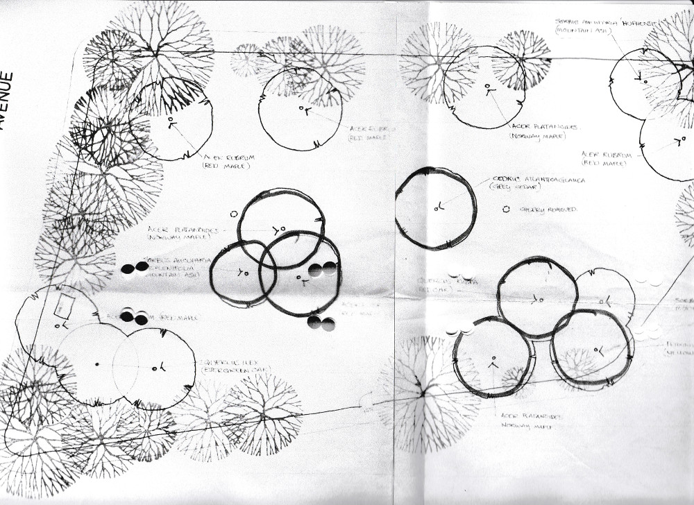
fig 51: Garden Design
Half a dozen families with young children came to live in the square during the 1980s, joined by around four more in the early 1990s, changing and enlivening the character of the square. Properties were now being bought for owner occupation rather than to let, and a number of houses underwent major renovation projects. In the late 1980s number 5 underwent a complete restoration by a family of builders who planned to live there, but had to sell when they got into financial difficulties. Number 7 was in very poor condition - so bad that another couple buying in the square at the time rejected it on account of the survey. However, the Fowlers took on the challenge, carrying out a major renovation, while living in the property with a baby. Some houses were reinstated as single dwellings. For example, by 1992 number 18 had been used as low grade student letting drifting into a squat. The property was in very poor condition. However, despite a very discouraging survey, Steve and Cathy bought and restored the property as their first home together.
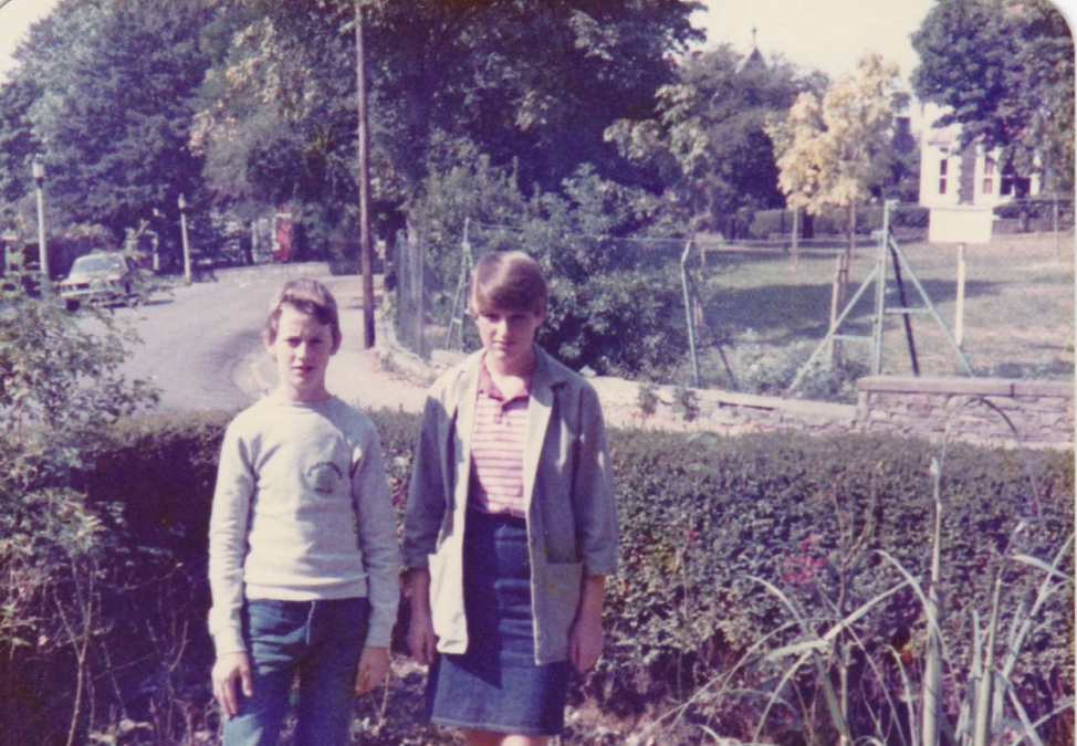
fig 52: Family photo from number 12
In 1987 the Home for Elderly Believers at numbers 1 and 2 was closed. The owners explained that closure was due to the fact that the building could not be altered to meet new legal guidelines, in particular it could not accommodate a lift which would be required in an old people's home. The two properties remained as one and were taken over by Freeways Trust, a Bristol based charity, as a residential home for 12 adults with learning difficulties. A former worker at the home described it as a 'very nice home to work in with some lovely characters'. The home was staffed by two workers during the day and two overnight workers - though no resident staff. The work involved cooking meals, doing laundry, etc. and residents were encouraged to help to develop life skills, though in most cases not likely to progress to independent living. The home had a fairly stable population with most of the residents having spent all their adult lives there. Many had come from St Christopher's School.
Number 10 continued in use as a hostel through the 1980s and 1990s. A former resident in the house during the late 1980s/early 1990s has described his experience there:
As you might expect, we had the usual characters there - frankly everyone there was, or had been, involved in crime of some sort, there's no glossing over that, that's what the house was for. Indeed, some residents had moved there from the two main probation hostels in the city. So there was always a lot of ducking and diving going on - dodgy deals, possibly dodgy goods changing hands etc - but, and I mean this, it was not really anything more serious than you'd see in Only Fools and Horses, frankly!.... I don't ever really recall the police, being required at the house in my four years, other than the time an ex-prisoner put a rock through the window of one resident's room to steal his bank book and passport - which he later flushed down a public toilet at the Arches!...... In my four years there, yes it was enjoyable, yes, I found it helpful, though we sometimes felt the rest of the Square didn't really want us there, nor did we ever get spoken to much, which was reciprocal. Perhaps people were suspicious of us, not really knowing what the house was used for - or indeed, they just left us to get on with it!
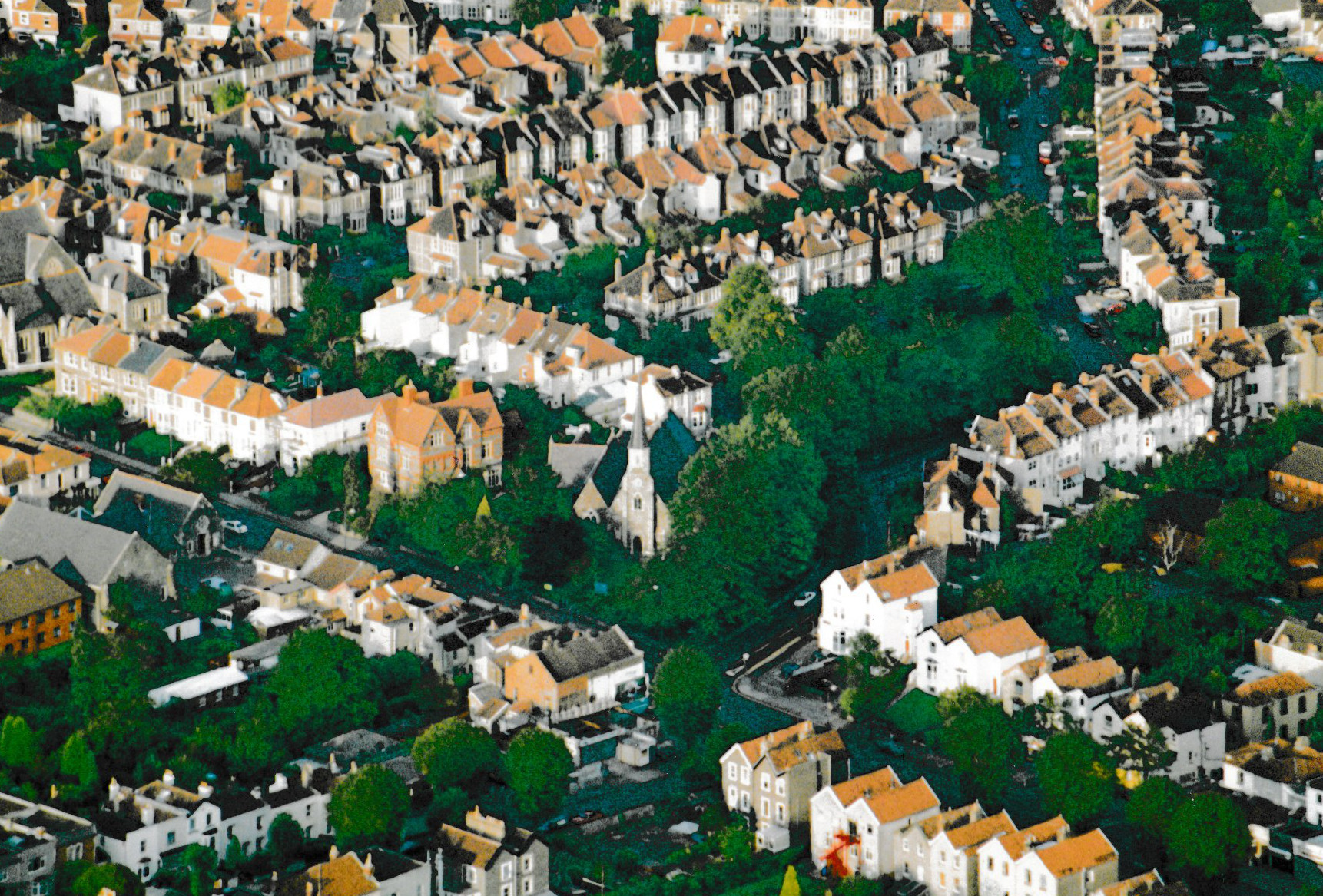
fig 53: Aerial photograph of Morley Square
The Residents Association committee continued its work, but in the summer of 1990, feeling burdened by the responsibility of making decisions regarding the square, they initiated a discussion on how the square should be managed and organised in future. It was decided to hold meetings approximately every 2 - 3 months. The 'Committee' was to consist of whoever attended meetings. Meetings were to be held in different house each time with all welcome to attend and be involved. Sue Phipps of 7 Brynland Avenue agreed to act as treasurer. Specific issues were: repairs to fence - essential cost £400 but this only stop-gap - better to consider longer term strategy - eg railings, contacting Victorian Society for grants. Gates needed a new padlock. Only residents were to be given keys though the committee could allow specific individuals to have keys. All to ensure gates are kept closed. Events to be allowed only if a resident is responsible and a contribution made to maintenance costs, no mess or litter, and the square still to be available to residents. Residents to be informed beforehand and have committee approval. Permission was given for Church Holiday Club to use the square in mornings of week in August. 'Event' = only formal organised function - not friends, birthday parties. The square to be regarded as extension of the residents' gardens. Signs to be put on gates: 'Private/Keyholders Only/No dogs allowed'
In 1991 it was decided that the gates should be replaced. Subs were increased from £15 to £25 plus an additional donation of £20 from each household for the cost of the gates. After a year, a quote was received for the gates - £800 for the double set and £400 for the single gate. Galvanising would cost an extra £100. This was accepted on the basis that no other quotes had been forthcoming. The gates were completed and installed in the summer of 1992. Miss Watts made large wooden tags with the house number printed on it for each key. A nail was provided for hanging keys when using the square. Further consideration was given to replacing the fencing with railings - but this was not thought viable. Work parties were arranged for significant repairs to the fencing and for the posts to be properly cemented in.
Miss Watts also proposed, at this time, that each house should take responsibility for the part of the edge of the square opposite their house. Plans were drawn up for a Family Fun Sports Day to include a Southside v Northside volley ball match. A grass cutting rota was established with 10 residents sharing the job.
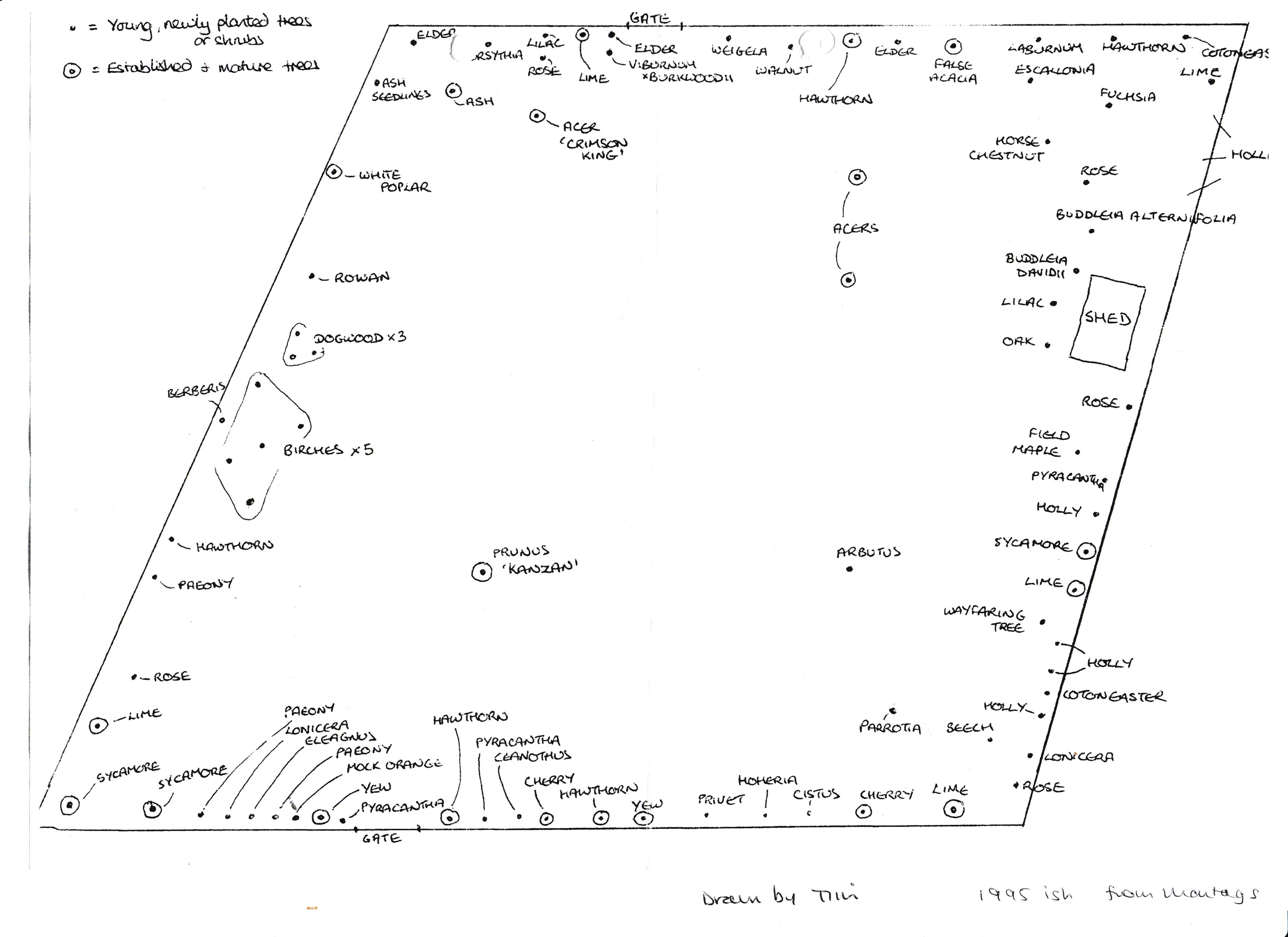
fig 54: Garden Plan by Tim
Another round of tree planting took place in the mid-90s, under the guidance of Tim Foster - a local horticulturalist who has been involved in horticultural matters in the square ever since. These included the Rowan and Silver birches on the East side, the Persian Ironwood, Beech and Whitebeam in the north west corner, and the Walnut on the south side. The larger trees were bought but others came from gardens Tim was working on elsewhere - including the Persian Ironwood and an Arbutus (which has now gone) - which came from a garden in Clifton! The remainder of trees planted at that time are still in the square.
The remainder of the 1990s saw the recurrence of issues such as the need for wall and/or fence repair, the need to keep the gates locked, the purchase of benches, the possibility of restoring railings to the square, etc.
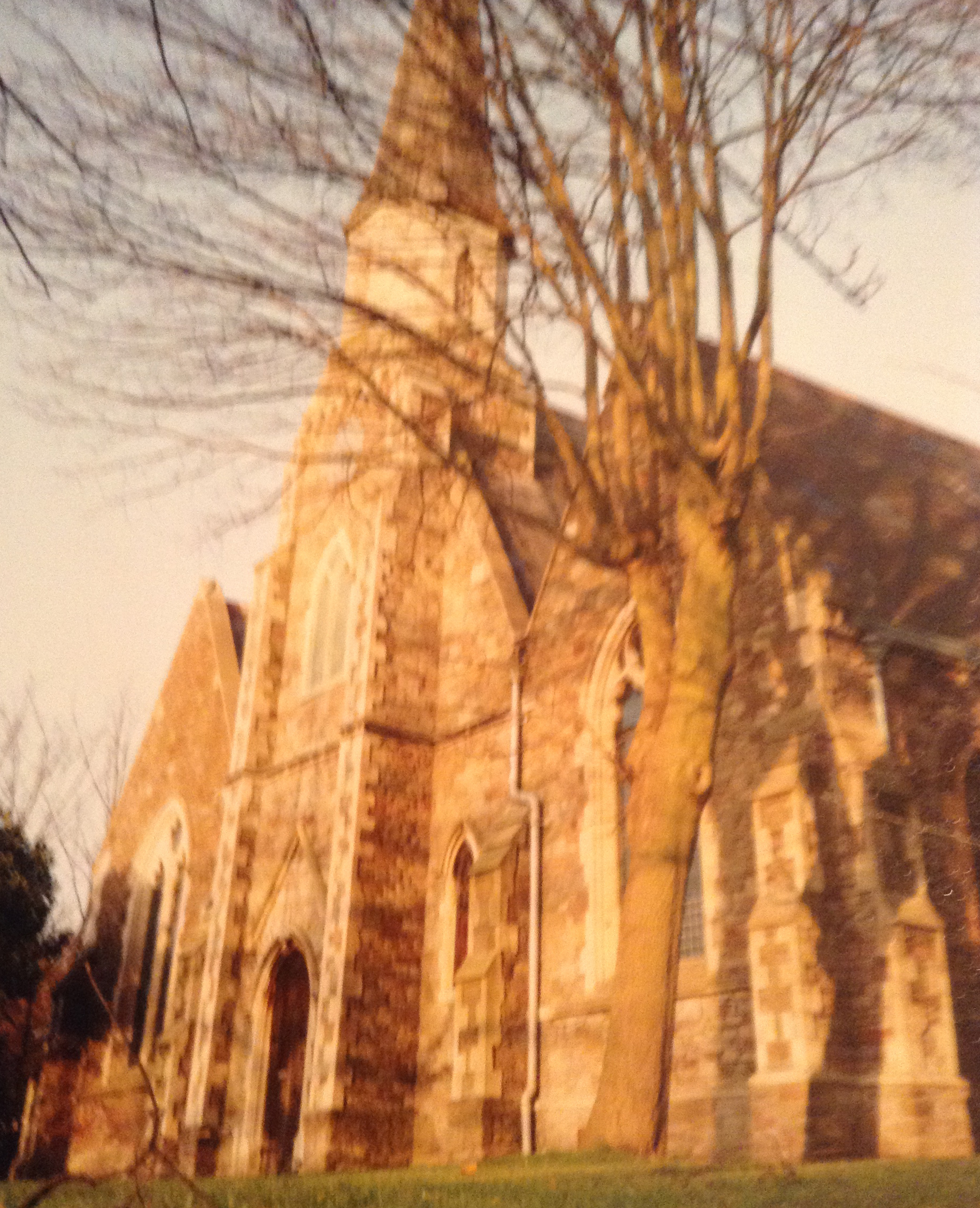
fig 55: St Michael and All Angels
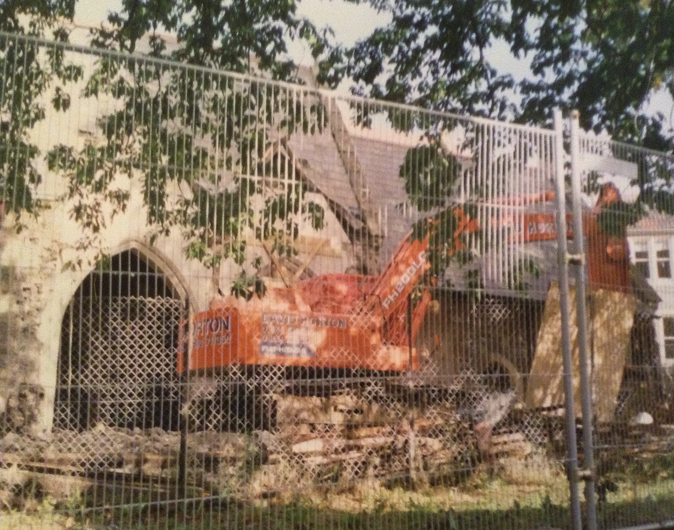
fig 56: Demolition of the church
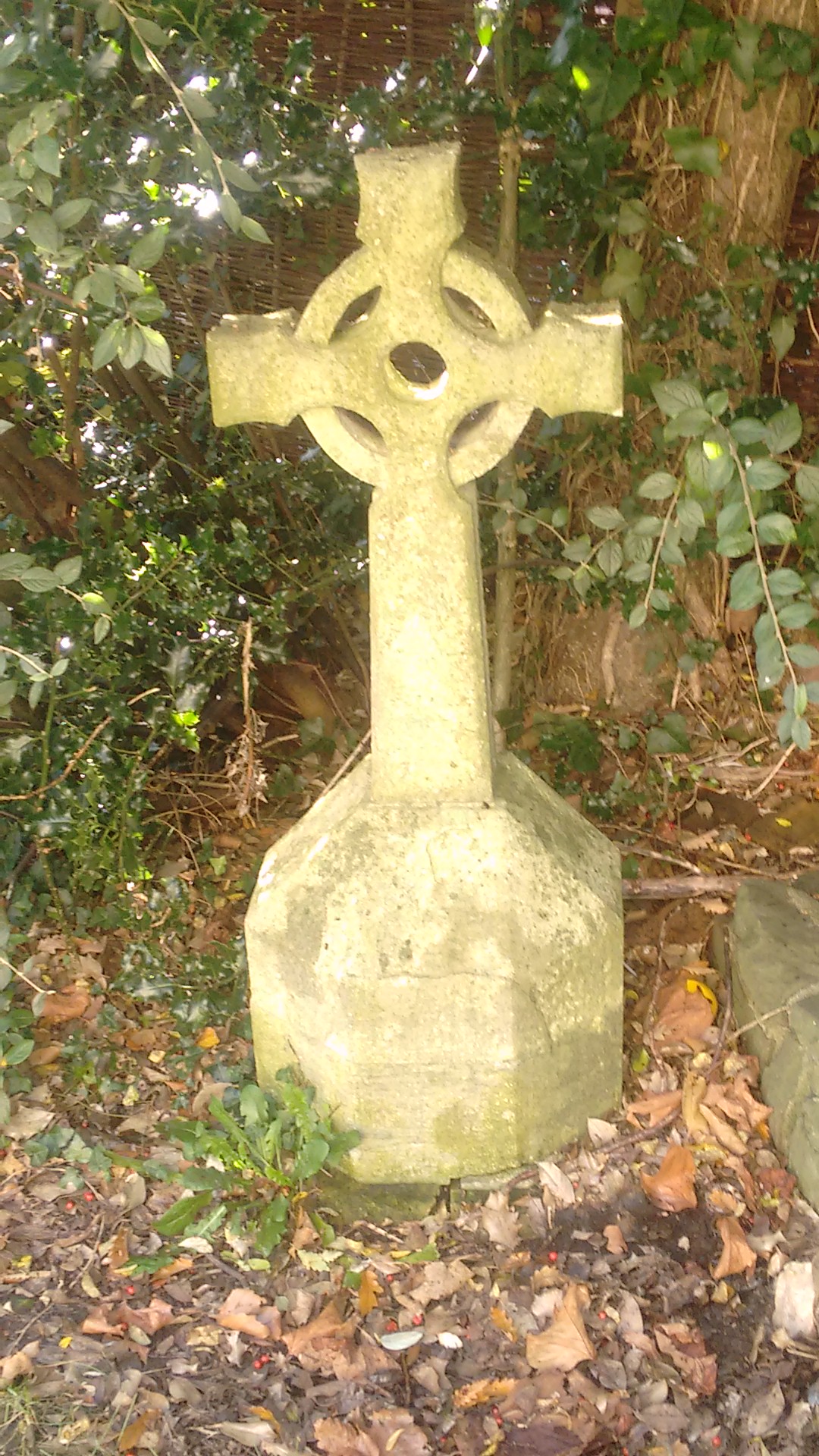
fig 57: Remnant of the church now in a private garden
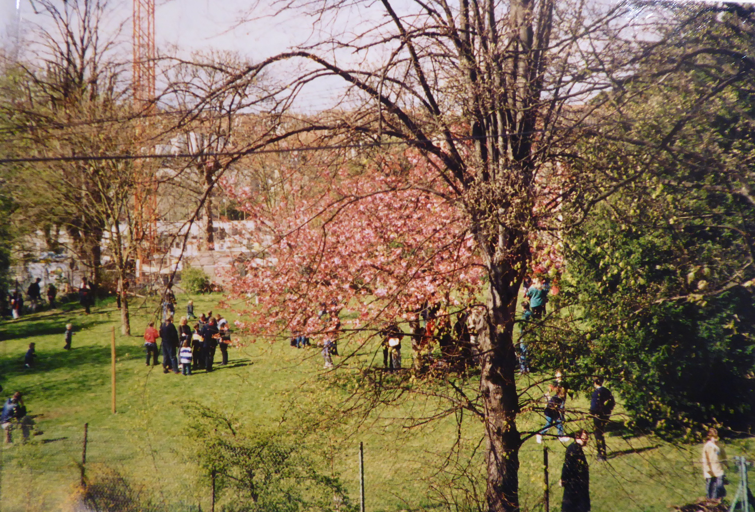
fig 58: Easter Egg Hunt - note flowering cherry and crane in the background during the building of The Oaks
In 1991 St Michael and All Angels church was declared structurally unsafe due to subsidence and services there ceased after Christmas that year, being moved across Gloucester Road to the church halls. The building remained abandoned for several years with windows boarded up and a campaign was mounted for the church to be repaired. Residents recall a Rave being held in the building. However, despite protesters occupying the tower, the building was demolished in October 1997 with much of the material being sold off. The Oaks - sheltered housing for the elderly was built on the site of the church a couple of years later.
Two notable residents during this period were sportsmen. Phil Kite the footballer and his family lived at number 24 from the mid-1990s. Phil joined Bristol Rovers as apprentice goalkeeper in 1979 and after 96 league appearances for Rovers he moved on to Southampton. After playing for a number of different clubs, but plagued by injury, he re-joined Bristol Rovers as physiotherapist and goalkeeping coach, retiring in 2015. Phil created the large fish pond in the garden. He and his family moved to Henleaze in 2002.
Tony Wright the cricketer came to live in number 19 with his wife and two children in 1997. Tony played for Gloucestershire from 1980 until 1998, scoring 13,440 runs for the county. After retiring from the game, he became a coach and the first director of the Gloucestershire Academy in 2002. The family moved in 2004.
fig 59: Residents' meeting in the square
This seems to have been a particularly community-minded era when a number of Morley Square traditions were initiated. The annual Easter Egg hunt was started in 1990 by Anna Rosetti with tickets at 50p per child. All children were invited and allowed tickets for up to two friends each. Bonfire night originally started in 1992 as a regular annual get together for the Neighbourhood Watch (Morley Square and Cricklade Rd) and was organised by the then Treasurer. It stopped for a couple of years before residents decided to hold it again. Anna organised refreshments with help from others - soup, hot dogs, cake. The first year everyone brought a box of fireworks and it took forever to light them all!! After that someone organised fewer and more expensive ones and residents and friends were charged to come to the event. Two local groups were also started at this time - the Morley Square Reading Group in 1995 - still going strong, although with only one member now from Morley Square! The Bishopston Progressive Supper had its first meal in the mid-1990s and is still flourishing after over 60 suppers. Perhaps it is no co-incidence that this period of innovation coincided with the presence of a large number of young children living in the square, inadvertently providing the opportunity for parents to meet, socialise and to plan events collaboratively.
2000 - 2017
Bishopston is now a popular, not to mention expensive, place to live. House prices have continued their meteoric rise, now reaching 20 times their 1980s values and about 2,000 times their original purchase prices in simple terms. A calculation factoring in average earnings in 1890 and now, shows that purchasers today would need to be nearly three times as affluent as the original purchasers. Morley Square is most certainly no longer an area of affordable housing - but the houses are apparently quick to sell.
According to the 2011 census, for which there is generalised statistical data available, Morley Square residents score well in terms of social grade, health and education. 58%, based on 'head of household,' are ABs - in higher and intermediate management, administration or professional positions, which compares with 35% in BS7 overall. 24% and 33% respectively are C1s - in supervisory, clerical and junior management, administrative or professional positions. 91% of Morley Square residents considered themselves to be in very good or good health, compared with 85% in BS7 overall, and 81% throughout the UK. 61% of Morley Square residents had degrees or professional qualifications, compared to 42.5% in BS7 generally and 27% in the UK overall.
Gloucester Road is buzzing. Described in an article in The Independent in 2004 as 'The last great British High Street,' the street has become recognised as unique, quirky and independent, and strives fiercely to maintain this reputation.
Opposite the Victorian edifice of Bristol North Swimming Baths is Murray's the butcher. Every Saturday, customers form long queues, while organic burgers and sausages sizzle on the shop's pavement barbecue.... You can buy pretty much anything you need here .... The bakers have people queuing out of the door, more like a French bread shop. The street has just evolved. I don't know how you could ever replicate it.... Gloucester Road survives because there are middle- class residential areas on either side. They provide a constant feed of people who would be critical of supermarket shopping and who don't want to travel miles for things. ...There's a reaction against the big out-of-town shopping centres where the staff aren't often well-trained and look bored.
Hon. Secretary of the Bishopston Traders' Association
By far the largest category of shops on the road are eating establishments - restaurants, bars, cafes and takeaways. The number of charity shops has multiplied as have businesses relating to personal appearance, as ever-increasing numbers of hairdressers have been joined by newer businesses - nails, tattooing, etc. However, these changes have not displaced the traditional bakers, butchers and fruit and vegetable shops which, while diminished in numbers, are thriving.
Morley Square is flourishing. Owner-occupation is now almost universal at nearly 80% of the private households, compared to 61% in 1890 and less than 50% in the 1930s, 40s and 50s. 60% of current households have come to the square since 2000. Following earlier property renovations, there is a continuing round of maintenance and ongoing refurbishment of properties - judging by the frequent appearance of skips and scaffolding around the square. The ambience of the square is now somewhat different to the sleepy streets of the early years of the 20th century. Parked cars are a constant and intrusive feature, together with frequent 'face offs' and over-large delivery lorries causing snarl-ups. Structural change in the form of off-street parking is increasing. All but one of the seven frontages on the east side of the square have now lost their original walls and most of their gardens.
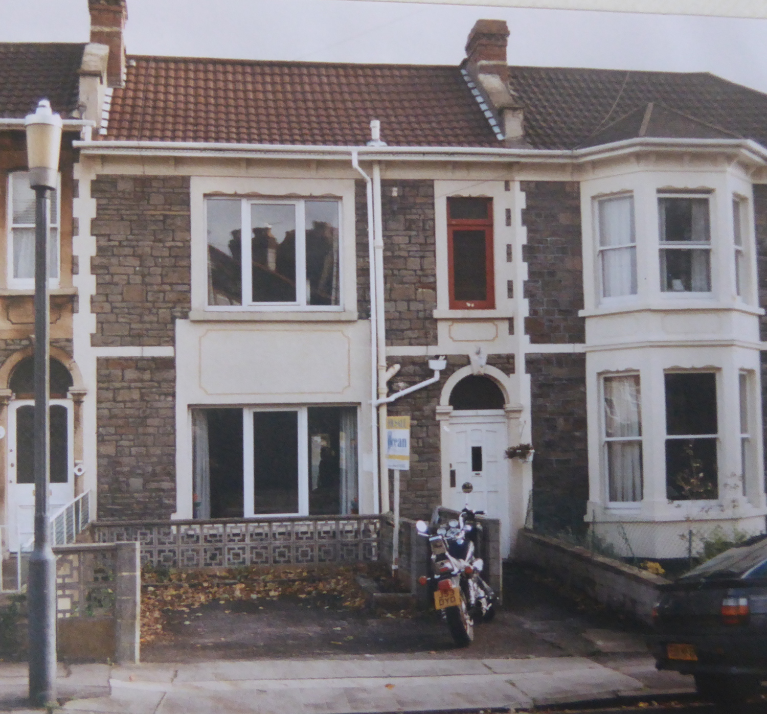
fig 60: Number 16, before renovation
Current residents reminisce fondly about summer evenings 10 or so years ago, spent sitting in the square - parents chatting together while children played. These children have now grown up - some have left, others still living at home. Children in the 10-17 year age range appear in the square more often unaccompanied by parents. For the first time in many years, the Easter Egg Hunt did not take place in 2017 - perhaps reflecting the small number of young children currently living here - currently only five children under the age of nine. The 5th November Bonfire is still going strong - albeit without fireworks - and always attracts a large crowd to watch the huge conflagration. Other events - both community and private - occur from time to time, and the square is obviously much loved by residents who enjoy it in their own ways. Many simply take pleasure in having a tranquil green space opposite their houses.
fig 61: Morley House Poem
Sadly, the occupants of number 1-2 - 'Morley House' - departed in the autumn of 2016 after 29 years - for reasons unknown - though it can be surmised that the property was found to be incapable of the sort of adaptation to the future needs of the residents as they became elderly. It seems that no decision has been made as to the eventual use of the property.
The Residents' Association meets at somewhat irregular intervals 2-3 times a year to deal with issues and plan upcoming events. The same issues recur: repairs to the fencing and walls, maintenance of the trees, the dilemma of whether to provide seating - which, at one stage seemed to get vandalised or stolen on a regular basis, children needing to be reminded to lock the gates when leaving the square, etc. Every few years the possibility of replacing the original iron railings is raised - only for it to be found to be prohibitively expensive.
The issue of 'guest membership' of the square came up for discussion when it became evident that guests were beginning to outnumber those with legal rights and responsibilities regarding the square. It was clearly anomalous that decisions might be made by those with no legal responsibilities for the square. It was decided to put a stop to further guest membership for the time being and that only those with legal ties to the square could take on the roles of secretary or treasurer. The autumn AGM is now exclusively for deedholders, while guest members attend other meetings - and make very positive contributions to the running of the square. A linked issue was that some local estate agents had taken to advertising properties as having rights to the square when this was not the case.
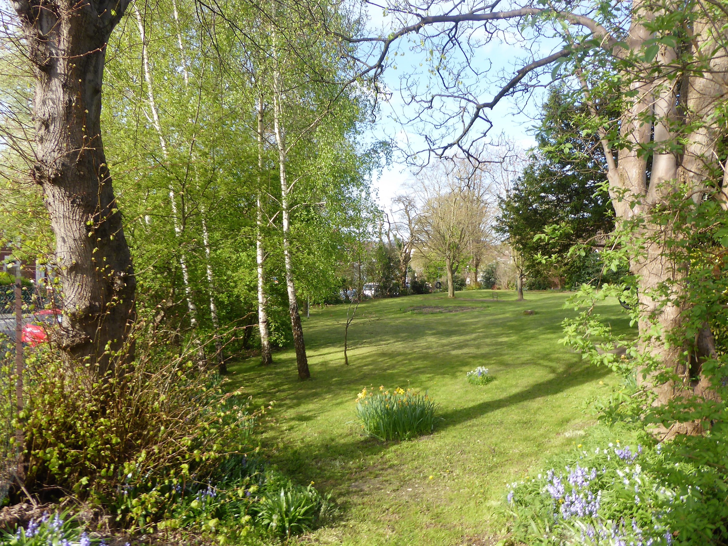
fig 62: View from south-east corner in spring
Garden maintenance is an ongoing duty. Mowing is done now almost exclusively by one resident - who apparently finds the exercise therapeutic! A thousand bulbs were planted around the perimeter of the square in the autumn of 2016. The trees in Morley Square became a major concern following an accident in December 2015 when a large hawthorn branch covered in ivy was blown down in 'Storm Desmond' and landed on a car parked in the square. The Residents' Association appointed a tree surgeon the spring of 2016 to provide more systematic management and maintenance of the trees, along with a Tree sub-committee. The trees were recently surveyed - girths and locations mapped. The largest trees are Common Limes and Sycamores, which may be original. Another original may be the Robinia pseudoacacia (False Acacia) on the southern perimeter, which with a girth of 3.3 m, would make it over 100 years old. Sadly, the four cherry trees planted by Miss Watts have now all gone. Five new trees were planted in the spring of 2017, again under the supervision of Tim Foster - Winter and Spring Flowering Cherries, a Gingko, a Rowan and a Pride of India.
We carried out an informal 'census' of Morley Square residents in 2017, attempting to mirror the areas covered by the earlier censuses for which we have full details. All but two households responded, providing a good picture of today's residents.
The population of the square today is 104, as compared to 153 in 1891. There are now 31 households, in comparison to the original 28 - with three properties now divided into flats and two having amalgamated. Whereas the 1891 population of the square was comprised exclusively of family households, there are now some additional types of residence with different characteristics. 27 households remain in private family occupation with four now in multiple occupation (HMOs).
The 'family' homes, which are more directly comparable to 1891, account for 73% of the residents of the square. There are striking differences in the composition of these households now, compared to 1891. The average size of these households is now 3 compared to 5.5 in 1891. 44% of households are now composed of just one or two residents - compared to 8% in 1891; 30% include children (17 and under) compared to 82% in 1891 and only 11% have children of 9 and under - compared to 64%. The average age of the adult population has increased from 36 in 1891 to 45 today. There are now two distinct adult age groups - 22% in the age range 18-29 and 78% over 40s, but no one at all in their 30s. While in 1891 only 7% of residents were over 60, today this group is 11% - smaller however than the peak of 34% of the 1930s. 60% of these households have come to the square since 2000 and 28% came during the 1990s. The remainder have lived in the square for very many years - the longest standing resident arrived in 1949. Six current residents of the square were born here - all but one of whom are girls.
The four HMOs account for 26% of the square's population. Two are rented privately - to a group of university students and to a group of young professionals, together totalling 10 residents, all but one of whom are males. The other two are run by local charitable organisations. One is currently inhabited by a group of 'guardians' following the closure of the former residential home. The age range of these residents is 18-39. The fourth property has been run by the Bristol based charity 1625 Independent People (1625ip) since 2013. 1625ip support young adults aged 16-25 years old who are either homeless or at risk of being, to reboot their lives and positively develop their independent living skills. The number of occupants of these properties averages 5-6 - more than in the family houses, but similar to the 1891 average size of household. Residence in all these properties is by nature more transient than the family homes.
Looking at the adult population of the square as a whole, 30% were born in Bristol - as compared with 44% in 1891. Places of birth are from further afield than in 1891, including 10% born outside the UK. Compared to the white collar workers in the original population, occupations are tending to the more professional now - including doctors, lawyers, accountants and teachers - and newer fields such as computing and welfare work. 11% of today's residents are retired - compared to 2% of the original residents. As compared with 1891, there is no distinction between male and female occupations.
Conclusion
Our initial curiosity about the square and its inhabitants has developed into a mini-social history project. Although Morley Square is only a small community in Bishopston, this study provides an illuminating example of late Victorian housing development and its evolution over the 130 years since its inception.
The initial building of the square exemplifies the piecemeal, largely unplanned nature of development at that time which must have placed a considerable burden on the local Horfield council and its staff to control and mediate between land-owners, builders and the local community. Problems with drainage and roads were overcome and substantial houses were built which have lasted well and have adapted to changing needs and family structures.
We are accustomed to believing we live in times of great change, but the early residents encountered huge changes too. In the first twenty years, residents saw the demise of servants, the introduction of public transport, electricity and petrol-driven cars. By comparison the last 20 years has seen the introduction of mobile phones and the internet (without which this research would have been impossible).
Our impression is that the character of the square has ebbed and flowed over the years. The first residents were typically large families with many children and life in the square and surrounding (empty) streets must have been very lively. As parents aged and children left home, servants disappeared, and the population dropped. The state of the houses seems to have worsened over time and the impression is of a quieter more down at heel era leading up to the second world war. After the war a gradual resurgence has gathered pace over several decades. Younger families started arriving in the square in the 80s and 90s, and houses were renovated and restored. The square must have been a valued resource for children as streets became busier. As this wave of families aged and properties became more expensive, once again family sizes reduced.
Sadly we never managed to discover the reason for the creation of the square itself - why the landowner did not simply cover the land with houses as he did elsewhere. However, since its creation, at least 1,500 souls have lived in the square, sharing it as a common focus and responsibility. Over the years residents have not just enjoyed the trees and greenery, but have also taken on the responsibility for the square's maintenance and development. Our research indicates that it has been looked after throughout and we are particularly indebted to those who 'saved' it for the future. The square remains the responsibility of the residents and continues to flourish; it is a good size - large enough for a pool of residents with the time to contribute and small enough to be personal.
The community life of the square fluctuates. We all enjoy our square and are bonded by it but a factor reinforcing this seems to be the presence of young children in the population, to bring out a collective and innovative atmosphere. Since completing the research for this book, life has been moving on. Three houses are changing hands and it seems that more young children will be moving into the square - which bodes well for a lively and dynamic future.
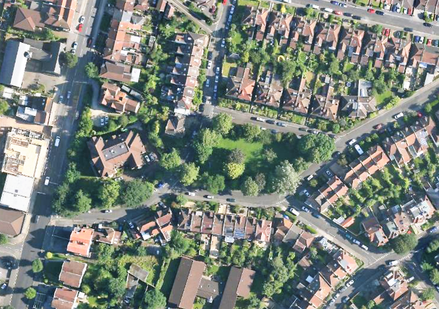
fig 63: Aerial Photo of Morley Square in 2012
Photo Gallery Top
May day
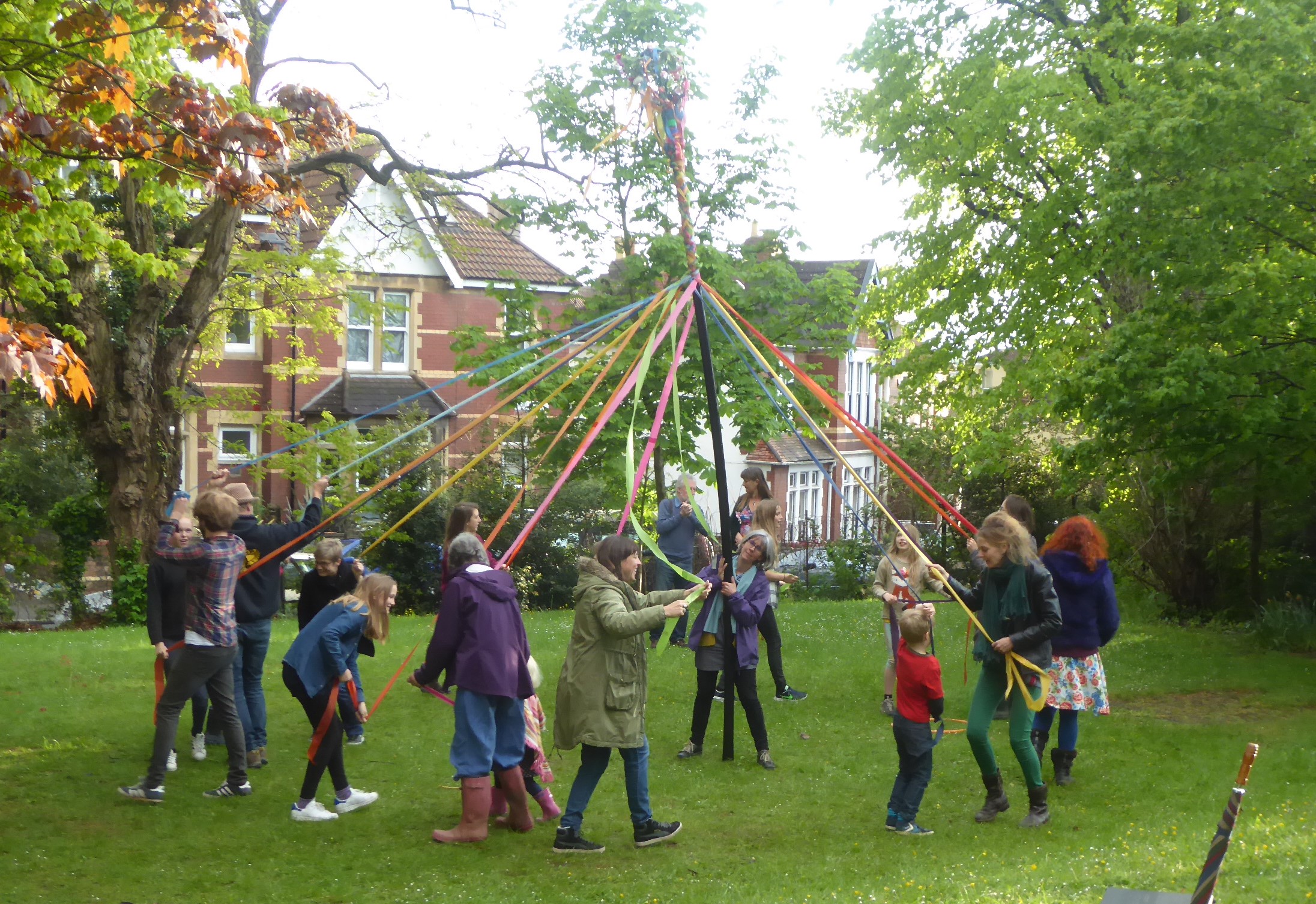
fig 64: May Day
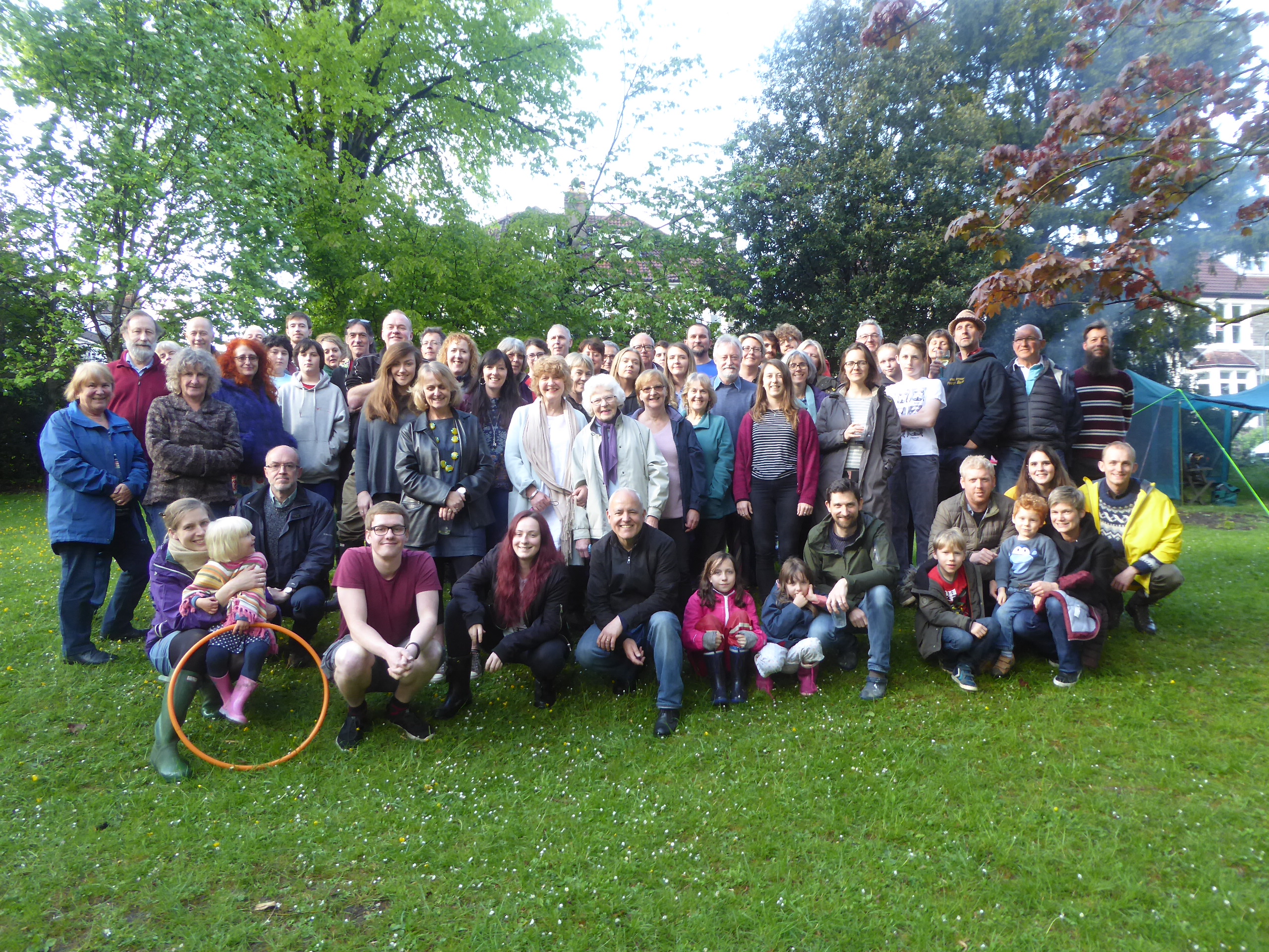
fig 65: Morley Square residents and neighbours
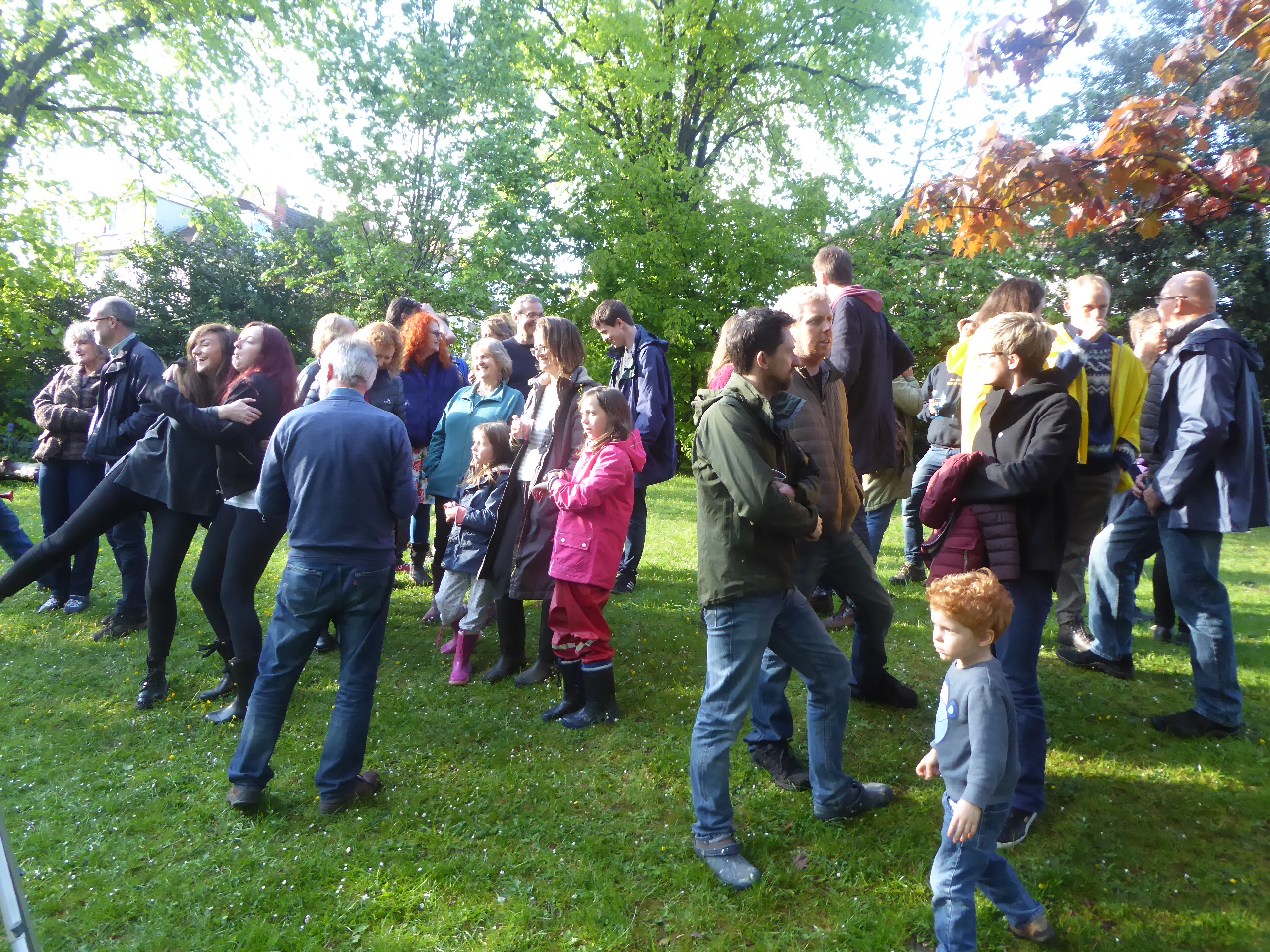
fig 66: May day
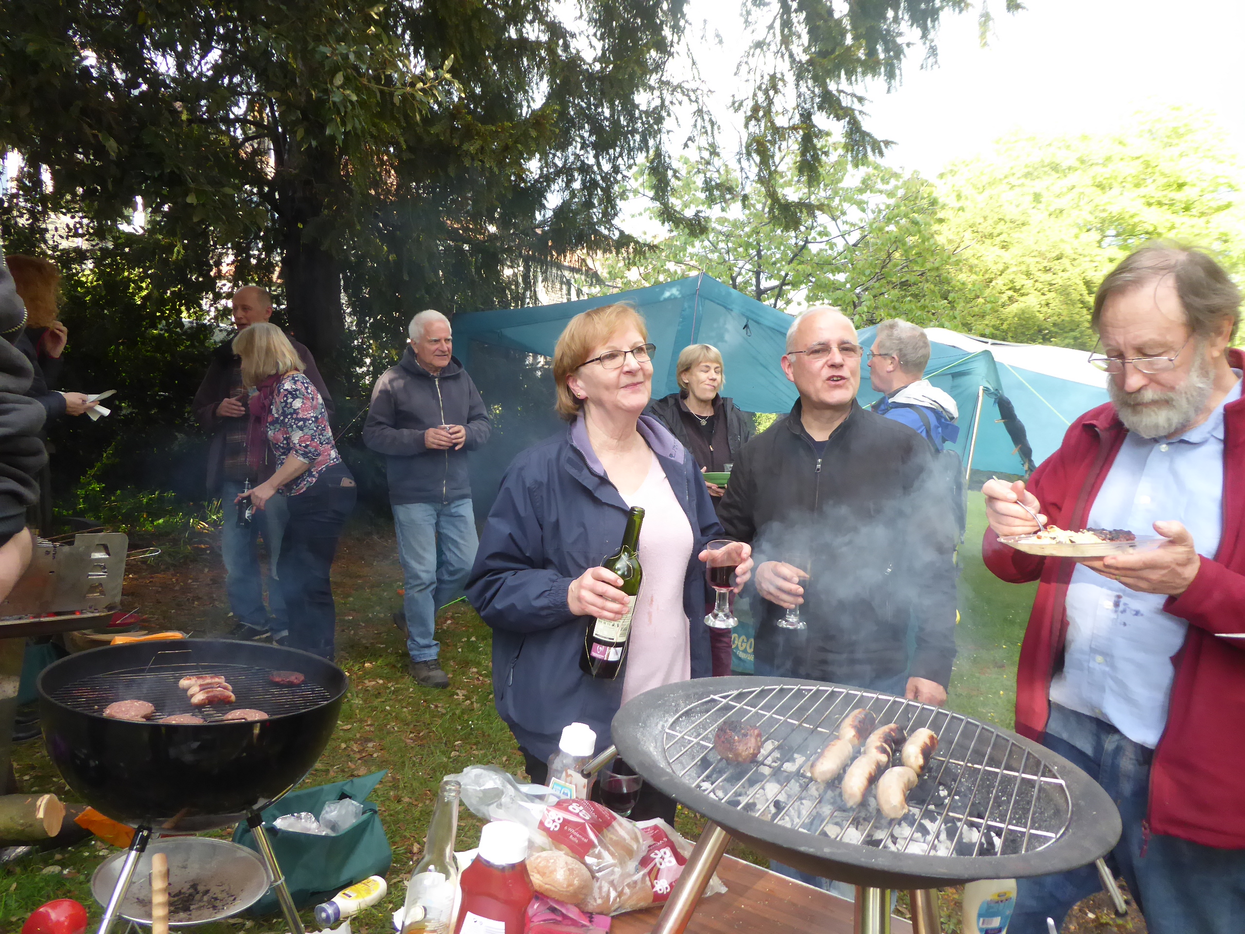
fig 67: Barbeque
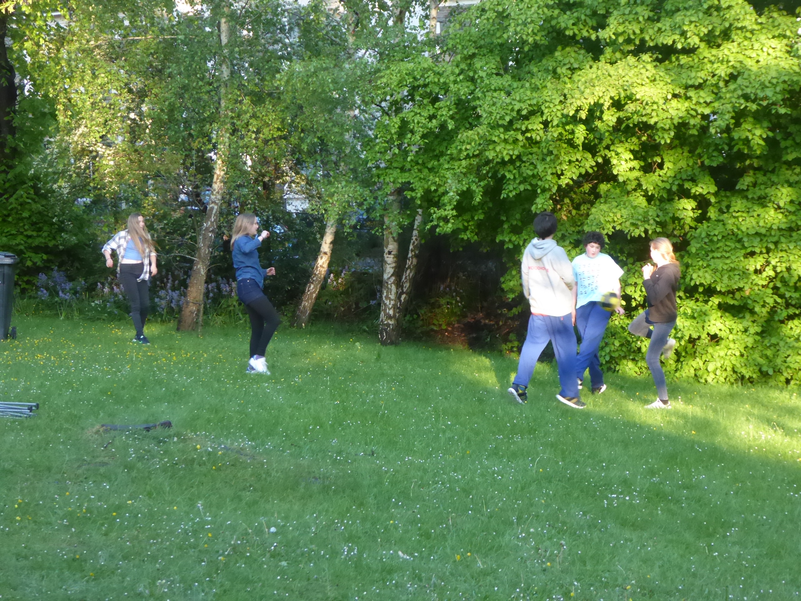
fig 68: Youngsters playing
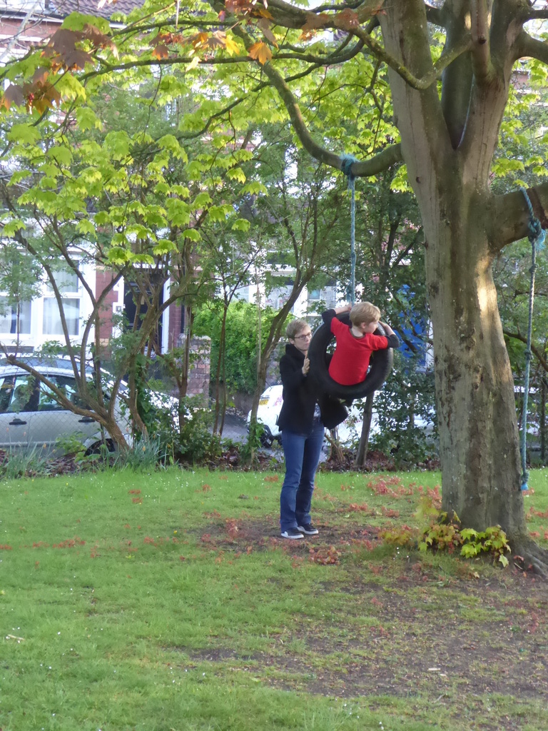
fig 69: A swing in the Maple
Looking after the square
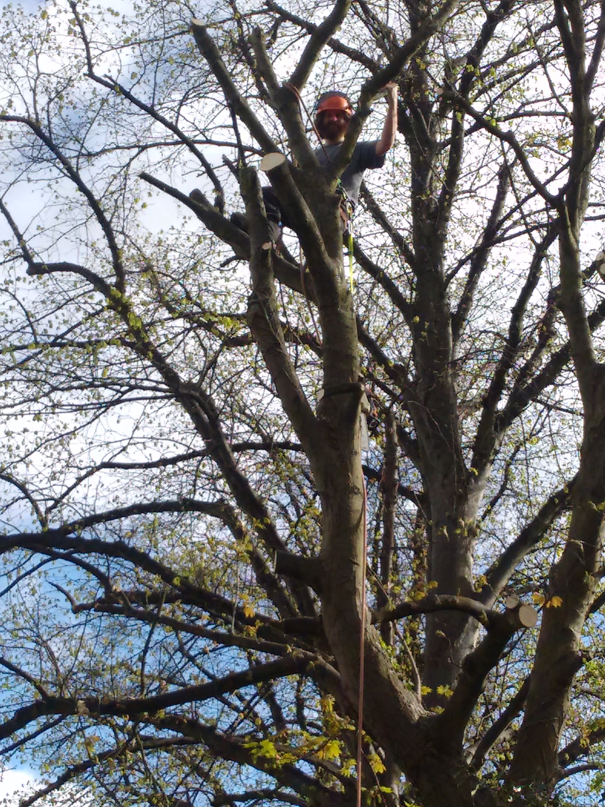
fig 70: Our tree surgeon felling the sycamore
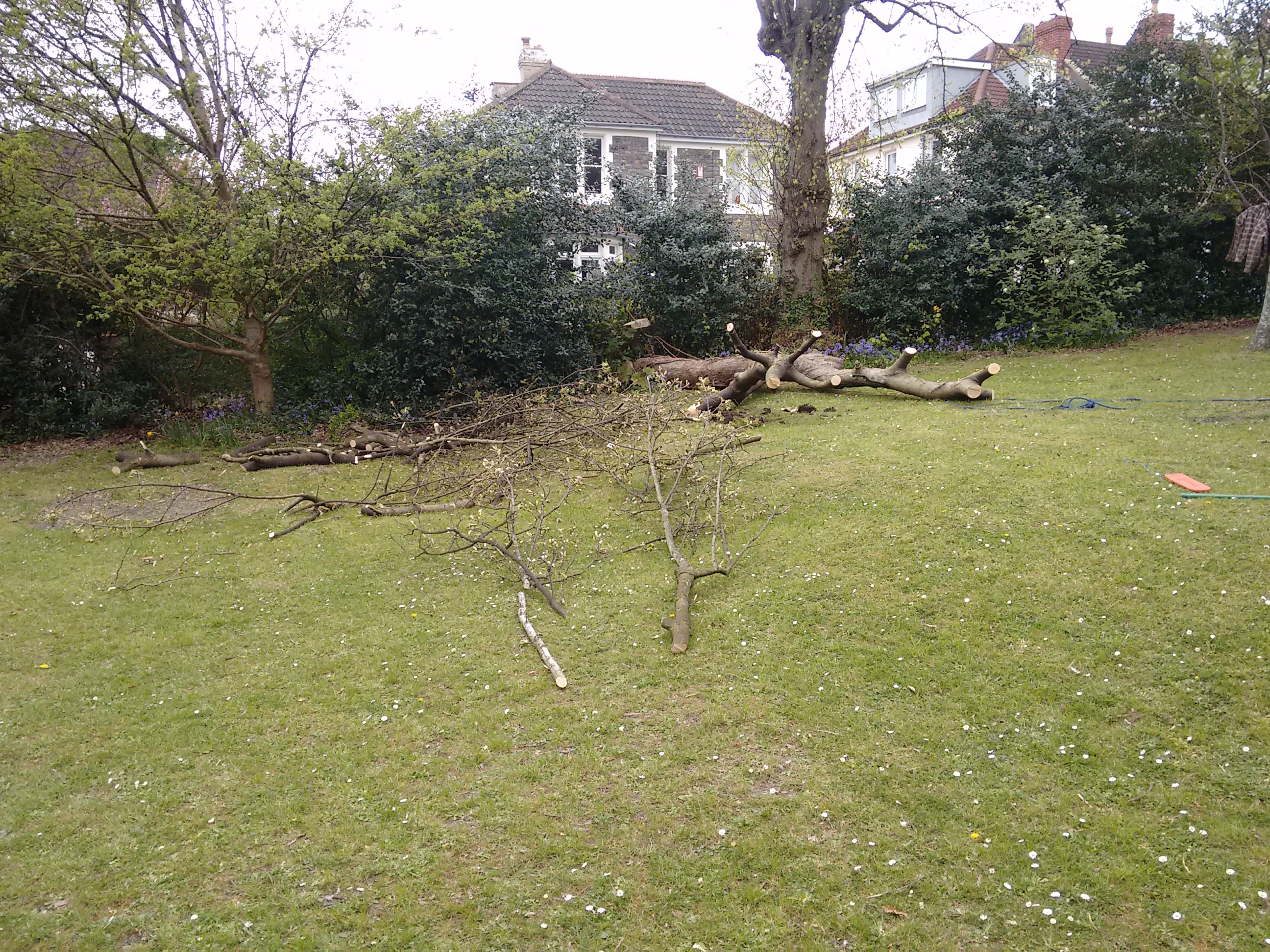
fig 71: Dangerously leaning Sycamore felled
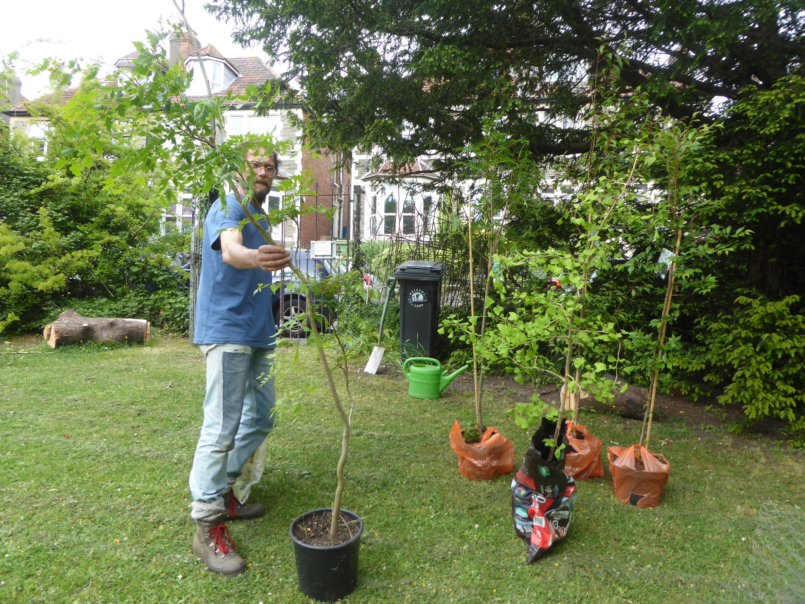
fig 72: Horticultural advisor Tim with five new trees for the square
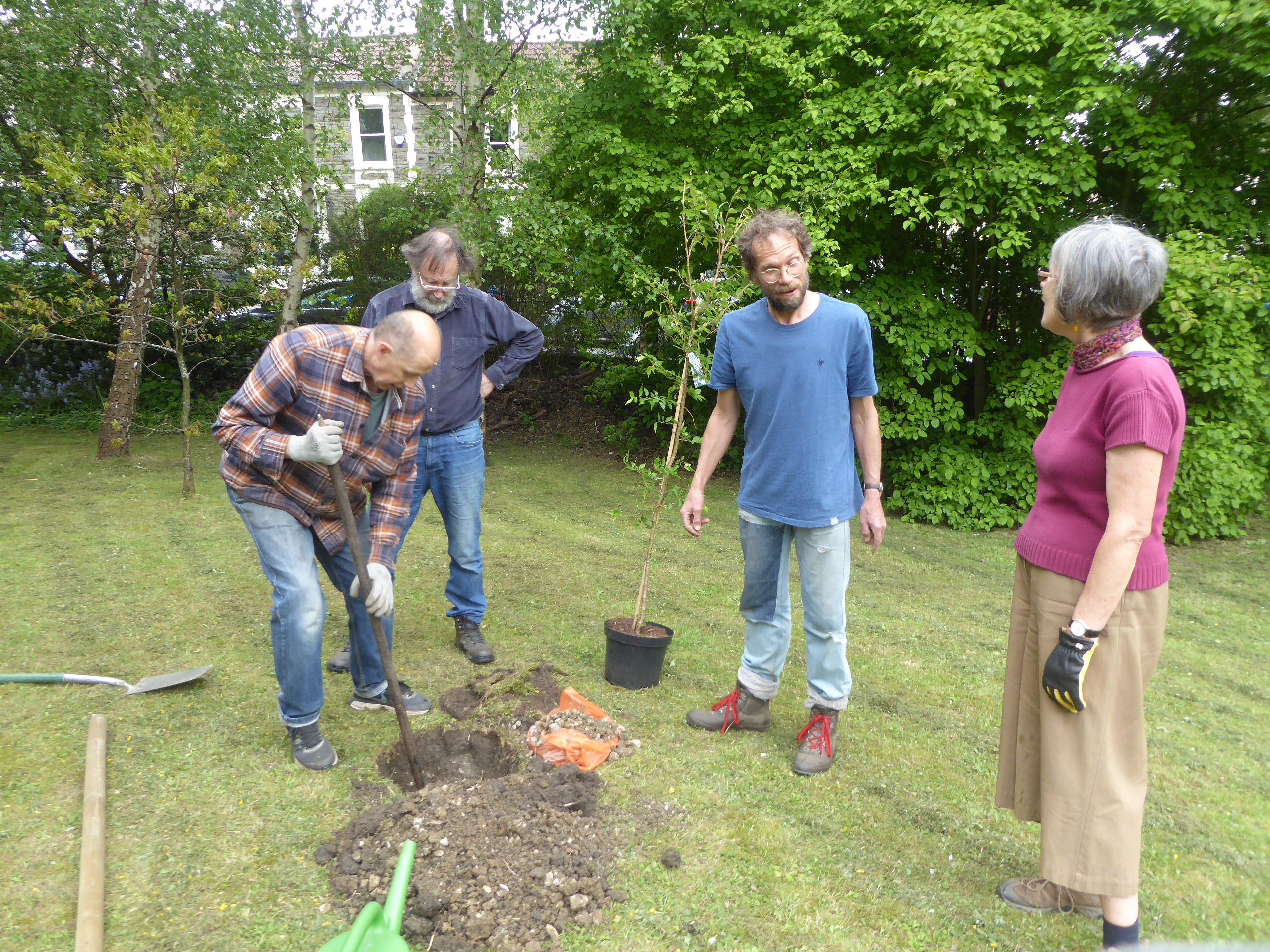
fig 73: Planting a Rowan tree, guided by Tim
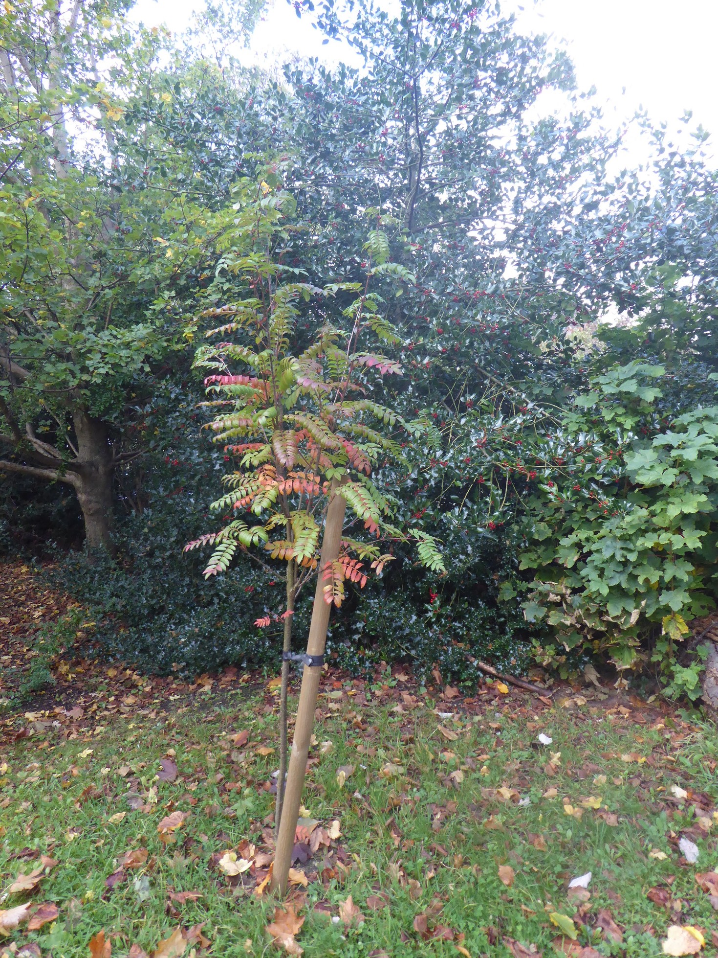
fig 74: The new Rowan tree in autumn
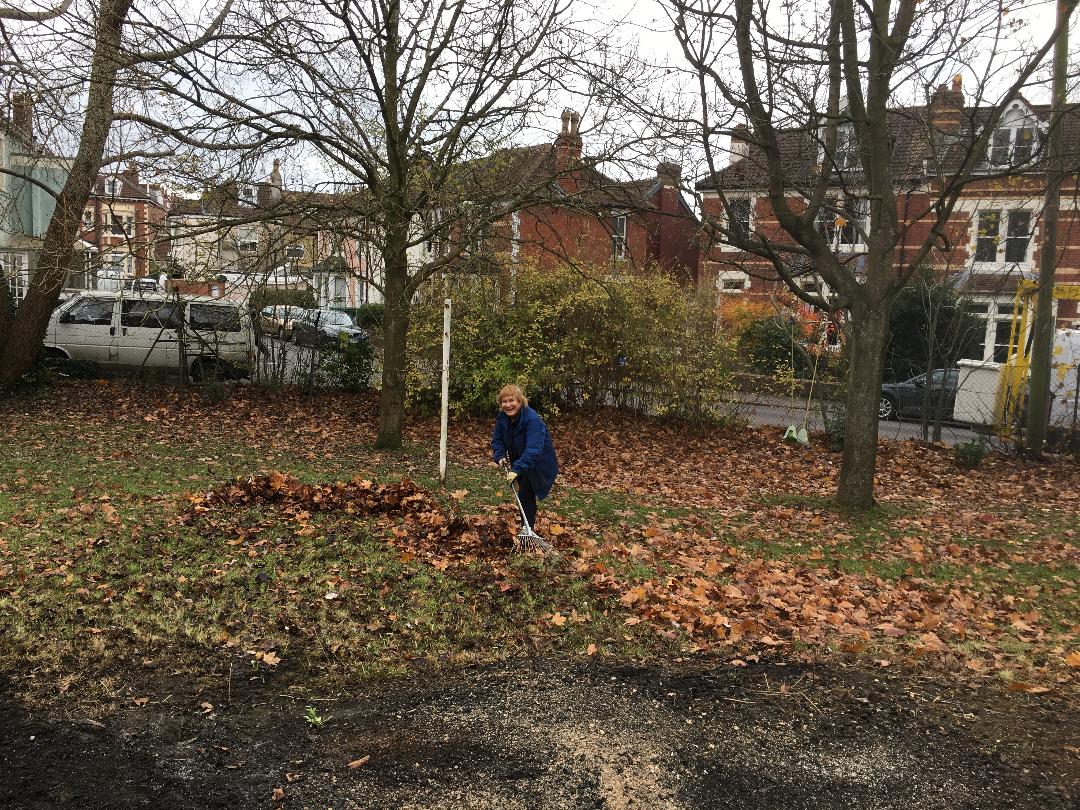
fig 75: Julia at work
November 5th
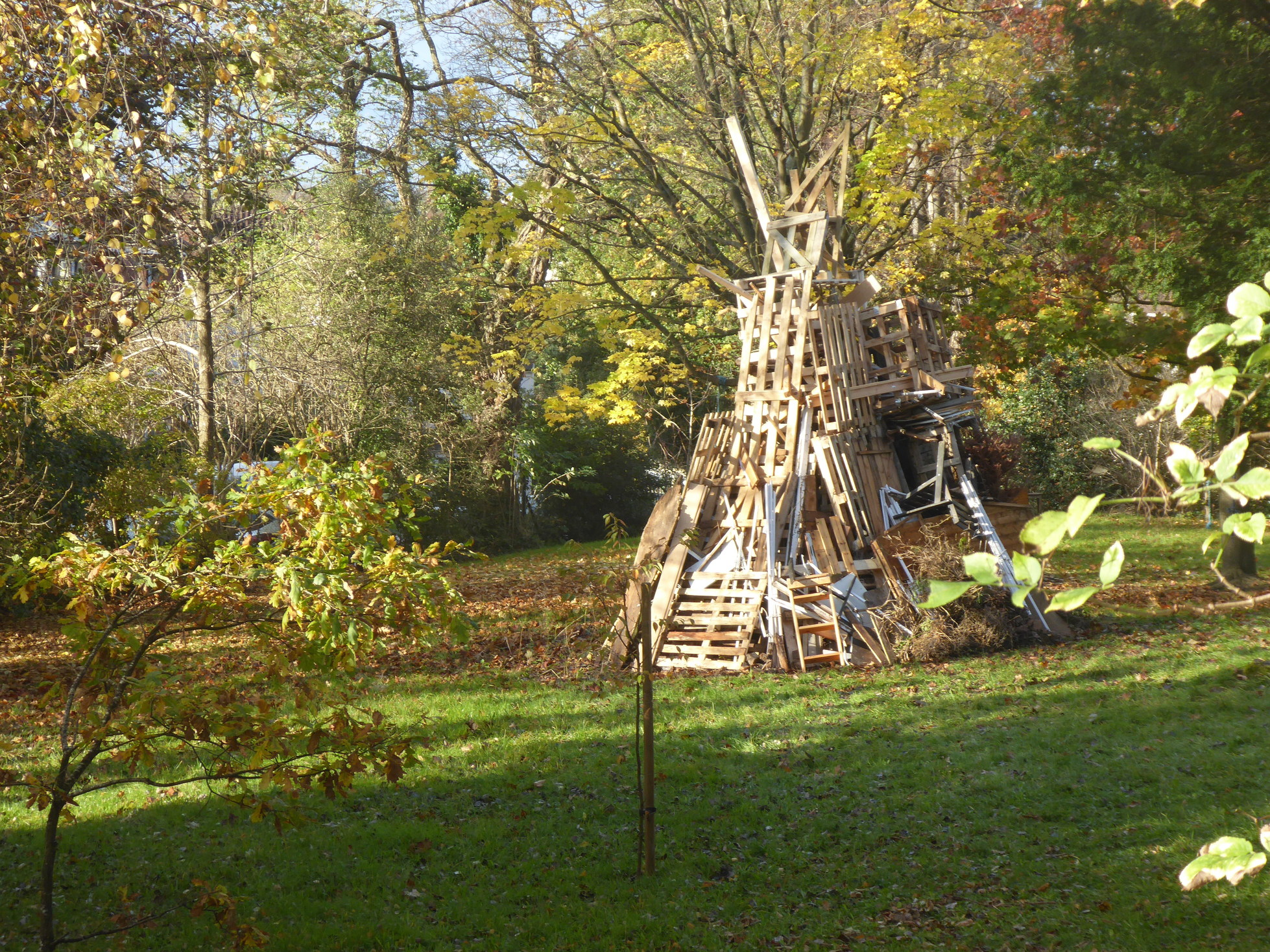
fig 76: The bonfire
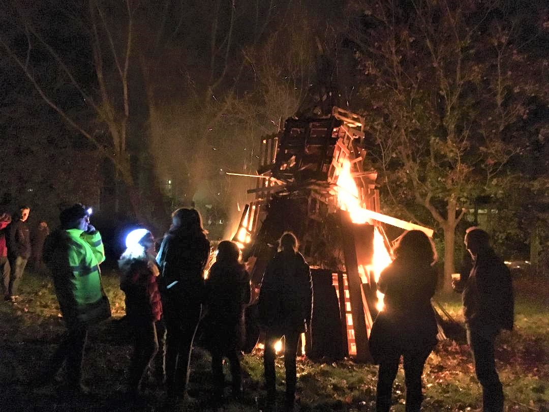
fig 77: Bonfire night
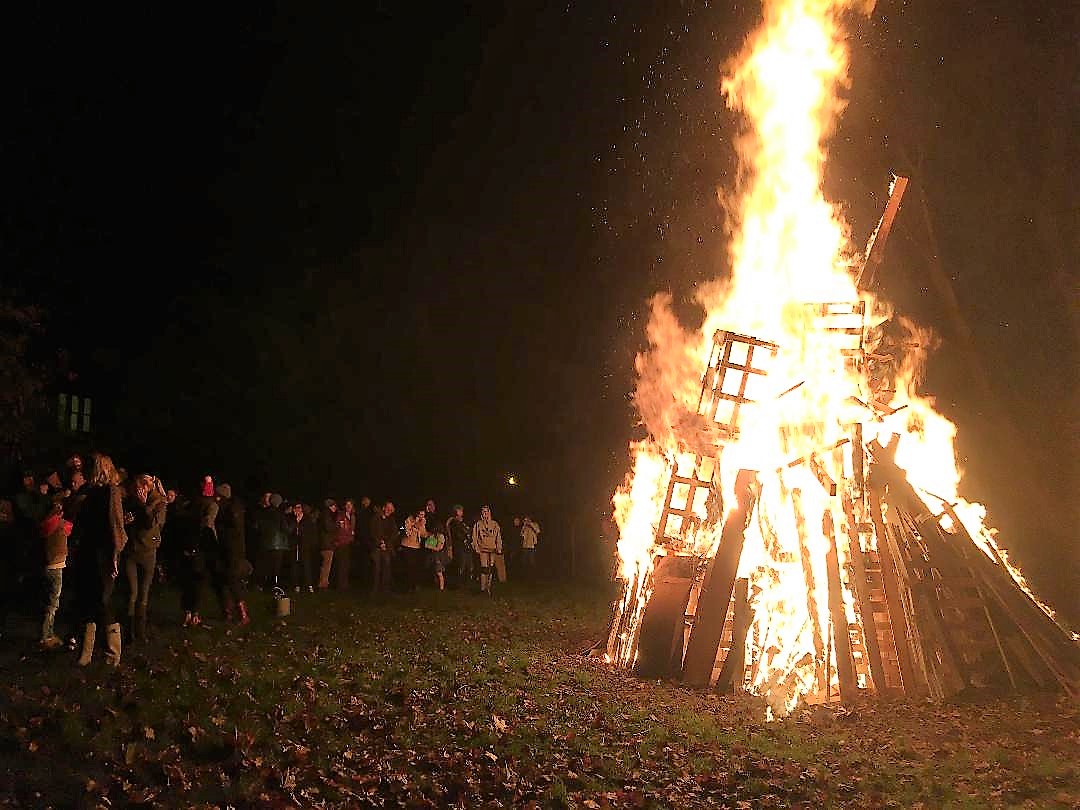
fig 78: Bonfire
Views
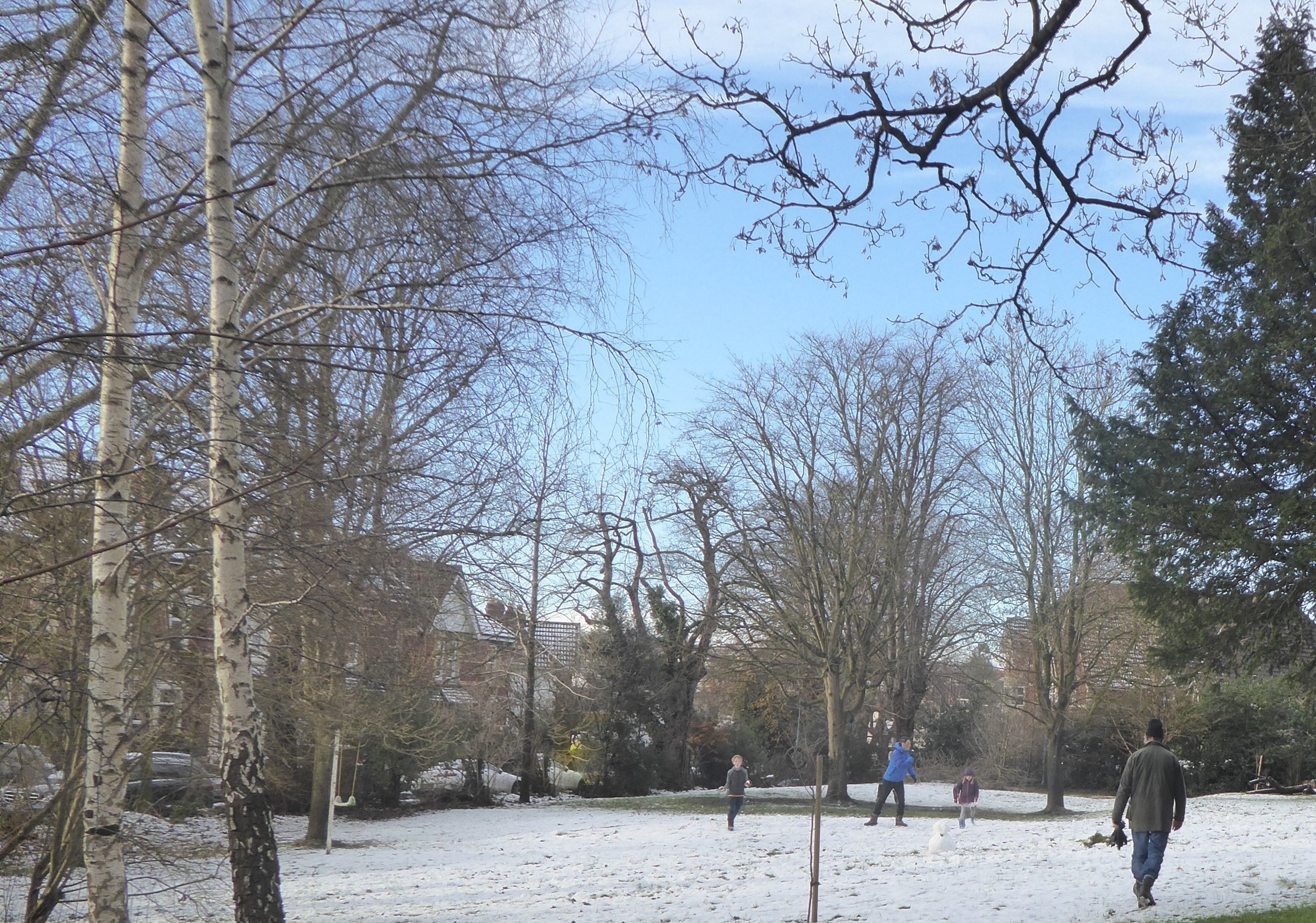
fig 79: Snow in Morley Square
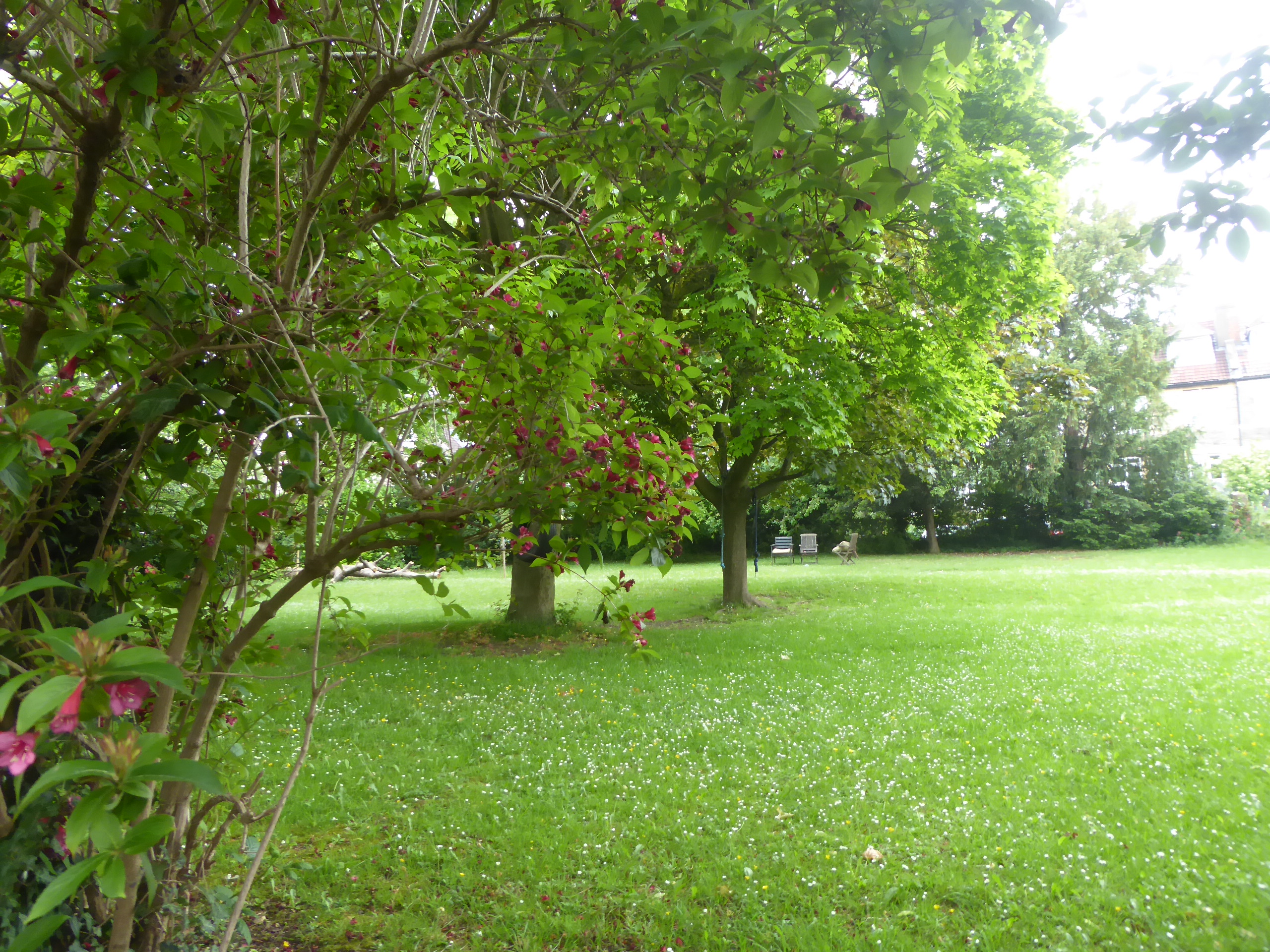
fig 80: View of Morley Square
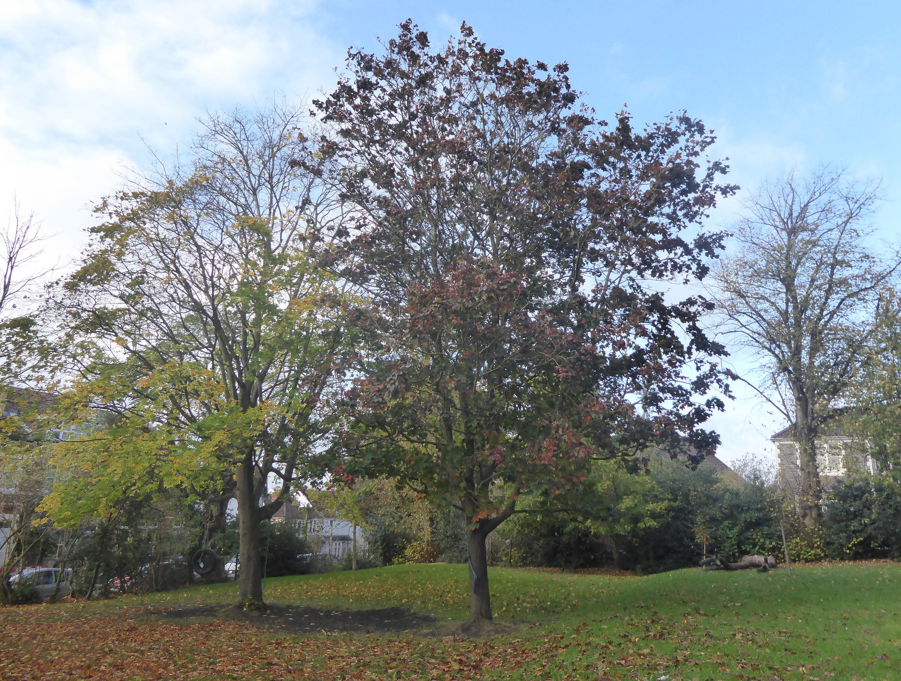
fig 81: Two Maples
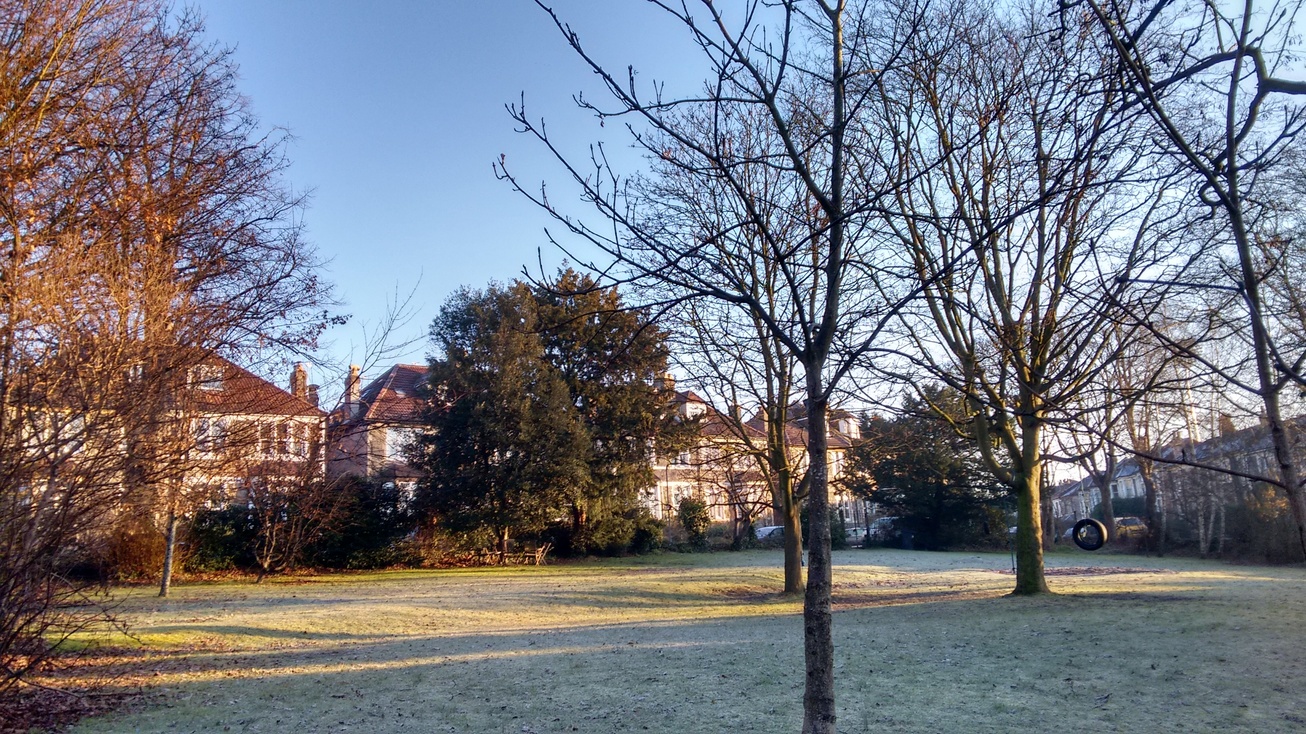
fig 82: Morley Square in winter
Around the Square
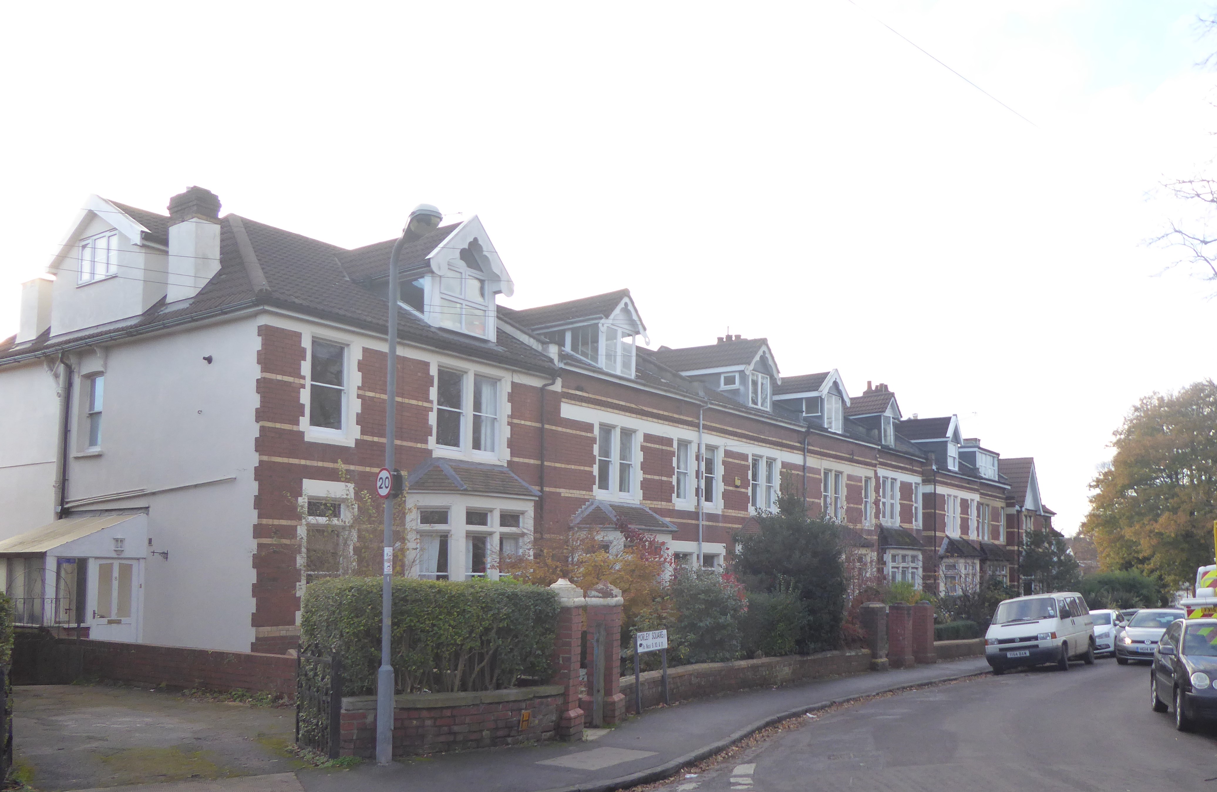
fig 83: Numbers 1 to 8
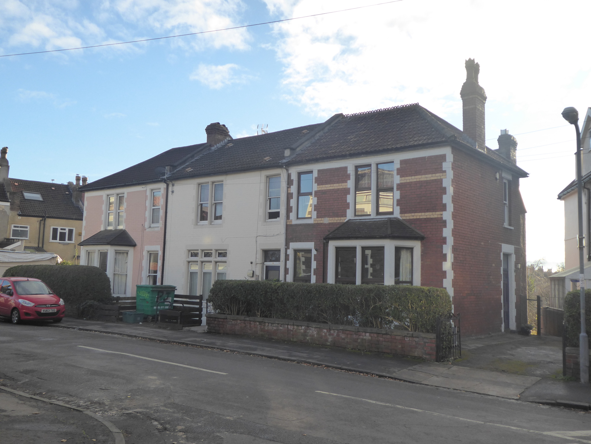
fig 84: Numbers 9 to 11
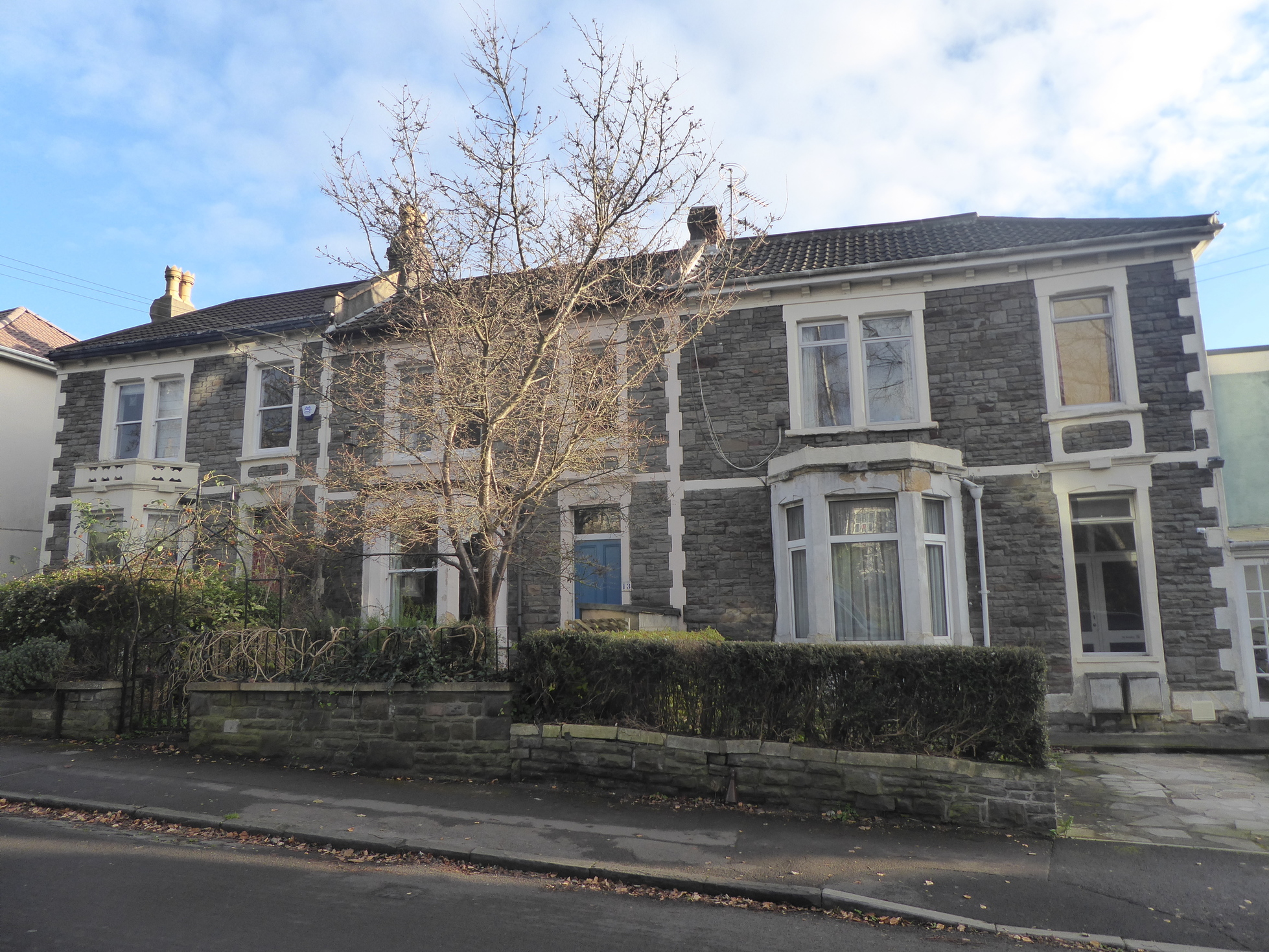
fig 85: Numbers 12-14
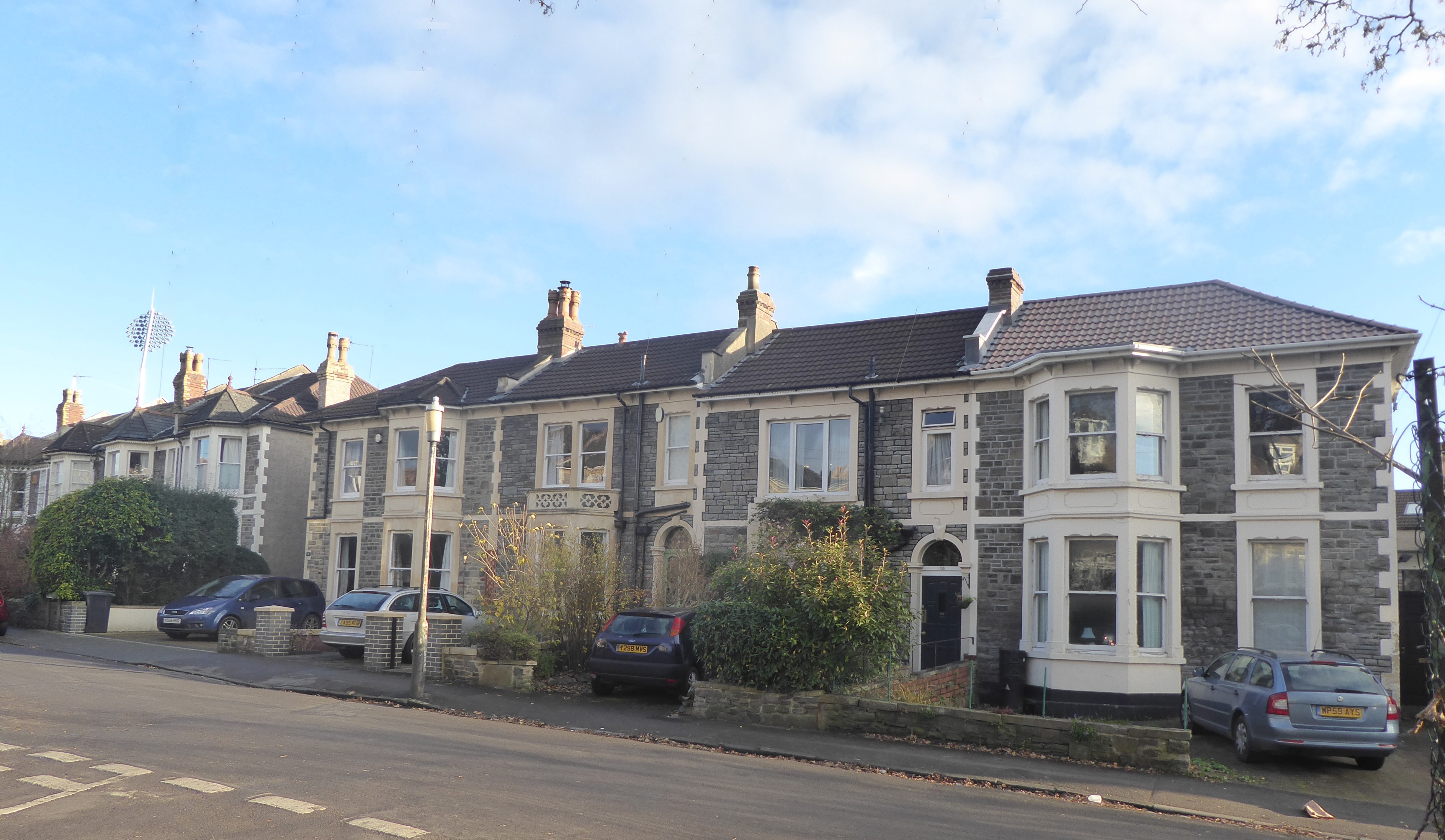
fig 86: Numbers 15-18
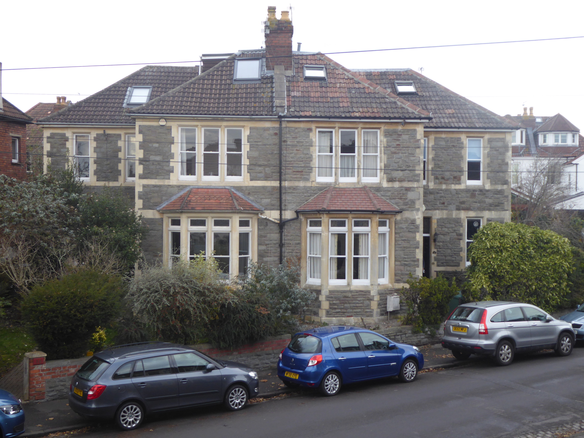
fig 87: Numbers 19 and 20
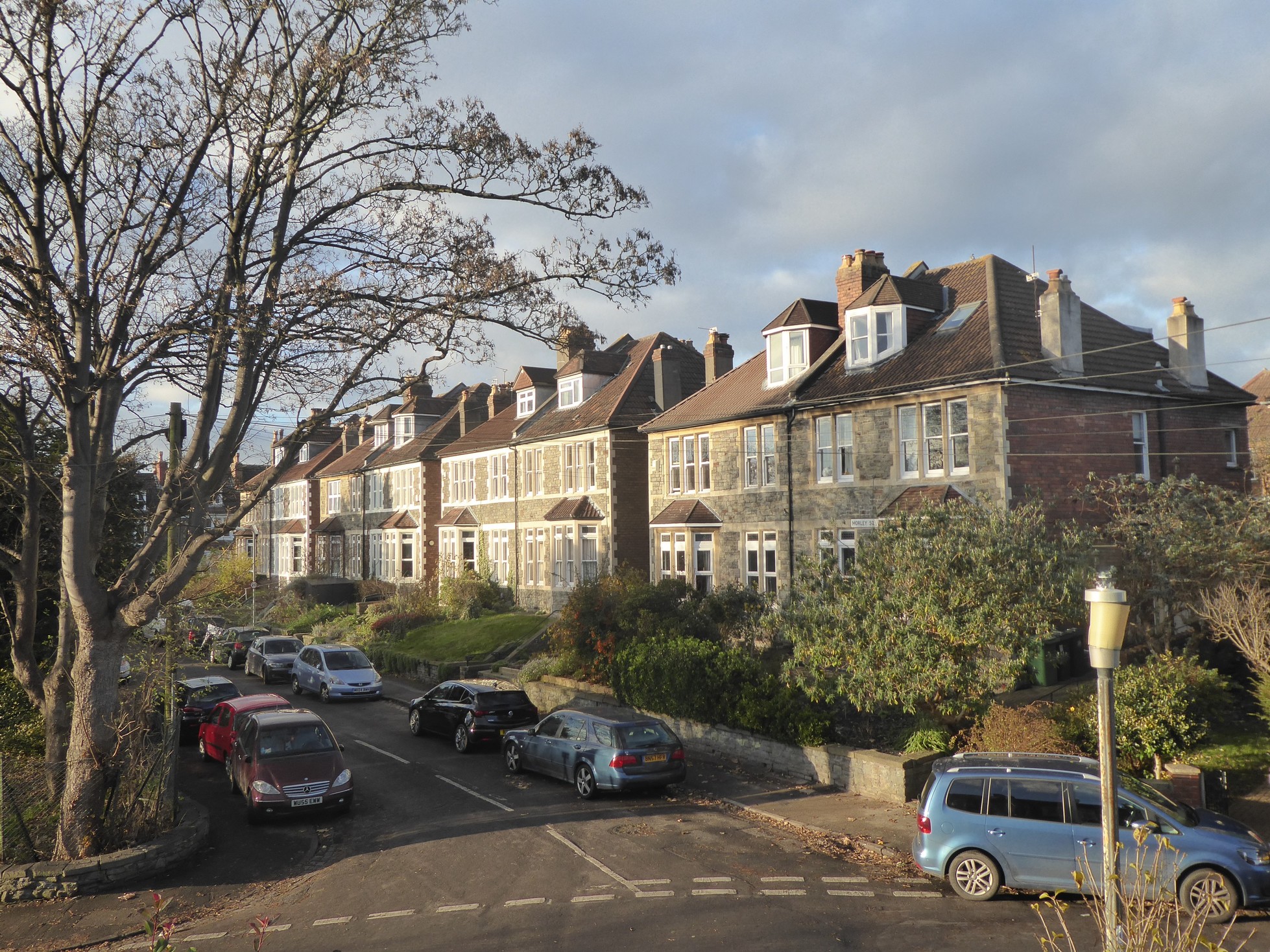
fig 88: Number 21 to 7 Brynland Avenue
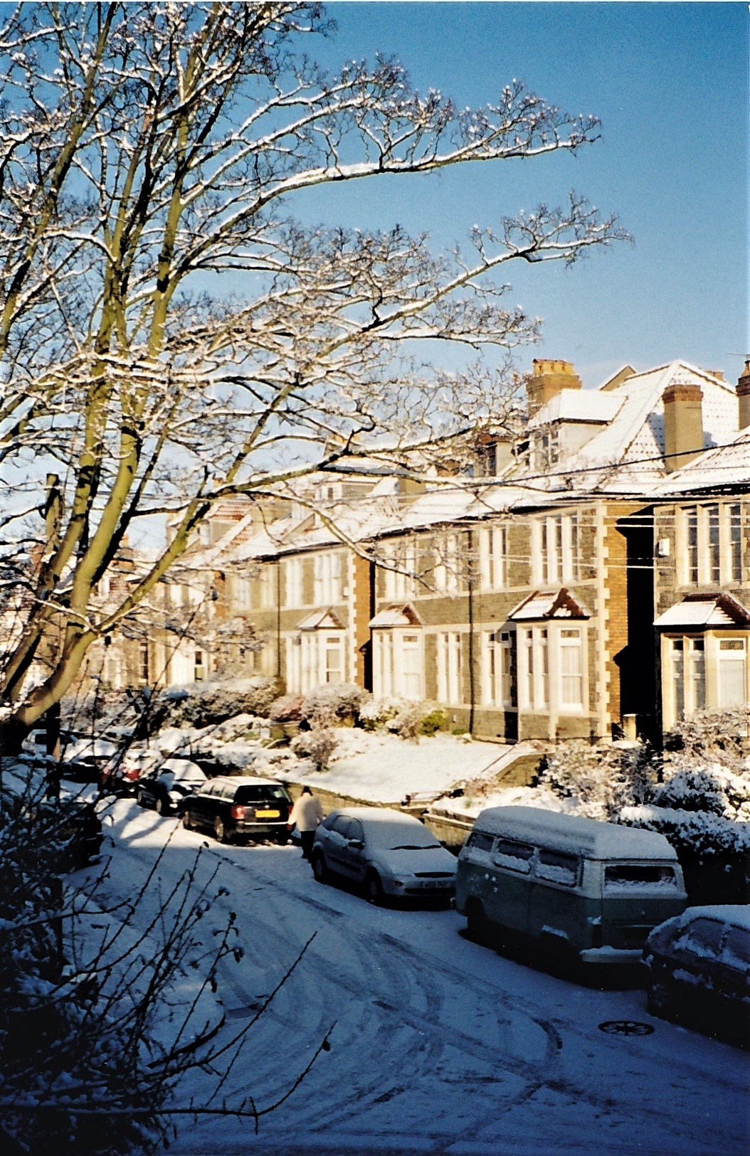
fig 89: North side snow
Then and Now
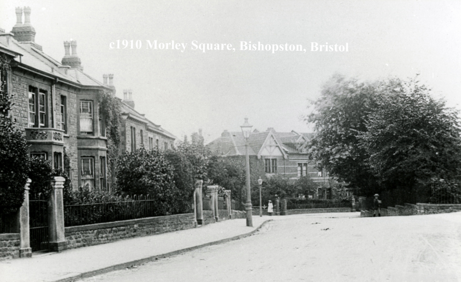
fig 90: East side of Morley Square, No 16 to No 7
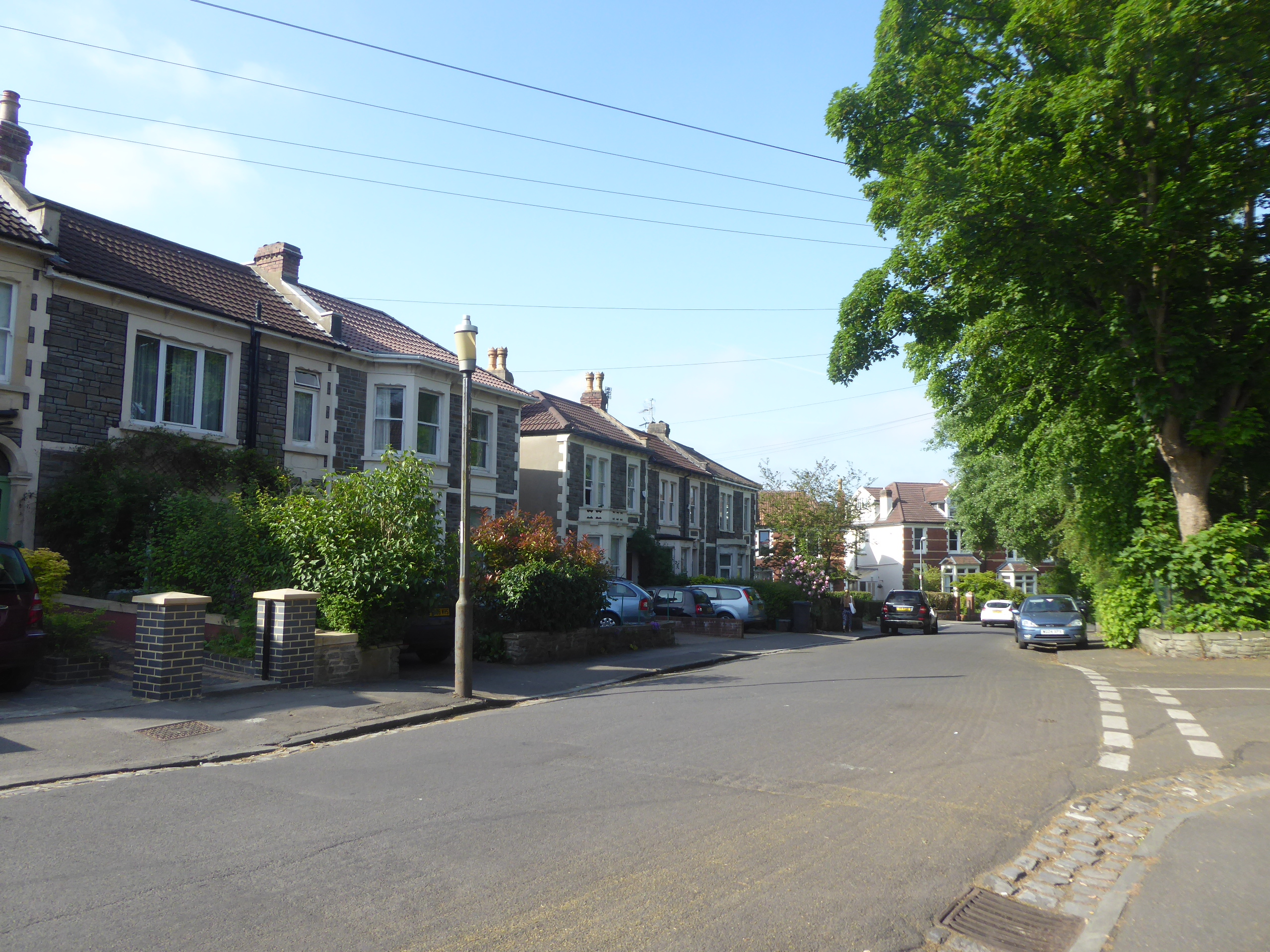
fig 91: The same view
A Year in Morley Square
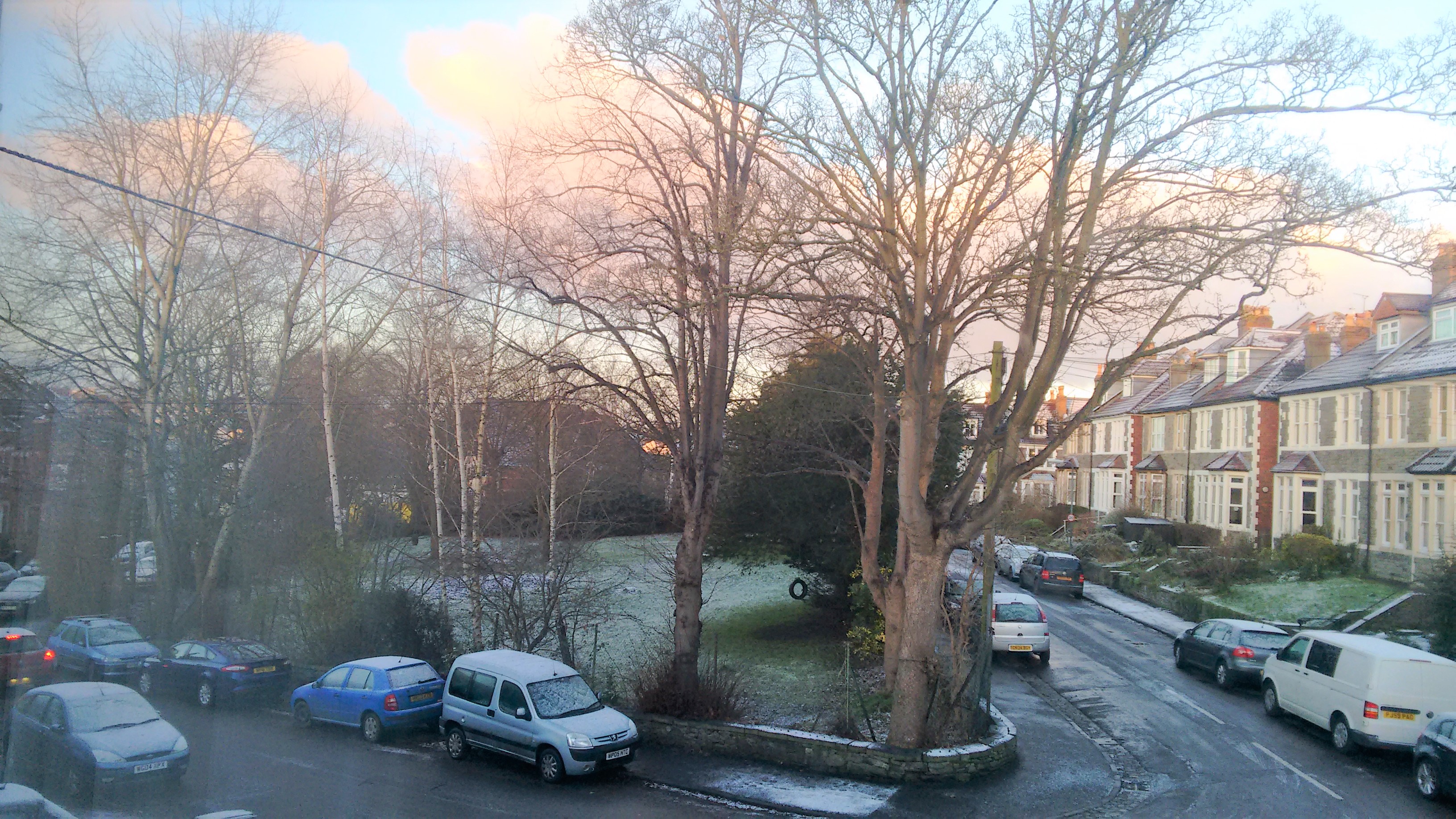
fig 92: January
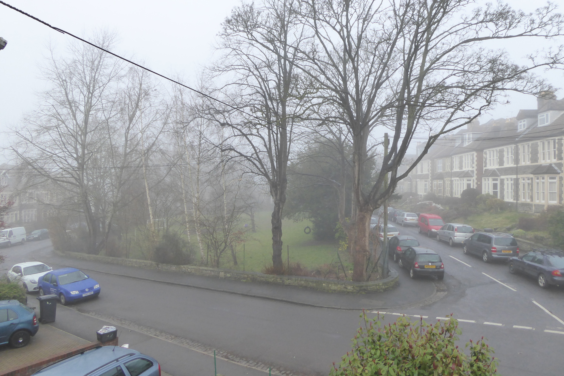
fig 93: February
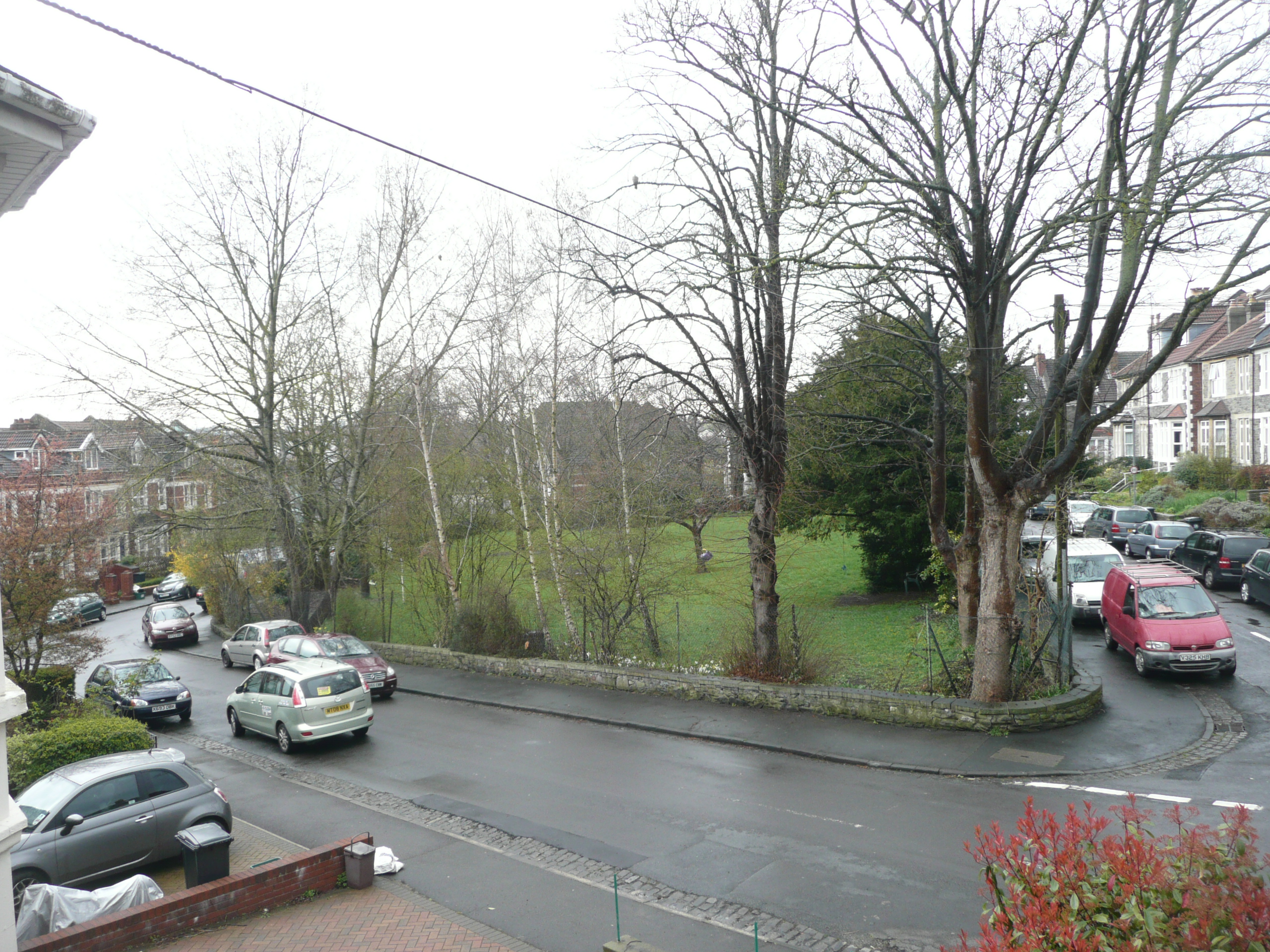
fig 94: March
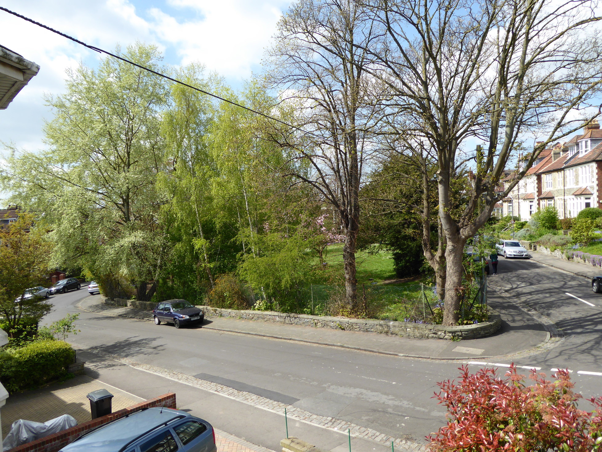
fig 95: April
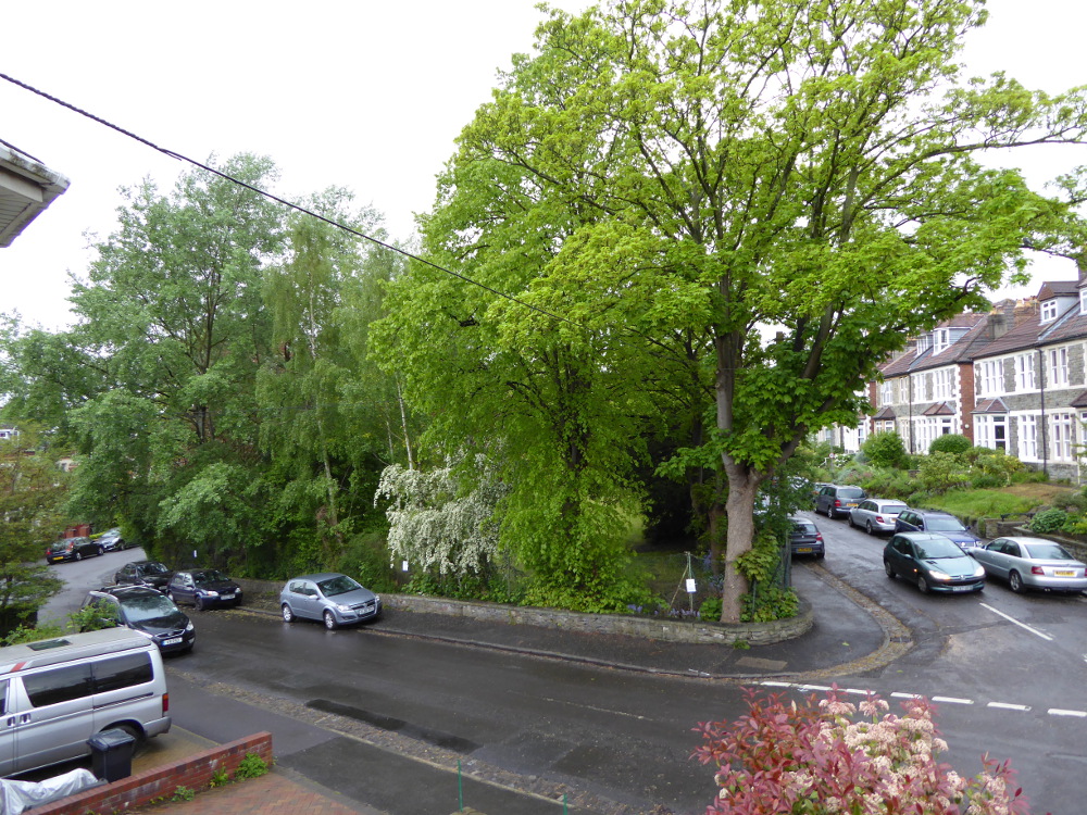
fig 96: May
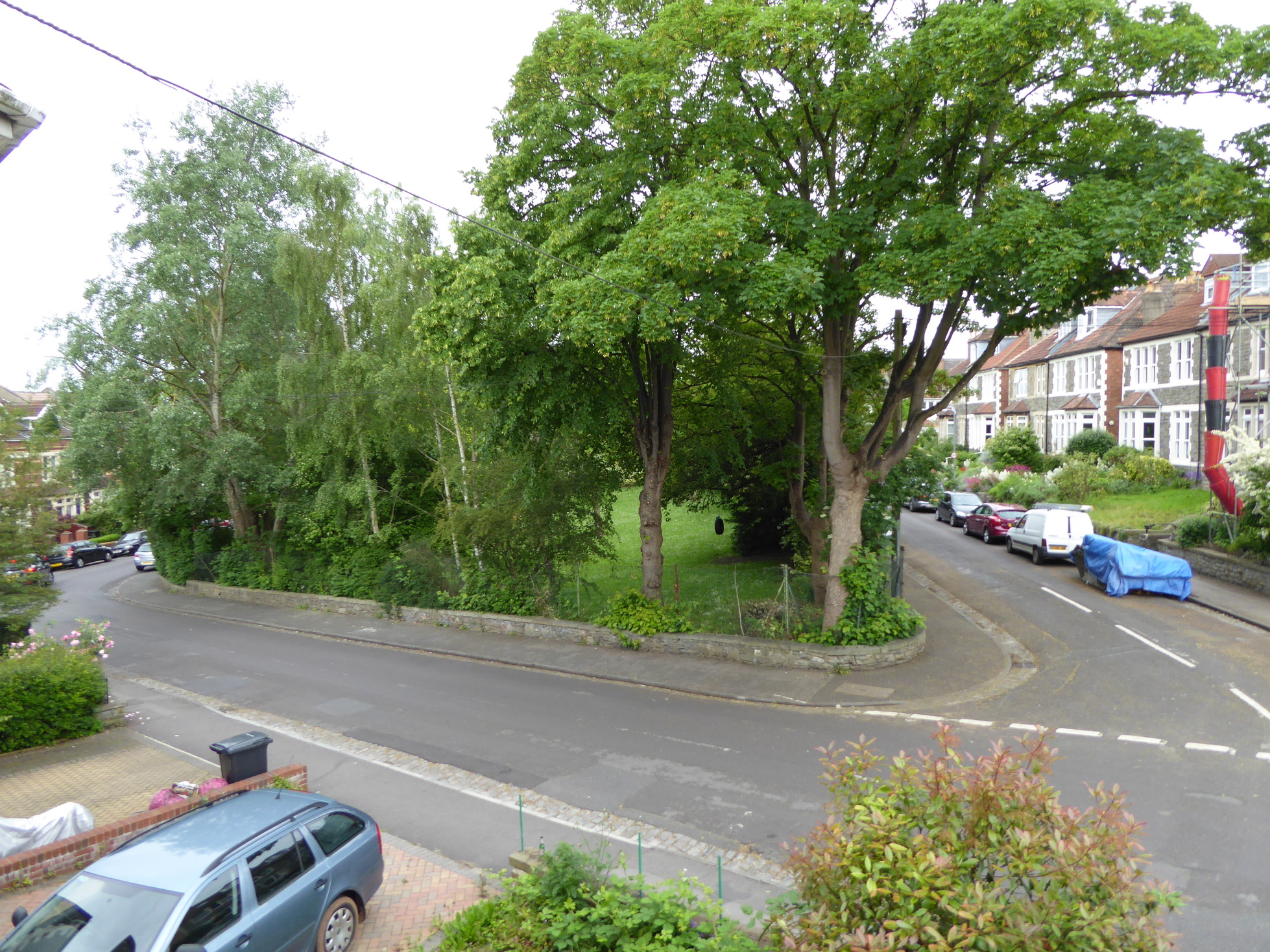
fig 97: June
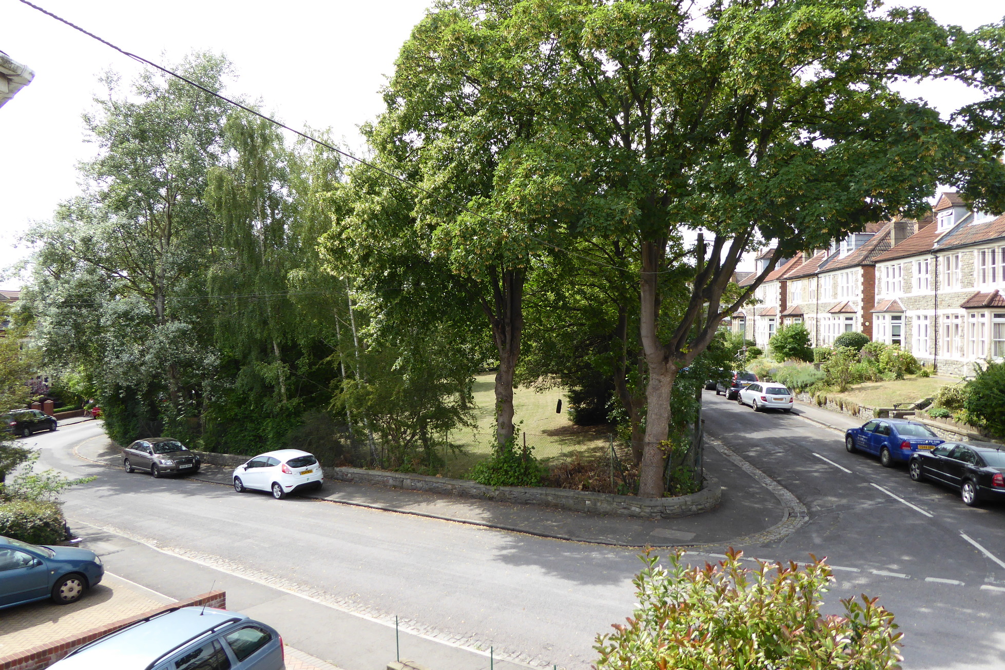
fig 98: July
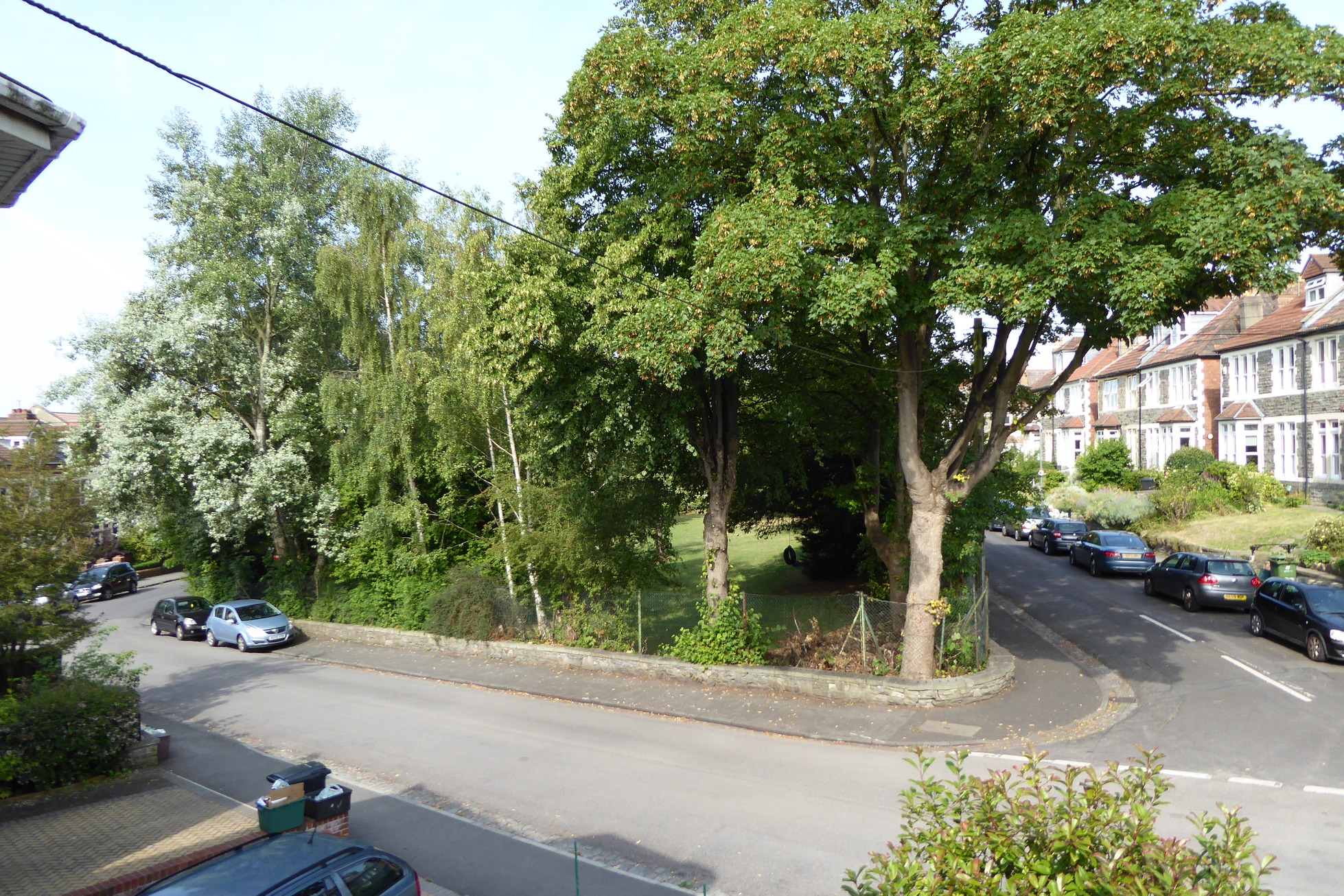
fig 99: August
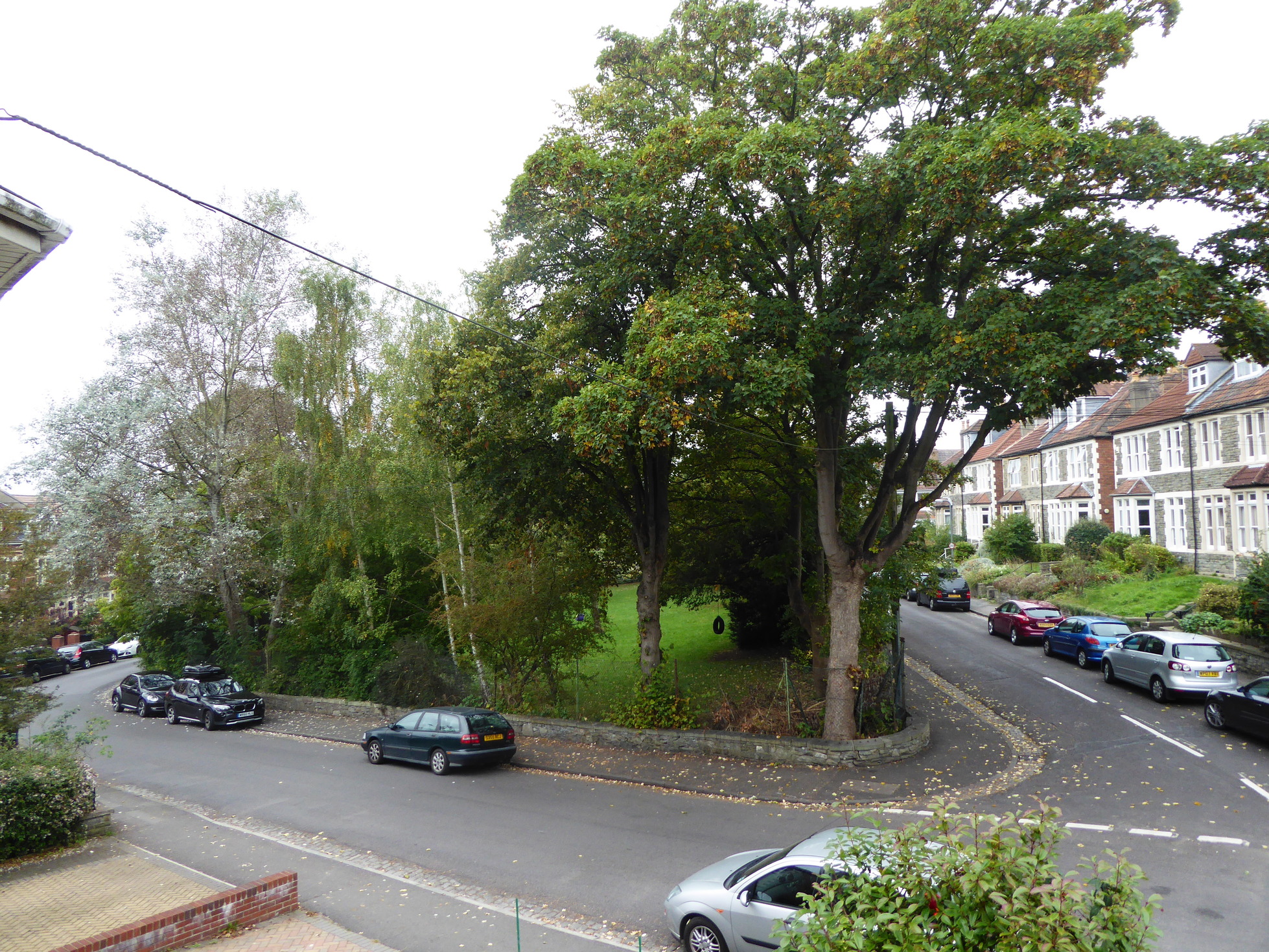
fig 100: September
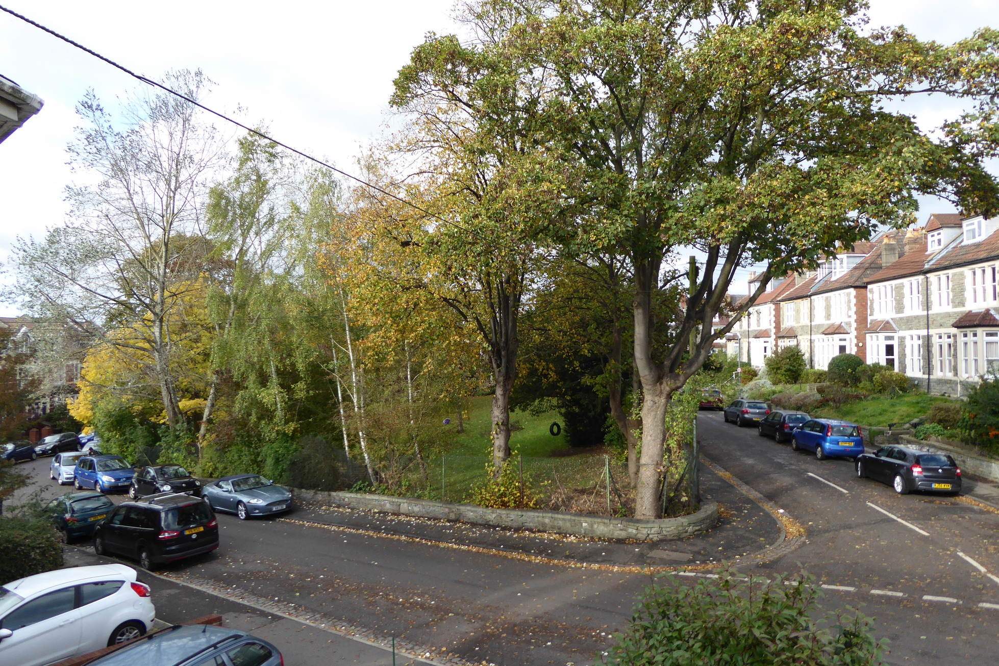
fig 101: October
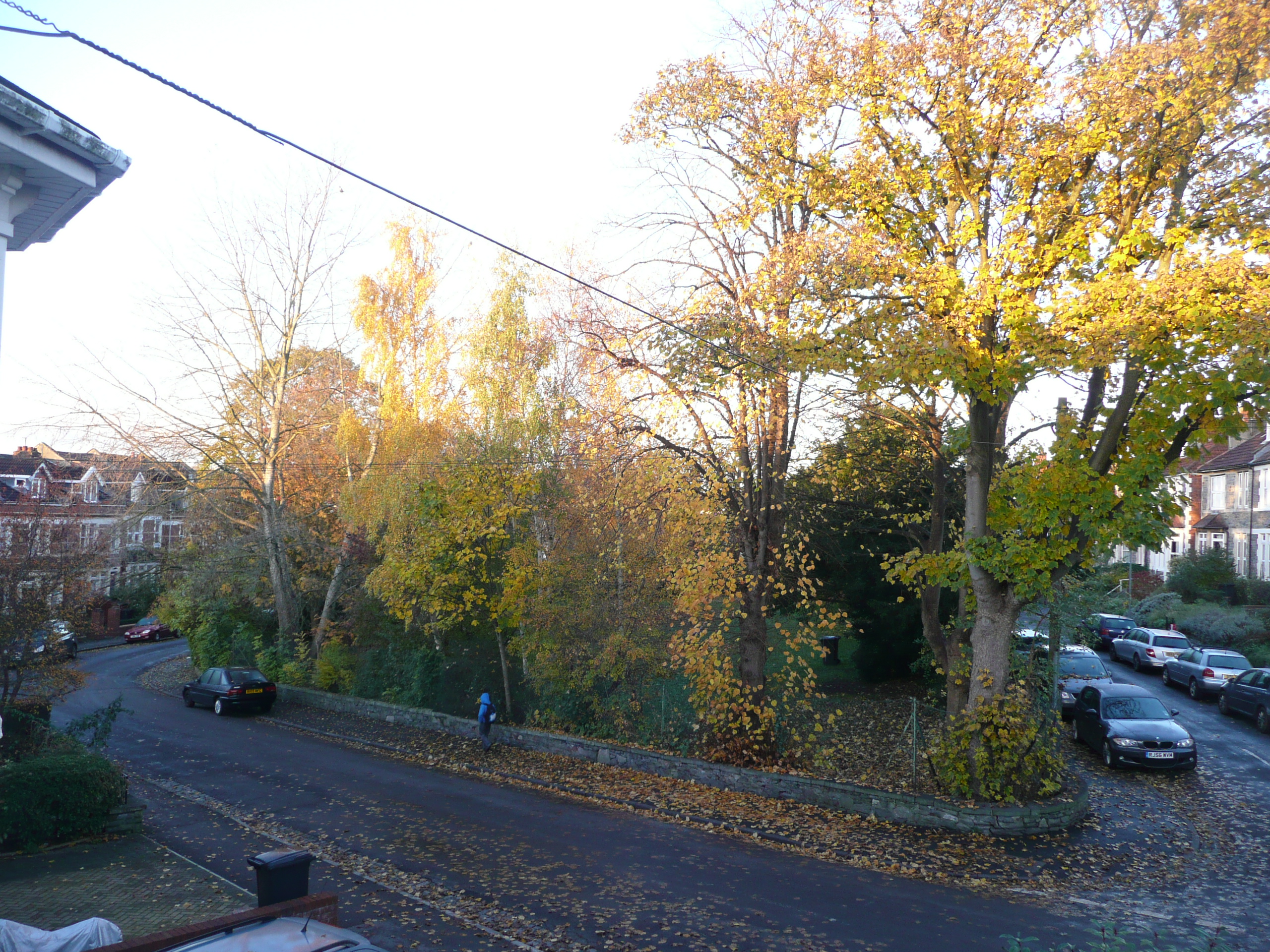
fig 102: November
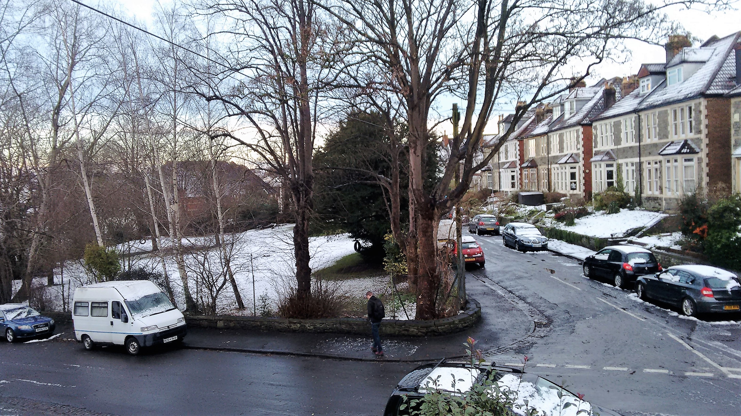
fig 103: December
Sources Top
Books and articles
We started this research by reading a number of books and articles on the history of the locality and meeting local historians:
Bishopston - The Early Years
by Denis Wright and John HydeThe Hidden History of St Andrews, Bristol
by Michael Manson- Article by Bishopston, Horfield & Ashley Down Local History Society Bishopston
- Articles by Andy Buchan and David Cemlyn in the local press
Public records
- Census returns for 1891, 1901, and 1911. Accessed via Ancestry amd Find My Past. Full census data is made available only after 100 years, so these are the only returns currently available.
- Valuation Survey 1910. Created for the 1910 Finance Act to provide data for a property tax. This survey recorded both property owners and occupiers, allowing us to establish which homes were owner occupied and which rented at that time, and, with a combination of other sources, which had been rented since being built. The price of each property at its last sale was also recorded. This record is held at the National Archive in Kew.
- The 1939 Register. This provides a snapshot of the civilian population of England and Wales just after the outbreak of the Second World War. Recording details of around 40 million people, the information was used to produce Identity Cards and to facilitate the issuing of ration books, also to administer conscription and division of labour, and to monitor and control the movement of the population caused by military mobilisation and mass evacuation. From 1948 the Register was used as the National Health Service (NHS) Register, and was updated until 1991, when the paper-based system was discontinued. These records remain closed for 100 years from dates of birth or until proof of death is produced; details of those still living are redacted. Five names are redacted from the Morley Square data. We assume these were all children in 1939, who would now be aged 78 years or older. This record is held online and available by subscription to the Findmypast website.
- Kelly's Directories. These list properties in street order, naming the 'head' occupant, rather than in alphabetical order by name. They were produced from the 1830s until around 1972/3. Dates of publication may be about a year after the information was collected.
- Electoral Roll Gives names of registered adult occupants eligible to vote.
- Land Registry. Copies of the property register reveal current owners, date of first conveyance and names of first owners.
- Local Newspapers Online subscription data in British Newspaper Archive - available up until 1959.
- Tree survey The tree survey for Morley Square is maintained as part of the Trees of Bristol project (also developed by Chris).
Private records
- Informal, anonymous census of today's residents (May 2017)
- Minutes of Residents Association from 1980.
- Memories of current and past residents.
- Eight sets of title deeds kindly lent by current owners.
Websites
- Wikipedia
- The Gloucester Road story detailed history of shops in Gloucester Road
- Streetcheck
- FindmypastPaid access to census and the 1939 register
- Free access to Births, Deaths and Marriages
- Ancestry, paid accessto census and other records
- Bishopston Society
- History of Horfield Common
- Horfield Manor Estate
- Horfield Parish Church
Maps
- Bristol Know Your Place- a wonderful resource created for Bristol City Council allowing exploration of a neighbourhood through historic maps, images and linked information.
Illustrations
- Old photos collected by local historian Paul Townsend
- Old post card photos collected by Derek and Janet Fisher
- Extracts from KnowYourPlace
- Documents in the Bristol Records Office
Bristol Archives
Holds numerous documents, photographs and maps, for example: Minutes of the Horfield Local Board, Horfield Tithe Map and Apportionments, Minutes of the Public Works Maintenance Committee. We are extremely grateful for the help and support of the Archive staff.
House Vignettes Top
No 7 - Bex Villa History
The house was built by Frank Scutt and conveyed to him by Mervyn Herbert Nevil Storey- Maskelyne on 18 July 1890 - along with most of the houses he had built in the square - numbers 3 - 11. Scutt lived next door at number 8, renting out his other properties.
The first residents at number 7 were the Denning family who had previously lived in Berkeley Road - Isaac, a retired accountant aged 71 and his wife Isabel, aged 60, together with their adult children William aged 42, a clerk journalist, Charles aged 38, accounts clerk and Mary aged 34. They lived in the property for four years. There followed a number of short term tenants - including a Mrs R Launitz-Schurer from 1895 - an obstetric nurse - the only working woman in the square at the time.
In March 1898, Frank Scutt moved out of the square and sold number 7 to Charles Spurrier and Thomas R Phillips of Kent Road, along with numbers 6 and 8, and also three properties on Brynland Avenue. Phillips, who became sole owner, continued letting the property. From 1901, the Kitchen family occupied the house - James, aged 35, a Minister of the Catholic Apostolic Church, his wife Helen aged 40 and their children Eric (6), Francis (4) and Eunice (2).
In 1913 Phillips began divesting himself of his rental properties - number 6 was sold to Frank Morley Snook. The Brynland Avenue properties were sold off during 1917-18, and with all his mortgages redeemed, in 1922 Phillips finally sold number 7, to his long term tenant, James Kitchen, for £400.
The Kitchen family remained at the property for many more years. James' son Francis had been killed in the First World War and his wife Helen died in 1927. James appears to have remarried, to Lillie Josephine. He died in 1940, the property passing to Lillie Josephine. She moved to Westgate on Sea renting out the house again to a series of tenants. Lillie Josephine died in 1962 and the property passed through her will to Rosa Winifred Abraham (spinster) who lived in London.
The house was occupied by Rowland and Irene Elliott- intermittently with others between 1964 and 1981, and Alfred Tucker and Janet Goode from 1983 to 1989.
The Fowler family bought number 7 in 1990, and brought their children up in the square before moving on in 2003. On purchase the property had been in very poor condition, and they embarked on major renovation project. Ceilings were taken down - giving a view from the basement through the house up to the attic rooms - and walls were taken back to brick. The property was rewired, and central heating installed.
The house was owned from 2003 to 2013 by Christopher and Karen Gray. The current residents bought the house in 2013 following their retirement. Jane is currently secretary of the Residents Association.
No 12 - Campbell/Argyll Villa History
This house was built by James Gilbert along with numbers 13 and 14. It was conveyed by Maskelyne, together with the other two properties, to Gilbert on 20 February 1890 for £600 in total, with a private mortgage to a widow in Bedminster. Gilbert, who lived in Egerton Road, let out all three properties. The first residents of number 12 were the Hope family - John, aged 43 - a Jewellers Assistant, his wife Elizabeth aged 31 and their children John (aged 2) and baby Leonard.
In 1893 the house was gifted, subject to mortgage, by James Gilbert to his son William, an accountant living on Claremont Road - together with number 14 and a property in Elton Road. A number of short term tenants lived in the house until 1897 when the Cooke family took up residence - William, aged 40, an Insurance Secretary Solicitor, his wife Ellen aged 37 and domestic servant Louisa Bale. The Cookes remained at the property for 12 years.
In 1910 the property became a branch office of the NSPCC. James Wiggins was the first of a number of NSPCC Inspectors who lived in the house with their families. James was 51 and his wife Bridget 53. They had 6 children - Ursula (27), Ella (25) a bread maker, Helena (23) a book-keeper, May (18) a dressmaker and sons Philip (14) and Thomas (6).
The property was sold in 1912 to Edward Moore for £320 - who continued letting it to the NSPCC, for the same purpose during the 1920s. The property passed to Arthur Moore - a builder - on the death of his father Edward in 1927. This was subject to a mortgage of £500 - possibly raised to pay off his seven siblings with whom he benefitted equally under their father's will. However, things seem not to have gone well, and in 1930 the mortgagee - the Co-op Building Society - sold the house for £635 to Fraser and Janet Bullock, who lived over the road in number 8.
The Bullocks continued letting rooms in the property - and also had lodgers in their home. Fraser Bullock died in 1935 but Janet remained at number 8. There were a number of occupants of number 12 during the 1930s - the 1939 register shows a total of 7 people living there that year. Elizabeth Steele, a widow, came to the property in 1944 to run a nursing home. She purchased the property in 1946, however in the same year Elizabeth was swindled out of £350 by a man who proposed marriage, asked to borrow money and then disappeared. It later transpired he had a wife and four children in Kent. The property was immediately sold on to Beatrice Charleston who continued running the nursing home.
The house was sold to the parents of the current owner in 1949 for £2,100. The family lived there while also using it as a boarding house for several years. The property was subsequently converted to three flats, with separate entrances being created in the early 1980s. The current owner continues to live in the middle flat with tenants above and in the basement.
No 13 History
The property was conveyed, along with the neighbours on each side, to the builder James Gilbert on 20 February 1890 - see number 12. The house was let first to the Lamoon family - William, aged 53 a Brewers Traveller from Scotland, his Irish wife Arabella aged 42 and their children - William (15), a clerk, George (14) a telegraph messenger, Lillian (10), Albert (9), Violet (7) and Daisy (6). However, they lived there for only a couple of years until 1892 when the house was conveyed for £320 to Mrs Rebecca Collis, acting as trustee for her husband Joseph - a Master Mariner away at sea. The couple lived in the property until 1895 when it was let again, first to Mrs Clark and then in 1899 to the Cummins family - Edwin, 62, an Agent for Spirits and Wine, his wife Sarah, 58, daughters Sarah, 30 and Alice, 22, a teacher, and sons Reginald and Percy aged 19 and 15.
The Cummins were replaced by the Prideaux family in 1910 - Spencer, 32, an Ironmongers assistant, wife Alice, 31 and son Theodore, 6, who lived in number 13 until 1913.
Joseph and Rebecca Collis were by now living in Fishponds and in 1913 sold the property for £220, to Mrs Julia Higman of Salthrop Road. Mrs Higman appears to have continued letting the house to short term tenants.
In 1924 the house was conveyed to Miss Ellen Mabel Ackerman for £712 10/-. Mabel, aged 25 at the time of purchase, lived at the property with her parents - father William aged 64 and mother Emily aged 57. There are no clues to the reason for this arrangement, but it is not unique. The family had previously lived on Gloucester Road where William had an ironmonger's business. William died in 1935 aged 75. Mabel, a qualified optician, lived at number 13 with her mother until 1954 and then with other tenants until 1966, when she was 64.
In 1966 the property was sold to a commercial company, for £1,850. This company sold the property on after five months - for £3,000 - to Peter and Lydia Eveleigh. The couple and their children lived together in the property until 1984 when the house was conveyed to Lydia - an artist and art teacher.
The property was bought by Anna Rosetti and Eddy Knasel in 1987, who lived there for 17 years, bringing up two daughters and running their educational consultancy from home. Anna and Eddy moved locally when they decided to split home and work premises, having contributed greatly to the community spirit of the square.
The current residents came to number 13 with their two children in 2006.
No 16 - Foyle House History
This house was built by William Howard and conveyed to its first resident - Walter Clark - in October 1889. Walter (aged 31), who was an accountant/superintendent with the Post Office, lived in the property with his wife Mary (aged 34) for 12 years. It was then sold, in 1901, for £370 to Mrs Emily Coldridge, who lived in the property with her husband Richard - a book canvasser, for the next 12 years.
In 1913 the Coldridges moved from the property and it was occupied by Mrs Sarah Shepherd, until its sale. The Coldridges had mortgaged the property to the Order of Oddfellows. On the default of this mortgage in 1916, the property was sold to P Nutt - a boot dealer - for £270.
The property was next sold in 1922 to Howard Thomas aged 46, a schoolmaster, for £730. After an occupation of only five years, the house was again sold in 1926 to George Stuart Reid who came from Glasgow, for £740. The Reid family were George (37) a Manager/Buyer in confectionery, his wife Elizabeth (32) and their daughters Elizabeth and Hilda aged 8 and 5. George's wife Elizabeth died in 1941. George appears to have married again - to Jean. On his death in 1961 the house was sold.
he next owners were Robert and Sylvia Pictor-Wayne, who bought the house in 1961, for £2,000. Again, after another relatively short period of residence, in 1965 the Pictor-Waynes sold the property to Denis Smith - a leading depot man with National Carriers - and his wife Vita for £3,350. We do not know when the bay window was removed.
The Smiths sold on to a Mr Clubb and Mr Carrick in 1982 for £30,000 - who after only eight months sold it on again to Richard and Tereza Szpyt for £32,000. After 7 years, the Szpyts sold the house to the Cruikshanks who lived in the property with their three children, but also rented it out while abroad.
The current residents bought the house in 1997, by which time it was in need of major renovation, including a new kitchen, rewiring, new bathrooms, work on the roof and complete re-decoration.
No 20 - Tynemore History
Built by George Tyler, the property was first conveyed to George Frederick Gough (36), a commercial traveller on 3rd May 1889 for £380. The Gough family - wife Mary (31), father Benjamin (73), children Charles, Alice and Marian - 7, 4 and 2, together with domestic servant Emily Bartlett. The family lived in the property for only three years.
In 1892 the property was sold for £410 to Lewis Congdon a Merchants Clerk - whose previous residence was 118 Gloucester Road (near the Texaco Garage). The Congdon family comprised Lewis (35), his wife Emily (32) and their children Henry and Winifred - 5 and 3. Ernest and Alan were born in 1893 and 1898. They had a domestic servant - Maud England aged 18. Ernest Congdon was killed in action during the First World War. The family lived in the property for the next 40 years.
The Miles family moved to number 20 in 1936. Edward, aged 55 was an estate agent, running his business from home - as is apparent from regular adverts in the local press during this time. His wife Elizabeth, 49, assisted in the business. Daughter Kathleen aged 24 was a mortgage clerk. Edward died in 1950 at the age of 69, leaving Elizabeth at the property - first with Annie Elliott and then with Dorothy Cullen. Elizabeth died in 1972.
Christopher and Marilyn Easton - a surveyor and teacher were the next occupants, until 1982 when they moved to Thornbury.
Dr John and Julie Boseley bought the property in 1982 and lived there for eight years. In 1989 John took over as Secretary/Treasurer of the Residents' Association for a short but active period.
Monte and Jean Shapiro bought the house in 1990, on their retirement - both from distinguished careers. Monte was a clinical psychologist who had worked with Hans Eysenck. A member of the Communist Party he volunteered for flying duties in the Second World War and was shot down in 1943, severely injuring his arm. His career saw ground-breaking work in his field. He died in 2000, aged 87. Jean was an early feminist journalist and writer. She worked for many years on Good Housekeeping magazine and run a non-fiction writing group in Bristol. She died in 2005 at the age of 88.
The current owners moved into number 20 in 2000. Both their children were born in the square. Olaf served as Treasurer of the Residents' Association for over 15 years.
No 25 - Trafalgar Villa History
This was one of the houses built by George Tyler and was sold to Charles Sessions, who had been living in Egerton Road, on 1 December 1988 for £350. The household comprised Charles, an Ironmonger's Manager, his wife Annie, their three children and 18 year old servant Susan Ford. Twins were born the following year. Charles died in 1897 aged only 42, leaving Annie £47. The family remained in the house, but evidently in impoverished circumstances - in 1901 there were also four lodgers in residence. Annie had mortgaged the house to a Robert Harding from Weston-super-mare in 1898. However, by 1911 the house appears to have been repossessed and occupied by Mary and Elizabeth Burrell, sisters in their late 60s - a teacher and a piano teacher, together with two female boarders. The Burrell sisters lived in the house until 1921, though the property had been sold in 1914 to Robert Taylor from Surrey Road, for £437 10/-.
Robert Taylor took up residence in the house in 1921, but died in 1929, leaving the house to his wife Alice Edith. Alice sold it 3 months later to Mrs Laura Jane Woodman from Montpelier for £875. Mrs Woodman lived in the house with her husband for about six years.
The house was next sold to Miss Florence Ethel Watts who lived at 247a Gloucester Road (between Brynland Avenue and Wesley Road) in 1935 for £670. The house was occupied from that time by Miss Watts' sister Fanny Elizabeth Davies - a gowns saleswoman, and her husband Clement Davies, a master hairdresser, together with a number of lodgers. Clement died in the late 1940s - Fanny continued living in the house together with numerous lodgers. In 1963 Florence Watts, who had subsequently married Alfred Ernest Wright, transferred number 25 to Fanny by a deed of gift. However, Fanny died only 18 months later at the age of 77.
In 1965 the property was sold to William and Frederick Nichols from Kent Road - whether father and son or two brothers we don't know - for £3,000. The house was then immediately transferred to Frederick for £1. Frederick lived there with numerous tenants - in 1970 there were ten adults living in the house. Frederick married Rachel Mary Clark, from Cheshire, in 1972. In 1974 Frederick sold the house to Rachel for £6,500. Neither lived in the house from that time and it appears to have been rented. Alan and Margaret Hayes appear to have bought the house in 1980, living there with 3-4 tenants until 1987, when they sold the house to the church for £70,000, to be used as a vicarage for St Michaels.
The first vicar, Rev William Challis lived in the house with his wife Melanie. They were followed by the Burbidge family - Rev Richard Burbidge, his wife Christine and their children until 2011, when the house was sold to the current residents.
No 27 History
The second property to be sold in the square, number 27 was conveyed to its first owner - Clara Smith on 3 October 1988 for £357. The 1891 census shows a Mr and Mrs Smith aged 33 and 28 living at the property, together with their domestic servant Rose Lester aged 15. It is not clear whether this family was related to the owner, or tenants - the name being simply a coincidence.
From 1895-7 the house was occupied by a surgeon - Thomas Patterson Devlin, before the Sherring family took up residence in 1899. They were Edwin Sherring, aged 47, an Assistant Superintendent with the Post Office, his wife Louisa aged 46, and their children - John aged 16, a Corn Merchant Clerk, Frederick aged 14, who became a Chemical Manufacturers Clerk, Winifred aged 12 and Thomas aged 6.
Clara Smith died in 1901, leaving the property to her brother Arthur, a wholesale stationer and his wife Caroline. In 1904 Arthur transferred the house to Caroline's sole name. It remained a tenanted property - the Sherring family continuing to live there until 1908.
In 1910 the Kimber family moved to number 27 - Ernest (38) a Hosier, his wife
Caroline (33) and their daughter Muriel aged 7 - and lived in the house for five
years. They were followed by a couple of short term occupants, before 1921 when
the property was sold for £900 to James Dent, a Commercial Traveller from
Kendal. The family - James and Mabel Mary - both 42 and their daughter Mabel
Kathleen aged 14. The Dents separated in 1930 and the house was transferred to
mother and daughter Mabel Mary and Mabel Kathleen - then aged 23, in
consideration of the wife agreeing not to apply for an order for restitution
of conjugal rights ...
In 1933 the house was sold for £690 to the Grant family who had previously lived in Westbury Park - James aged 62 a Retired Civil Servant his wife Rachel, 61 - engaged in the standard 'unpaid domestic duties', 25-year-old daughter Mabel - a ledger clerk and son John aged 23. Another son, James aged 32 lived in Henleaze with his wife Emily. The house was owned in Mabel's sole name, with her father standing as surety for the mortgage. It is not obvious why this was done, but it is not the only example of this situation. Rachel died in 1950 aged 79, followed by James in 1960/59 aged 87. Emily Grant moved to the property in around 1956 at the age of 52. John moved from the property after his father's death and died in Bristol in 2003. This left Mabel and Emily, who lived together in the house until 1980. They died in Bristol at the ages of 98 and 97 respectively.
The property was sold, in 1981, to John and Freida Murray for £31,000. They lived in number 27 with daughter Joanna - and a series of lodgers - until 1993.
The house was sold to the current residents in 1996.